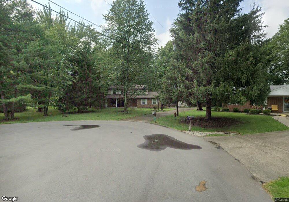
6210 Millstone Ct Milford, OH 45150
Estimated Value: $354,916 - $382,000
4
Beds
3
Baths
1,996
Sq Ft
$183/Sq Ft
Est. Value
About This Home
This home is located at 6210 Millstone Ct, Milford, OH 45150 and is currently estimated at $366,229, approximately $183 per square foot. 6210 Millstone Ct is a home located in Clermont County with nearby schools including Milford Senior High School, Milford Christian Academy, and St. Andrew - St. Elizabeth Ann Seton School.
Ownership History
Date
Name
Owned For
Owner Type
Purchase Details
Closed on
Apr 2, 2002
Sold by
Combs Arthur E
Bought by
Shrider William B and Diehl Sheila L
Current Estimated Value
Home Financials for this Owner
Home Financials are based on the most recent Mortgage that was taken out on this home.
Original Mortgage
$149,103
Outstanding Balance
$62,339
Interest Rate
6.93%
Mortgage Type
FHA
Estimated Equity
$303,890
Purchase Details
Closed on
Feb 1, 1986
Create a Home Valuation Report for This Property
The Home Valuation Report is an in-depth analysis detailing your home's value as well as a comparison with similar homes in the area
Home Values in the Area
Average Home Value in this Area
Purchase History
| Date | Buyer | Sale Price | Title Company |
|---|---|---|---|
| Shrider William B | $151,500 | -- | |
| -- | $71,000 | -- |
Source: Public Records
Mortgage History
| Date | Status | Borrower | Loan Amount |
|---|---|---|---|
| Open | Shrider William B | $149,103 |
Source: Public Records
Tax History Compared to Growth
Tax History
| Year | Tax Paid | Tax Assessment Tax Assessment Total Assessment is a certain percentage of the fair market value that is determined by local assessors to be the total taxable value of land and additions on the property. | Land | Improvement |
|---|---|---|---|---|
| 2024 | $4,383 | $96,190 | $13,830 | $82,360 |
| 2023 | $4,428 | $96,190 | $13,830 | $82,360 |
| 2022 | $4,125 | $68,220 | $9,800 | $58,420 |
| 2021 | $4,129 | $68,220 | $9,800 | $58,420 |
| 2020 | $3,958 | $68,220 | $9,800 | $58,420 |
| 2019 | $3,439 | $56,280 | $9,660 | $46,620 |
| 2018 | $3,440 | $56,280 | $9,660 | $46,620 |
| 2017 | $3,288 | $56,280 | $9,660 | $46,620 |
| 2016 | $3,288 | $48,930 | $8,400 | $40,530 |
| 2015 | $3,205 | $48,930 | $8,400 | $40,530 |
| 2014 | $3,068 | $48,930 | $8,400 | $40,530 |
| 2013 | $3,181 | $49,210 | $9,100 | $40,110 |
Source: Public Records
Map
Nearby Homes
- 1289 Woodville Pike
- 1285 State Rte 28
- 5065 Cross Creek Ln
- 6049 Delfair Ln
- 5975 Buckwheat Rd
- 6074 Deerfield Rd Unit 28
- 6074 Deerfield Rd Unit 317
- 6074 Deerfield Rd Unit 314
- 6074 Deerfield Rd Unit 507
- 6074 Deerfield Rd Unit 304
- 6074 Deerfield Rd Unit 78
- 6074 Deerfield Rd Unit 205
- 6074 Deerfield Rd Unit 97
- 6074 Deerfield Rd Unit 310
- 6074 Deerfield Rd Unit 203
- 6074 Deerfield Rd Unit 8
- 6074 Deerfield Rd Unit 306
- 5614 Water Mills Dr
- 5613 Water Mills Dr
- 6034 Delfair Ln
- 6212 Millstone Ct
- 6209 Millstone Ct
- 6214 Millstone Ct
- 6211 Millstone Ct
- 6029 Mill Row Ct
- 6027 Mill Row Ct
- 6031 Mill Row Ct
- 6213 Millstone Ct
- 6216 Millstone Ct
- 6033 Mill Row Ct
- 6002 Grist Mill Ct
- 6215 Millstone Ct
- 6218 Millstone Ct
- 6000 Grist Mill Ct
- 6035 Mill Row Ct
- 6026 Mill Row Ct
- 6006 Grist Mill Ct
- 6217 Millstone Ct
- 6028 Mill Row Ct
- 6220 Millstone Ct