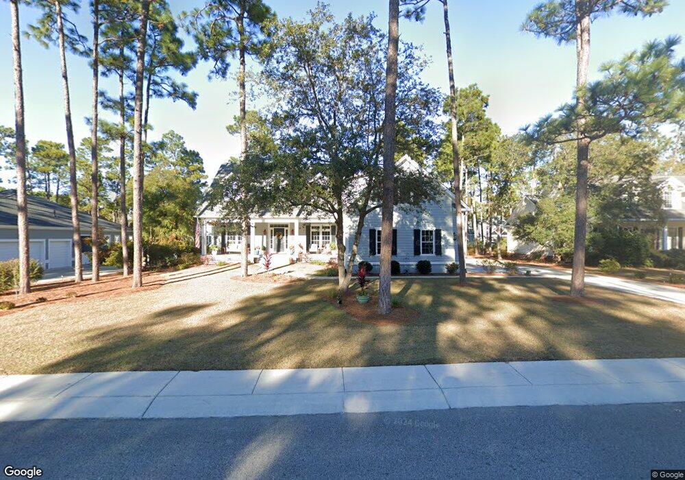
6210 Navigator Way Southport, NC 28461
Estimated Value: $743,431 - $867,000
4
Beds
3
Baths
2,494
Sq Ft
$323/Sq Ft
Est. Value
About This Home
This home is located at 6210 Navigator Way, Southport, NC 28461 and is currently estimated at $805,108, approximately $322 per square foot. 6210 Navigator Way is a home located in Brunswick County with nearby schools including Southport Elementary School, South Brunswick Middle School, and South Brunswick High School.
Ownership History
Date
Name
Owned For
Owner Type
Purchase Details
Closed on
Dec 22, 2017
Sold by
Podesta Joseph F and Podesta Monika M
Bought by
Doster Scott E and Doster Terri A
Current Estimated Value
Purchase Details
Closed on
Jul 21, 2005
Sold by
Mclamb William and Mclamb Amy P
Bought by
Podesta Joseph F and Podesta Monika M
Home Financials for this Owner
Home Financials are based on the most recent Mortgage that was taken out on this home.
Original Mortgage
$139,500
Interest Rate
5.46%
Mortgage Type
Purchase Money Mortgage
Purchase Details
Closed on
Jul 1, 2005
Sold by
Mclamb William and Mclamb Amby P
Bought by
Pope Earl D and Pope Doris N
Home Financials for this Owner
Home Financials are based on the most recent Mortgage that was taken out on this home.
Original Mortgage
$139,500
Interest Rate
5.46%
Mortgage Type
Purchase Money Mortgage
Create a Home Valuation Report for This Property
The Home Valuation Report is an in-depth analysis detailing your home's value as well as a comparison with similar homes in the area
Home Values in the Area
Average Home Value in this Area
Purchase History
| Date | Buyer | Sale Price | Title Company |
|---|---|---|---|
| Doster Scott E | $103,000 | None Available | |
| Podesta Joseph F | $155,000 | None Available | |
| Pope Earl D | -- | None Available |
Source: Public Records
Mortgage History
| Date | Status | Borrower | Loan Amount |
|---|---|---|---|
| Previous Owner | Podesta Joseph F | $139,500 |
Source: Public Records
Tax History Compared to Growth
Tax History
| Year | Tax Paid | Tax Assessment Tax Assessment Total Assessment is a certain percentage of the fair market value that is determined by local assessors to be the total taxable value of land and additions on the property. | Land | Improvement |
|---|---|---|---|---|
| 2025 | $4,509 | $593,800 | $153,000 | $440,800 |
| 2024 | $4,509 | $593,800 | $153,000 | $440,800 |
| 2023 | $4,540 | $593,800 | $153,000 | $440,800 |
| 2022 | $4,540 | $449,660 | $85,000 | $364,660 |
| 2021 | $3,965 | $449,660 | $85,000 | $364,660 |
| 2020 | $1,801 | $185,980 | $85,000 | $100,980 |
| 2019 | $711 | $85,000 | $85,000 | $0 |
| 2018 | $572 | $68,000 | $68,000 | $0 |
| 2017 | $571 | $68,000 | $68,000 | $0 |
| 2016 | $534 | $68,000 | $68,000 | $0 |
| 2015 | $534 | $68,000 | $68,000 | $0 |
| 2014 | $665 | $90,000 | $90,000 | $0 |
Source: Public Records
Map
Nearby Homes
- 1012 E Moore St
- 1015 E Moore St
- 1014 Softwind Way
- 1010 Softwind Way
- 1003 Softwind Way
- 282 Sand Dollar Ln
- 282 Sand Dollar Ln Unit 38
- 5147 Fernwood Dr
- 306 N Fodale Ave
- 712 Longleaf Dr
- 5122 Fernwood Dr
- 5138 Fernwood Dr
- 2035 Oakton Dr Unit 9
- 2071 Rosin Dr Unit 19
- 717 E Moore St
- 131 Stuart Ave Unit 42
- The Thorpe Plan at Waters at Southport
- The Brandt Plan at Waters at Southport
- The Salters Plan at Waters at Southport
- 131 Stuart Ave
- 6212 Navigator Way
- 6206 Navigator Way
- 6207 Pebble Shore Ln
- 6205 Pebble Shore Ln
- 6209 Navigator Way
- 6207 Navigator Way
- 6215 Navigator Way
- 6211 Pebble Shore Ln
- 6204 Pebble Shore Ln
- 6217 Navigator Way
- 6206 Pebble Shore Ln
- 6208 Pebble Shore Ln
- 6205 Navigator Way
- 6202 Pebble Shore Ln
- 6218 Navigator Way
- 6201 Navigator Way
- 6199 Navigator Way
- 6212 Pebble Shore Ln
- 6220 Navigator Way
- 6222 Navigator Way