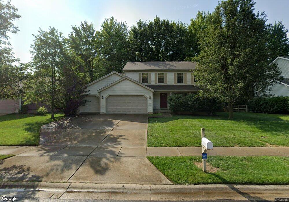
6210 Spires Dr Loveland, OH 45140
Outer Loveland NeighborhoodEstimated Value: $416,298 - $458,000
4
Beds
3
Baths
2,032
Sq Ft
$216/Sq Ft
Est. Value
About This Home
This home is located at 6210 Spires Dr, Loveland, OH 45140 and is currently estimated at $439,575, approximately $216 per square foot. 6210 Spires Dr is a home located in Clermont County with nearby schools including Milford Senior High School, Milford Christian Academy, and St. Andrew - St. Elizabeth Ann Seton School.
Ownership History
Date
Name
Owned For
Owner Type
Purchase Details
Closed on
Feb 1, 2019
Sold by
Sullivan Daniel P and Ross Cynthia A
Bought by
Sullivan Daniel P
Current Estimated Value
Purchase Details
Closed on
Mar 31, 2004
Sold by
M/I Homes Of Cincinnati Llc
Bought by
Sullivan Daniel P and Sullivan Cynthia A
Home Financials for this Owner
Home Financials are based on the most recent Mortgage that was taken out on this home.
Original Mortgage
$192,000
Interest Rate
2.37%
Mortgage Type
Purchase Money Mortgage
Create a Home Valuation Report for This Property
The Home Valuation Report is an in-depth analysis detailing your home's value as well as a comparison with similar homes in the area
Home Values in the Area
Average Home Value in this Area
Purchase History
| Date | Buyer | Sale Price | Title Company |
|---|---|---|---|
| Sullivan Daniel P | -- | None Available | |
| Sullivan Daniel P | $240,100 | -- |
Source: Public Records
Mortgage History
| Date | Status | Borrower | Loan Amount |
|---|---|---|---|
| Closed | Sullivan Daniel P | $192,000 |
Source: Public Records
Tax History Compared to Growth
Tax History
| Year | Tax Paid | Tax Assessment Tax Assessment Total Assessment is a certain percentage of the fair market value that is determined by local assessors to be the total taxable value of land and additions on the property. | Land | Improvement |
|---|---|---|---|---|
| 2024 | $5,070 | $110,290 | $21,110 | $89,180 |
| 2023 | $5,122 | $110,290 | $21,110 | $89,180 |
| 2022 | $4,696 | $76,930 | $14,700 | $62,230 |
| 2021 | $4,701 | $76,930 | $14,700 | $62,230 |
| 2020 | $4,508 | $76,930 | $14,700 | $62,230 |
| 2019 | $4,768 | $77,390 | $18,450 | $58,940 |
| 2018 | $4,770 | $77,390 | $18,450 | $58,940 |
| 2017 | $4,443 | $77,390 | $18,450 | $58,940 |
| 2016 | $4,483 | $66,120 | $15,750 | $50,370 |
| 2015 | $4,145 | $66,120 | $15,750 | $50,370 |
| 2014 | $4,145 | $66,120 | $15,750 | $50,370 |
| 2013 | $3,727 | $57,650 | $15,580 | $42,070 |
Source: Public Records
Map
Nearby Homes
- 6211 Spires Dr
- 6320 Ashford Dr
- 1803 Wheatfield Way
- 6108 Donna Jay Dr
- 2013 Weber Rd
- 6077 Branch Hill Guinea Pike
- 1140 Weber Rd
- 6149 Century Farm Dr
- 1376 Barre Ln
- 6395 Barre Rd
- 1285 State Rte 28
- 6141 Brandywine Ct
- 5933 Firm Stance Dr
- 1064 Weber Rd
- 1289 Woodville Pike
- 6467 Smith Rd
- 1113 Clover Field Dr
- 6211 Cook Rd
- 1513 Charleston Ln
- 6074 Deerfield Rd Unit 28
- 6212 Spires Dr
- 6208 Spires Dr
- 6214 Spires Dr
- 6206 Spires Dr
- 6213 Spires Dr
- 6216 Spires Dr
- 6279 Deerhaven Ln
- 6207 Spires Dr
- 6215 Spires Dr
- 6204 Spires Dr
- 6281 Deerhaven Ln
- 6205 Spires Dr
- 6217 Spires Dr
- 6218 Spires Dr
- 6202 Spires Dr
- 6203 Spires Dr
- 6219 Spires Dr
- 6220 Spires Dr
- 6290 Deerhaven Ln
- 6200 Spires Dr