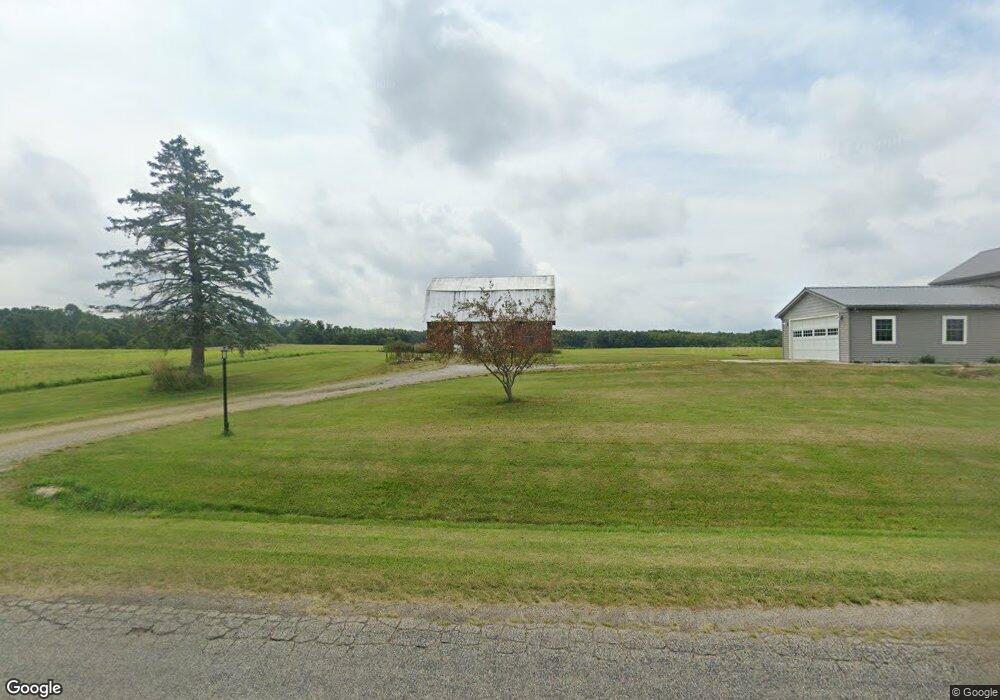
6211 Sampson Rd Camden, MI 49232
Estimated Value: $168,000 - $222,000
3
Beds
1
Bath
1,416
Sq Ft
$143/Sq Ft
Est. Value
About This Home
This home is located at 6211 Sampson Rd, Camden, MI 49232 and is currently estimated at $203,153, approximately $143 per square foot. 6211 Sampson Rd is a home located in Hillsdale County with nearby schools including Camden-Frontier K-8 School and Camden-Frontier High School.
Ownership History
Date
Name
Owned For
Owner Type
Purchase Details
Closed on
May 28, 2021
Sold by
Daglow Joyce R
Bought by
Martin Ethan and Martin Karli
Current Estimated Value
Home Financials for this Owner
Home Financials are based on the most recent Mortgage that was taken out on this home.
Original Mortgage
$141,600
Outstanding Balance
$128,400
Interest Rate
3%
Mortgage Type
New Conventional
Estimated Equity
$74,753
Purchase Details
Closed on
Feb 12, 2019
Sold by
Daglow Joyce and Daglow Marvin
Bought by
Daglow Joyce R and Daglow Joyce R
Purchase Details
Closed on
Sep 8, 2011
Sold by
Butler William H and Butler Jamie K
Bought by
Daglow Joyce
Purchase Details
Closed on
Feb 15, 2008
Sold by
Daglow Marvin and Daglow Joyce
Bought by
Butler William H and Butler Jamie K
Purchase Details
Closed on
Jun 29, 1999
Sold by
Enekes Christina T
Bought by
Perego Jean
Purchase Details
Closed on
Jun 1, 1993
Bought by
Enekes
Create a Home Valuation Report for This Property
The Home Valuation Report is an in-depth analysis detailing your home's value as well as a comparison with similar homes in the area
Home Values in the Area
Average Home Value in this Area
Purchase History
| Date | Buyer | Sale Price | Title Company |
|---|---|---|---|
| Martin Ethan | $177,000 | Midstate Ttl Agcy Of Souther | |
| Daglow Joyce R | -- | None Available | |
| Daglow Joyce | -- | None Available | |
| Butler William H | -- | First American Title Ins | |
| Perego Jean | -- | -- | |
| Enekes | -- | -- |
Source: Public Records
Mortgage History
| Date | Status | Borrower | Loan Amount |
|---|---|---|---|
| Open | Martin Ethan | $141,600 | |
| Closed | Martin Ethan | $15,930 |
Source: Public Records
Tax History Compared to Growth
Tax History
| Year | Tax Paid | Tax Assessment Tax Assessment Total Assessment is a certain percentage of the fair market value that is determined by local assessors to be the total taxable value of land and additions on the property. | Land | Improvement |
|---|---|---|---|---|
| 2025 | -- | $68,437 | $6,773 | $61,664 |
| 2024 | -- | $73,854 | $6,278 | $67,576 |
| 2023 | -- | $66,389 | $5,924 | $60,465 |
| 2022 | $855 | $56,276 | $5,740 | $50,536 |
| 2021 | $855 | $49,300 | $0 | $0 |
| 2020 | $868 | $46,600 | $0 | $0 |
| 2019 | $837 | $41,700 | $0 | $0 |
| 2018 | $668 | $33,300 | $0 | $0 |
| 2017 | $312 | $30,450 | $0 | $0 |
| 2016 | $312 | $28,800 | $0 | $0 |
| 2015 | $312 | $28,800 | $0 | $0 |
| 2013 | -- | $28,840 | $0 | $0 |
| 2012 | $295 | $26,910 | $0 | $0 |
Source: Public Records
Map
Nearby Homes
- 0 W Territorial Rd Unit 25043960
- 0 W Territorial Rd Unit 11603977
- 107 Mary St
- 18405 County Road 2-50
- 14934 Heather Ct
- 9677 W Camden Rd
- 6524 W Montgomery Rd
- 14364 Horn Dr
- 623-624 Yuma Trail
- 13551 Hillsdale Rd
- 115 N Michigan St
- 0 Dimmers Rd
- 600 Seneca Dr
- 219 N Hayward St
- 988-989 Seneca Dr
- 207 Modoc Trail
- 638 Seneca Dr
- 00 County Road 150
- 213 Navajo Trail
- 7950 E 400 N
- 6180 Sampson Rd
- 6360 Sampson Rd
- 6051 Sampson Rd
- 6011 Sampson Rd
- 5900 Sampson Rd
- 5711 Sampson Rd
- 6740 Sampson Rd
- 6911 Sampson Rd
- 5660 Sampson Rd
- 6911 Sampson Rd
- 6000 Sampson Rd
- 0 Sampson Rd
- 14151 Rice Rd
- 6960 Sampson Rd
- 14600 Rice
- 14500 Rice Rd
- 5280 Sampson Rd
- 14810 Rice Rd
- 5251 Sampson Rd
- 7211 Sampson Rd