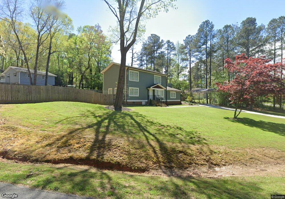
6212 Laurel Wood Trail Flowery Branch, GA 30542
Estimated Value: $398,119 - $420,000
3
Beds
2
Baths
2,200
Sq Ft
$184/Sq Ft
Est. Value
About This Home
This home is located at 6212 Laurel Wood Trail, Flowery Branch, GA 30542 and is currently estimated at $405,780, approximately $184 per square foot. 6212 Laurel Wood Trail is a home located in Hall County with nearby schools including Flowery Branch Elementary School, West Hall Middle School, and West Hall High School.
Ownership History
Date
Name
Owned For
Owner Type
Purchase Details
Closed on
Apr 18, 2018
Sold by
Nelson Cheryl
Bought by
Sims Cheryl Charle Castro
Current Estimated Value
Purchase Details
Closed on
May 17, 2013
Sold by
Edmonson Marlene R
Bought by
Nelson Cheryl B and Nelson Wayman
Purchase Details
Closed on
May 28, 1997
Sold by
Sherwood D H
Bought by
Edmonson Marlene R
Home Financials for this Owner
Home Financials are based on the most recent Mortgage that was taken out on this home.
Original Mortgage
$84,918
Interest Rate
8.13%
Mortgage Type
FHA
Create a Home Valuation Report for This Property
The Home Valuation Report is an in-depth analysis detailing your home's value as well as a comparison with similar homes in the area
Home Values in the Area
Average Home Value in this Area
Purchase History
| Date | Buyer | Sale Price | Title Company |
|---|---|---|---|
| Sims Cheryl Charle Castro | -- | -- | |
| Nelson Cheryl B | $2,500 | -- | |
| Edmonson Marlene R | $85,000 | -- |
Source: Public Records
Mortgage History
| Date | Status | Borrower | Loan Amount |
|---|---|---|---|
| Previous Owner | Edmonson Marlene R | $84,918 |
Source: Public Records
Tax History Compared to Growth
Tax History
| Year | Tax Paid | Tax Assessment Tax Assessment Total Assessment is a certain percentage of the fair market value that is determined by local assessors to be the total taxable value of land and additions on the property. | Land | Improvement |
|---|---|---|---|---|
| 2024 | $3,469 | $137,560 | $23,840 | $113,720 |
| 2023 | $3,027 | $119,640 | $16,800 | $102,840 |
| 2022 | $2,170 | $81,440 | $8,400 | $73,040 |
| 2021 | $2,106 | $77,480 | $8,400 | $69,080 |
| 2020 | $2,069 | $73,880 | $8,400 | $65,480 |
| 2019 | $1,983 | $70,040 | $8,400 | $61,640 |
| 2018 | $1,631 | $55,268 | $8,400 | $46,868 |
| 2017 | $1,504 | $51,308 | $8,800 | $42,508 |
| 2016 | $1,144 | $39,348 | $7,560 | $31,788 |
| 2015 | $535 | $16,792 | $7,360 | $9,432 |
| 2014 | $535 | $16,792 | $7,360 | $9,432 |
Source: Public Records
Map
Nearby Homes
- 6262 Laurel Wood Trail
- 6237 Stillwater Place
- 5904 Clipper Bay
- 6121 Stillwater Trail
- 6416 Deep Woods Ct
- 6414 Deep Valley Ct Unit 14081408
- 6749 Leigh St
- 6740 Leigh St
- 6732 Leigh St
- SUDBURY 24' TOWNHOME Plan at Waypoint
- ADDINGTON Plan at Waypoint
- SALISBURY 24' TOWNHOME Plan at Waypoint
- AMESBURY Plan at Waypoint
- 6737 Leigh St
- 6745 Leigh St
- 6226 Laurel Wood Trail
- 6205 Sweetgum Trail
- 6211 Sweetgum Trail
- 6215 Laurel Wood Trail
- 6211 Laurel Wood Trail
- 6219 Laurel Wood Trail Unit 26
- 6219 Laurel Wood Trail
- 6225 Laurel Wood Trail
- 6207 Laurel Wood Trail
- 6232 Laurel Wood Trail
- 6215 Sweetgum Trail
- 6231 Laurel Wood Trail
- 0000 Orville Dr
- 6238 Laurel Wood Trail
- 6203 Laurel Wood Trail
- 6206 Sweetgum Trail
- 6179 Laurel Wood Trail
- 6235 Laurel Wood Trail
- 6223 Sweetgum Trail
- 6218 Sweetgum Trail