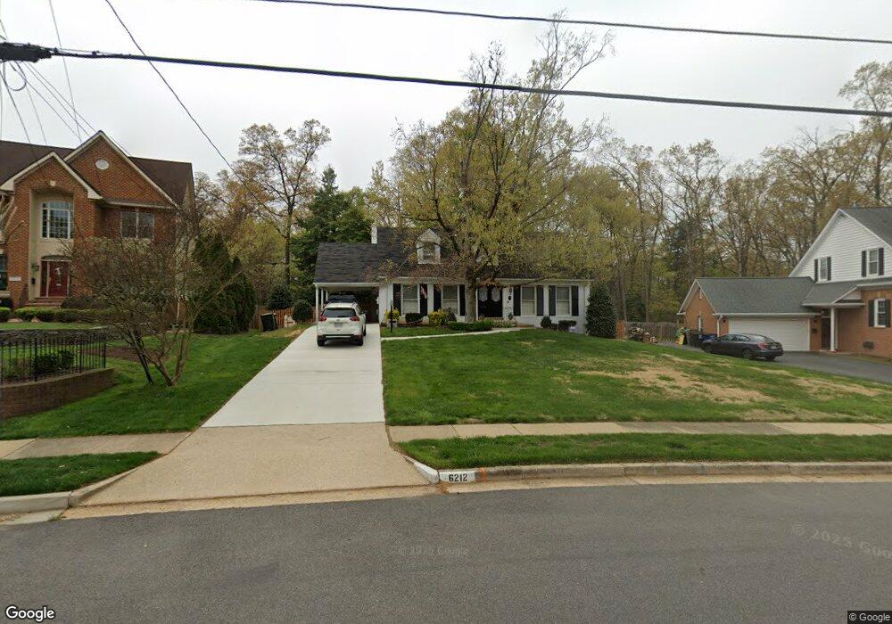
6212 Wayles St Springfield, VA 22150
Springtown NeighborhoodEstimated Value: $716,462 - $766,000
Studio
3
Baths
1,716
Sq Ft
$432/Sq Ft
Est. Value
About This Home
This home is located at 6212 Wayles St, Springfield, VA 22150 and is currently estimated at $741,231, approximately $431 per square foot. 6212 Wayles St is a home located in Fairfax County with nearby schools including Springfield Estates Elementary School, Key Middle, and Lewis High School.
Ownership History
Date
Name
Owned For
Owner Type
Purchase Details
Closed on
Jul 6, 2016
Sold by
Brocato Joseph R and Bradu Melanie R
Bought by
Brocato Joseph R
Current Estimated Value
Purchase Details
Closed on
Jul 16, 1998
Sold by
Lloyd Delores M
Bought by
Brocato Joseph R
Home Financials for this Owner
Home Financials are based on the most recent Mortgage that was taken out on this home.
Original Mortgage
$192,000
Interest Rate
6.98%
Create a Home Valuation Report for This Property
The Home Valuation Report is an in-depth analysis detailing your home's value as well as a comparison with similar homes in the area
Home Values in the Area
Average Home Value in this Area
Purchase History
| Date | Buyer | Sale Price | Title Company |
|---|---|---|---|
| Brocato Joseph R | -- | None Available | |
| Brocato Joseph R | $240,000 | -- |
Source: Public Records
Mortgage History
| Date | Status | Borrower | Loan Amount |
|---|---|---|---|
| Previous Owner | Brocato Joseph R | $192,000 |
Source: Public Records
Tax History
| Year | Tax Paid | Tax Assessment Tax Assessment Total Assessment is a certain percentage of the fair market value that is determined by local assessors to be the total taxable value of land and additions on the property. | Land | Improvement |
|---|---|---|---|---|
| 2025 | $7,948 | $742,980 | $313,000 | $429,980 |
| 2024 | $7,948 | $686,050 | $293,000 | $393,050 |
| 2023 | $8,091 | $716,950 | $293,000 | $423,950 |
| 2022 | $7,176 | $627,510 | $253,000 | $374,510 |
| 2021 | $6,833 | $582,290 | $223,000 | $359,290 |
| 2020 | $6,611 | $558,560 | $219,000 | $339,560 |
| 2019 | $6,067 | $512,650 | $205,000 | $307,650 |
| 2018 | $5,895 | $512,650 | $205,000 | $307,650 |
| 2017 | $5,835 | $502,620 | $201,000 | $301,620 |
| 2016 | $5,708 | $492,710 | $197,000 | $295,710 |
| 2015 | $5,115 | $458,360 | $182,000 | $276,360 |
| 2014 | $5,104 | $458,360 | $182,000 | $276,360 |
Source: Public Records
Map
Nearby Homes
- 6124 Crozet Ct
- 6430 Franconia Rd
- 6476 Franconia Ct
- 6009 Jennings Ln
- 6350 Racetec Place
- 6703 Cimarron St
- 6348 Dakine Cir
- 6613 Elder Ave
- 6405 Little Potters Ln
- 6209 Waterlily Ct
- 6615 Deer Gap Ct
- 6223 Summit Point Ct
- 6262 Summit Point Ct
- 6185 Little Valley Way
- 6149 Cilantro Dr
- 6167 Cobbs Rd
- 6139 Cinnamon Ct
- 6735 Applemint Ln
- 6908 Victoria Dr Unit B
- 5907 Camberly Ave
- 6210 Wayles St
- 6214 Wayles St
- 6300 Wayles St
- 6208 Wayles St
- 6211 Wayles St
- 6213 Wayles St
- 6302 Wayles St
- 6206 Wayles St
- 6207 Wayles St
- 6301 Wayles St
- 6436 Burwell St
- 6434 Burwell St
- 6308 Wayles St
- 6205 Wayles St
- 6204 Wayles St
- 6427 Deepford St
- 6303 Wayles St
- 6432 Burwell St
- 6429 Deepford St
- 6440 Burwell St
Your Personal Tour Guide
Ask me questions while you tour the home.