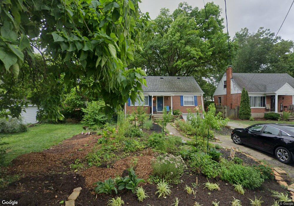
6213 Dawes Ln Cincinnati, OH 45230
Mount Washington NeighborhoodEstimated Value: $237,708 - $299,000
4
Beds
2
Baths
1,485
Sq Ft
$183/Sq Ft
Est. Value
About This Home
This home is located at 6213 Dawes Ln, Cincinnati, OH 45230 and is currently estimated at $271,677, approximately $182 per square foot. 6213 Dawes Ln is a home located in Hamilton County with nearby schools including Mt. Washington Elementary School, Clark Montessori High School, and Shroder High School.
Ownership History
Date
Name
Owned For
Owner Type
Purchase Details
Closed on
Apr 13, 2021
Sold by
Hettel Harry L
Bought by
Hettel Harry L and Hettel Carol L
Current Estimated Value
Purchase Details
Closed on
Oct 14, 1997
Sold by
Brockman Thecla L and Bihlman Thecla L
Bought by
Hettel Harry L
Purchase Details
Closed on
May 13, 1994
Sold by
Makee James E and Makee Jill M
Bought by
Bihlman Thecla L
Home Financials for this Owner
Home Financials are based on the most recent Mortgage that was taken out on this home.
Original Mortgage
$70,000
Interest Rate
8.5%
Create a Home Valuation Report for This Property
The Home Valuation Report is an in-depth analysis detailing your home's value as well as a comparison with similar homes in the area
Home Values in the Area
Average Home Value in this Area
Purchase History
| Date | Buyer | Sale Price | Title Company |
|---|---|---|---|
| Hettel Harry L | -- | None Available | |
| Hettel Harry L | $109,000 | -- | |
| Bihlman Thecla L | -- | -- |
Source: Public Records
Mortgage History
| Date | Status | Borrower | Loan Amount |
|---|---|---|---|
| Previous Owner | Bihlman Thecla L | $70,000 |
Source: Public Records
Tax History Compared to Growth
Tax History
| Year | Tax Paid | Tax Assessment Tax Assessment Total Assessment is a certain percentage of the fair market value that is determined by local assessors to be the total taxable value of land and additions on the property. | Land | Improvement |
|---|---|---|---|---|
| 2024 | $3,327 | $55,580 | $9,226 | $46,354 |
| 2023 | $3,402 | $55,580 | $9,226 | $46,354 |
| 2022 | $2,878 | $42,148 | $7,753 | $34,395 |
| 2021 | $2,767 | $42,148 | $7,753 | $34,395 |
| 2020 | $2,848 | $42,148 | $7,753 | $34,395 |
| 2019 | $2,732 | $36,971 | $6,801 | $30,170 |
| 2018 | $2,736 | $36,971 | $6,801 | $30,170 |
| 2017 | $2,599 | $36,971 | $6,801 | $30,170 |
| 2016 | $3,010 | $42,252 | $7,770 | $34,482 |
| 2015 | $2,714 | $42,252 | $7,770 | $34,482 |
| 2014 | $2,734 | $42,252 | $7,770 | $34,482 |
| 2013 | $2,781 | $42,252 | $7,770 | $34,482 |
Source: Public Records
Map
Nearby Homes
- 6114 Glade Ave
- 6146 Mariwood Ln
- 1634 Brandon Ave
- 1549 Sutton Ave
- 1508 Beth Ln
- 1605 Marlou Ln
- 1323 Thornbird Dr
- 1405 Dyer Ave
- 6952 Shadow Ridge Rd
- 1739 Marquette Ave
- 6390 Cambridge Ave
- 4 Cottage Ct
- 6137 Benneville St
- 6258 Benneville St
- 1 Salem Rd
- 6065 Salem Rd
- 3 Salem Rd
- 4 Salem Rd
- 2 Salem Rd
- 1944 Rockland Ave