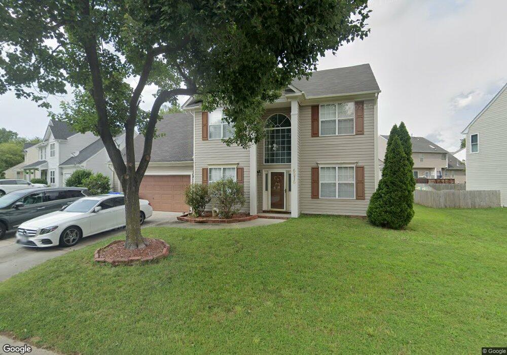
6216 Burbage Acres Dr Suffolk, VA 23435
Nansemond NeighborhoodEstimated Value: $424,677 - $440,000
4
Beds
3
Baths
1,978
Sq Ft
$218/Sq Ft
Est. Value
About This Home
This home is located at 6216 Burbage Acres Dr, Suffolk, VA 23435 and is currently estimated at $430,419, approximately $217 per square foot. 6216 Burbage Acres Dr is a home located in Suffolk City with nearby schools including Northern Shores Elementary School, John Yeates Middle School, and Nansemond River High School.
Ownership History
Date
Name
Owned For
Owner Type
Purchase Details
Closed on
Dec 6, 2010
Sold by
Fannie Mae
Bought by
Sutton James
Current Estimated Value
Home Financials for this Owner
Home Financials are based on the most recent Mortgage that was taken out on this home.
Original Mortgage
$204,578
Outstanding Balance
$135,161
Interest Rate
4.22%
Mortgage Type
FHA
Estimated Equity
$295,258
Purchase Details
Closed on
Jul 13, 2010
Sold by
Professional Foreclosure Corp and Boyd Theodore A
Bought by
Federal National Mtg Asoc
Create a Home Valuation Report for This Property
The Home Valuation Report is an in-depth analysis detailing your home's value as well as a comparison with similar homes in the area
Home Values in the Area
Average Home Value in this Area
Purchase History
| Date | Buyer | Sale Price | Title Company |
|---|---|---|---|
| Sutton James | $209,900 | -- | |
| Federal National Mtg Asoc | $244,704 | -- |
Source: Public Records
Mortgage History
| Date | Status | Borrower | Loan Amount |
|---|---|---|---|
| Open | Federal National Mtg Asoc | $204,578 |
Source: Public Records
Tax History Compared to Growth
Tax History
| Year | Tax Paid | Tax Assessment Tax Assessment Total Assessment is a certain percentage of the fair market value that is determined by local assessors to be the total taxable value of land and additions on the property. | Land | Improvement |
|---|---|---|---|---|
| 2024 | $4,759 | $393,900 | $85,000 | $308,900 |
| 2023 | $4,608 | $367,400 | $85,000 | $282,400 |
| 2022 | $3,564 | $327,000 | $85,000 | $242,000 |
| 2021 | $3,124 | $281,400 | $69,700 | $211,700 |
| 2020 | $3,033 | $273,200 | $69,700 | $203,500 |
| 2019 | $2,896 | $260,900 | $69,700 | $191,200 |
| 2018 | $2,813 | $252,300 | $69,700 | $182,600 |
| 2017 | $2,633 | $246,100 | $69,700 | $176,400 |
| 2016 | $2,633 | $246,100 | $69,700 | $176,400 |
| 2015 | $1,282 | $238,900 | $62,500 | $176,400 |
| 2014 | $1,282 | $239,000 | $62,500 | $176,500 |
Source: Public Records
Map
Nearby Homes
- 6832 Ivanhoe Ct
- 6417 Pelican Crescent N
- 6215 Cambridge Dr
- 6446 Olde Bullocks Cir
- 5109 Hoffler St
- 1018 Ashworth Way
- 2002 Ashworth Way
- 2020 Ashworth Way
- 1008 Ashworth Way
- 1010 Ashworth Way
- 6750 Burbage Landing Cir
- 6602 James Point Ct
- 6109 Compton Ct
- 4913 Marina Dr
- 5028 Bay Cir
- 206 Rockwood Place
- 4071 Long Point Blvd
- 1132 Samuel Greene Way
- 1129 Marston St
- 1130 Samuel Greene Way
- 6214 Burbage Acres Dr
- 6218 Burbage Acres Dr
- 6404 Aberdeen Place
- 6406 Aberdeen Place
- 6301 Cheshire Dr
- 6212 Burbage Acres Dr
- 6215 Burbage Acres Dr
- 6402 Aberdeen Place
- 6300 Cheshire Dr
- 6213 Burbage Acres Dr
- 6210 Burbage Acres Dr
- 6401 Yorkshire Dr
- 6222 Burbage Acres Dr
- 6408 Aberdeen Place
- 6201 Winthrope Dr
- 6302 Cheshire Dr
- 6403 Yorkshire Dr
- 6211 Burbage Acres Dr
- 6302 Dover Dr
- 6405 Yorkshire Dr