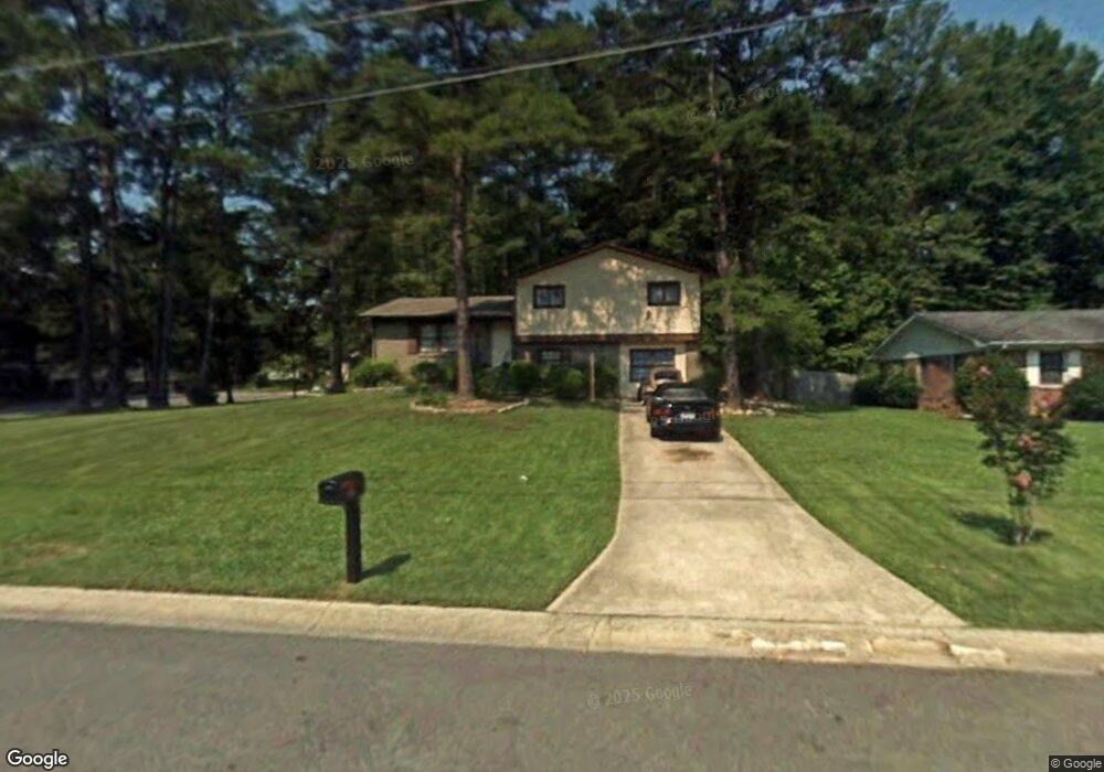
6219 Thornhedge Dr Unit 4 Riverdale, GA 30296
Estimated Value: $181,000 - $255,000
3
Beds
2
Baths
1,227
Sq Ft
$180/Sq Ft
Est. Value
About This Home
This home is located at 6219 Thornhedge Dr Unit 4, Riverdale, GA 30296 and is currently estimated at $220,632, approximately $179 per square foot. 6219 Thornhedge Dr Unit 4 is a home located in Clayton County with nearby schools including Oliver Elementary School, North Clayton Middle School, and North Clayton High School.
Ownership History
Date
Name
Owned For
Owner Type
Purchase Details
Closed on
Jan 1, 2013
Sold by
Madden Shenicka L
Bought by
Madden Martha Ann
Current Estimated Value
Purchase Details
Closed on
Jul 26, 2006
Sold by
Madden Martha A
Bought by
Madden Shenicka L
Home Financials for this Owner
Home Financials are based on the most recent Mortgage that was taken out on this home.
Original Mortgage
$97,600
Interest Rate
6.74%
Mortgage Type
New Conventional
Create a Home Valuation Report for This Property
The Home Valuation Report is an in-depth analysis detailing your home's value as well as a comparison with similar homes in the area
Home Values in the Area
Average Home Value in this Area
Purchase History
| Date | Buyer | Sale Price | Title Company |
|---|---|---|---|
| Madden Martha Ann | -- | -- | |
| Madden Shenicka L | $122,100 | -- |
Source: Public Records
Mortgage History
| Date | Status | Borrower | Loan Amount |
|---|---|---|---|
| Previous Owner | Madden Shenicka L | $97,600 |
Source: Public Records
Tax History Compared to Growth
Tax History
| Year | Tax Paid | Tax Assessment Tax Assessment Total Assessment is a certain percentage of the fair market value that is determined by local assessors to be the total taxable value of land and additions on the property. | Land | Improvement |
|---|---|---|---|---|
| 2024 | $1,249 | $72,520 | $8,000 | $64,520 |
| 2023 | $2,421 | $67,040 | $8,000 | $59,040 |
| 2022 | $915 | $55,720 | $8,000 | $47,720 |
| 2021 | $779 | $48,160 | $8,000 | $40,160 |
| 2020 | $622 | $39,308 | $8,000 | $31,308 |
| 2019 | $1,479 | $35,564 | $4,800 | $30,764 |
| 2018 | $1,271 | $30,438 | $4,800 | $25,638 |
| 2017 | $1,114 | $26,493 | $4,800 | $21,693 |
| 2016 | $1,127 | $26,827 | $4,800 | $22,027 |
| 2015 | $1,026 | $0 | $0 | $0 |
| 2014 | $816 | $19,633 | $4,800 | $14,833 |
Source: Public Records
Map
Nearby Homes
- 6278 Thornhedge Dr
- 1991 Flat Shoals Rd
- 1857 Rockford Ct
- 1959 Conkle Rd
- 6307 Thornhedge Dr
- 1836 Whitworth Dr
- 2069 Swan Ct
- 6105 Camden Forrest Ct
- 6180 Beethoven Cir
- 1711 Austin Dr
- 6213 Bishop Place
- 1969 Banks Way
- 6350 Mozart Dr
- 6073 Camden Forrest Dr
- 6255 Mozart Dr
- 6076 Camden Forrest Dr
- 5950 Milligan Ct
- 6220 Polar Fox Ct
- 0 Garland Ct
- 6207 Thornhedge Dr
- 1935 Garland Ct
- 6218 Thornhedge Dr
- 6237 Thornhedge Dr
- 1939 Garland Ct
- 6197 Thornhedge Dr
- 6206 Thornhedge Dr
- 6236 Thornhedge Dr
- 6236 Thornhedge Dr
- 1934 Garland Ct
- 6220 Auburn Dr
- 6196 Thornhedge Dr Unit 4
- 6200 Auburn Dr
- 1895 Trenton Ct
- 6230 Auburn Dr
- 6253 Thornhedge Dr
- 6187 Thornhedge Dr
- 1938 Flat Shoals Rd Unit 5
- 1894 Trenton Ct