Estimated Value: $476,000 - $526,999
3
Beds
3
Baths
2,922
Sq Ft
$172/Sq Ft
Est. Value
About This Home
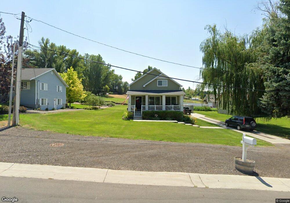
This home is located at 622 Anderson Ave, Hyrum, UT 84319 and is currently estimated at $501,250, approximately $171 per square foot. 622 Anderson Ave is a home located in Cache County with nearby schools including Millville School, South Cache Middle School, and Mountain Crest High School.
Ownership History
Date
Name
Owned For
Owner Type
Purchase Details
Closed on
Mar 15, 2017
Sold by
Farsworth Benjamin E and Farnsworth Elaine R
Bought by
Talbot Meridith
Current Estimated Value
Home Financials for this Owner
Home Financials are based on the most recent Mortgage that was taken out on this home.
Original Mortgage
$17,880
Outstanding Balance
$14,783
Interest Rate
4.15%
Mortgage Type
New Conventional
Estimated Equity
$486,467
Purchase Details
Closed on
Oct 3, 2012
Sold by
Lancaster Jason and Lancaster Elizabeth
Bought by
Sierra Construction Homes Inc
Home Financials for this Owner
Home Financials are based on the most recent Mortgage that was taken out on this home.
Original Mortgage
$144,000
Interest Rate
3.52%
Mortgage Type
Construction
Create a Home Valuation Report for This Property
The Home Valuation Report is an in-depth analysis detailing your home's value as well as a comparison with similar homes in the area
Home Values in the Area
Average Home Value in this Area
Purchase History
| Date | Buyer | Sale Price | Title Company |
|---|---|---|---|
| Talbot Meridith | -- | Cache Title Company | |
| Sierra Construction Homes Inc | -- | American Secure Title Logan |
Source: Public Records
Mortgage History
| Date | Status | Borrower | Loan Amount |
|---|---|---|---|
| Open | Talbot Meridith | $17,880 | |
| Previous Owner | Sierra Construction Homes Inc | $144,000 |
Source: Public Records
Tax History Compared to Growth
Tax History
| Year | Tax Paid | Tax Assessment Tax Assessment Total Assessment is a certain percentage of the fair market value that is determined by local assessors to be the total taxable value of land and additions on the property. | Land | Improvement |
|---|---|---|---|---|
| 2025 | $1,816 | $260,695 | $0 | $0 |
| 2024 | $1,934 | $259,260 | $0 | $0 |
| 2023 | $2,097 | $268,890 | $0 | $0 |
| 2022 | $2,189 | $268,890 | $0 | $0 |
| 2021 | $1,707 | $323,169 | $69,190 | $253,979 |
| 2020 | $1,633 | $290,042 | $69,190 | $220,852 |
| 2019 | $1,603 | $267,852 | $47,000 | $220,852 |
| 2018 | $1,512 | $244,190 | $47,000 | $197,190 |
| 2017 | $1,541 | $129,140 | $0 | $0 |
| 2016 | $1,576 | $96,195 | $0 | $0 |
Source: Public Records
Map
Nearby Homes
- 628 E Anderson Ave N
- 610 Anderson Ave
- 652 Anderson Ave
- 660 Anderson Ave
- 623 Anderson Ave
- 611 Anderson Ave
- 190 N 600 E
- 601 Anderson Ave
- 647 Anderson Ave
- 195 Park Ave
- 220 Park Ave
- 230 Amberfields Dr
- 210 Park Ave
- 271 Panoramic Dr
- 200 Park Ave
- 260 Panoramic Dr
- 250 N 300 E
- 250 N 600 E
- 700 Anderson Ave
- 281 Panoramic Dr