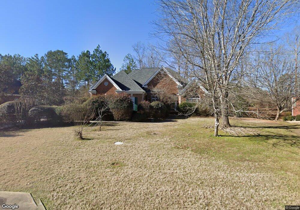
622 Chesterfield Rd Bogart, GA 30622
Estimated Value: $488,000 - $529,000
5
Beds
4
Baths
3,066
Sq Ft
$168/Sq Ft
Est. Value
About This Home
This home is located at 622 Chesterfield Rd, Bogart, GA 30622 and is currently estimated at $514,006, approximately $167 per square foot. 622 Chesterfield Rd is a home located in Clarke County with nearby schools including Cleveland Road Elementary School, Burney-Harris-Lyons Middle School, and Clarke Central High School.
Ownership History
Date
Name
Owned For
Owner Type
Purchase Details
Closed on
Aug 26, 2008
Sold by
Bedle Robert T
Bought by
Myers Patricia Ann
Current Estimated Value
Purchase Details
Closed on
Apr 20, 2005
Sold by
Bedle Robert T
Bought by
Bedle Robert T and Robert Travis Bedle
Purchase Details
Closed on
Oct 7, 2003
Sold by
H & B Homes Llc
Bought by
Bedle Robert T and Bedle Frances O
Purchase Details
Closed on
Mar 1, 2000
Sold by
Willwork L L C
Bought by
H & B Homes Llc
Create a Home Valuation Report for This Property
The Home Valuation Report is an in-depth analysis detailing your home's value as well as a comparison with similar homes in the area
Home Values in the Area
Average Home Value in this Area
Purchase History
| Date | Buyer | Sale Price | Title Company |
|---|---|---|---|
| Myers Patricia Ann | $273,500 | -- | |
| Bedle Robert T | -- | -- | |
| Bedle Robert T | $249,000 | -- | |
| H & B Homes Llc | $18,800 | -- |
Source: Public Records
Tax History Compared to Growth
Tax History
| Year | Tax Paid | Tax Assessment Tax Assessment Total Assessment is a certain percentage of the fair market value that is determined by local assessors to be the total taxable value of land and additions on the property. | Land | Improvement |
|---|---|---|---|---|
| 2025 | $3,813 | $206,929 | $18,000 | $188,929 |
| 2024 | $3,813 | $197,754 | $18,000 | $179,754 |
| 2023 | $3,848 | $184,723 | $18,000 | $166,723 |
| 2022 | $3,659 | $159,752 | $18,000 | $141,752 |
| 2021 | $3,474 | $131,837 | $16,000 | $115,837 |
| 2020 | $3,441 | $129,418 | $16,000 | $113,418 |
| 2019 | $3,304 | $117,444 | $16,000 | $101,444 |
| 2018 | $3,216 | $111,096 | $16,000 | $95,096 |
| 2017 | $3,100 | $102,834 | $16,000 | $86,834 |
| 2016 | $3,064 | $100,263 | $16,000 | $84,263 |
| 2015 | $2,959 | $97,017 | $16,000 | $81,017 |
| 2014 | $3,097 | $100,919 | $16,000 | $84,919 |
Source: Public Records
Map
Nearby Homes
- 682 Chesterfield Rd
- 190 W Huntington Rd
- 240 W Huntington Rd
- 100 Hanover Dr
- 241 Meeler Cir
- 212 Huntington Shoals Dr
- 141 Huntington Shoals Dr
- 637 Huntington Rd Unit B1
- 112 Deerhollow Rd
- 470 Huntington Rd Unit 5
- 532 Huntington Rd Unit 7
- 150 Callaway Dr
- 256 Cherokee Ridge
- 178 Ben Burton Cir
- 240 Deerfield Rd
- 575 Vaughn Rd
- 211 Littleton Way
- 240 Cleveland Rd Unit 105
- 632 Chesterfield Rd
- 616 Chesterfield Rd
- 631 Chesterfield Rd
- 636 Chesterfield Rd
- 612 Chesterfield Rd
- 621 Chesterfield Rd
- 698 Cleveland Rd
- 641 Chesterfield Rd
- 611 Chesterfield Rd
- 602 Chesterfield Rd
- 642 Chesterfield Rd
- 117 Brittany Rd
- 601 Chesterfield Rd
- 114 Brittany Rd
- 140 Chelsea Ct
- 600 Chesterfield Rd
- 127 Brittany Rd
- 651 Chesterfield Rd
- 652 Chesterfield Rd
- 124 Brittany Rd