Estimated Value: $285,000 - $400,000
4
Beds
2
Baths
1,924
Sq Ft
$170/Sq Ft
Est. Value
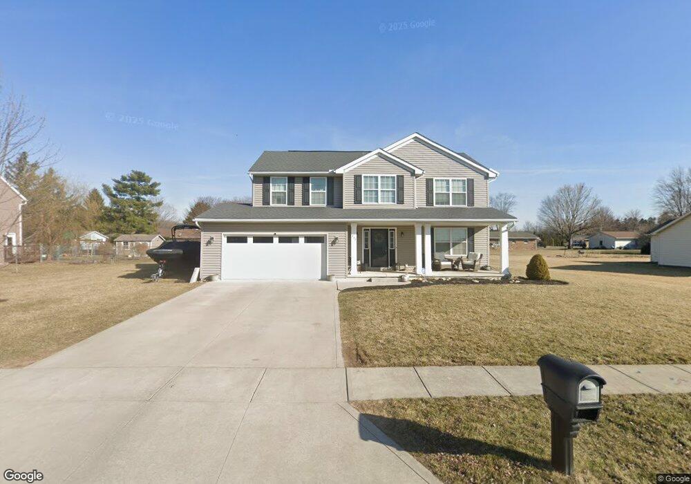
About This Home
This home is located at 622 Clint Dr, Ada, OH 45810 and is currently estimated at $326,465, approximately $169 per square foot. 622 Clint Dr is a home with nearby schools including Ada Elementary School and Ada High School.
Ownership History
Date
Name
Owned For
Owner Type
Purchase Details
Closed on
Aug 18, 2009
Sold by
Country Excavating Properties Llc
Bought by
Hall Michael A and Hall Andrea J
Current Estimated Value
Purchase Details
Closed on
Dec 19, 2005
Sold by
Simon Properties Llc
Bought by
Country Excavating Properties Llc
Create a Home Valuation Report for This Property
The Home Valuation Report is an in-depth analysis detailing your home's value as well as a comparison with similar homes in the area
Home Values in the Area
Average Home Value in this Area
Purchase History
| Date | Buyer | Sale Price | Title Company |
|---|---|---|---|
| Hall Michael A | $100,000 | None Available | |
| Country Excavating Properties Llc | $13,000 | None Available |
Source: Public Records
Tax History
| Year | Tax Paid | Tax Assessment Tax Assessment Total Assessment is a certain percentage of the fair market value that is determined by local assessors to be the total taxable value of land and additions on the property. | Land | Improvement |
|---|---|---|---|---|
| 2024 | $3,837 | $98,940 | $8,860 | $90,080 |
| 2023 | $3,814 | $98,940 | $8,860 | $90,080 |
| 2022 | $3,403 | $77,160 | $8,450 | $68,710 |
| 2021 | $3,734 | $77,160 | $8,450 | $68,710 |
| 2020 | $3,770 | $76,840 | $8,450 | $68,390 |
| 2019 | $3,530 | $72,810 | $8,050 | $64,760 |
| 2018 | $3,453 | $72,810 | $8,050 | $64,760 |
| 2017 | $3,374 | $72,810 | $8,050 | $64,760 |
| 2016 | $2,920 | $66,350 | $4,550 | $61,800 |
| 2015 | $2,824 | $66,350 | $4,550 | $61,800 |
| 2014 | $2,844 | $66,350 | $4,550 | $61,800 |
| 2013 | $2,895 | $62,370 | $4,550 | $57,820 |
Source: Public Records
Map
Nearby Homes
- 820 S Main St
- 710 S Main St
- 722 S Johnson St
- 318 Willeke Ave
- 314 E University Ave
- 308-310 S Simon St
- 210 N Gilbert St
- 211 S Main St
- 510 E Lehr Ave Unit 510R
- 2959 County Road 60
- 1689 County Road 50
- 420 N Simon St
- 327 W North Ave
- 530 N Main St
- 442 Edwards St
- 629 N Main St
- 503 E North Ave
- 724 N Main St
- 746 N Main St Unit 61
- 746 N Main St Unit 63
- XXX Clint Dr
- 624 Clint Dr
- 512 Clint Dr
- 621 Clint Dr
- 627 Clint Dr
- 517 Clint Dr
- 613 Pleasantview St Unit 615
- 508 Clint Dr
- 509 Pleasantview St Unit 511
- 626 Clint Dr
- 619 Pleasantview St
- 625 Clint Dr
- 614 Pleasantview St
- 620 Pleasantview St
- 505 Pleasantview St
- 623 Pleasantview St
- 626 Pleasantview St
- 507 Clint Dr
- 2002 Southernview St
- 506 Pleasantview St
Your Personal Tour Guide
Ask me questions while you tour the home.