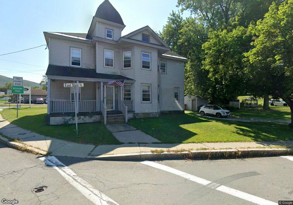
622 E Main St North Adams, MA 01247
Estimated Value: $214,000 - $268,000
5
Beds
2
Baths
2,714
Sq Ft
$89/Sq Ft
Est. Value
About This Home
This home is located at 622 E Main St, North Adams, MA 01247 and is currently estimated at $241,199, approximately $88 per square foot. 622 E Main St is a home located in Berkshire County with nearby schools including Colegrove Park Elementary School and Drury High School.
Ownership History
Date
Name
Owned For
Owner Type
Purchase Details
Closed on
Dec 12, 2023
Sold by
Kierstead Scott A and Kierstead Kathy S
Bought by
Kierstead Kathy S and Kierstead Morgan L
Current Estimated Value
Purchase Details
Closed on
Jan 18, 1985
Bought by
Kierstead Scott A and Kierstead Kathy S
Create a Home Valuation Report for This Property
The Home Valuation Report is an in-depth analysis detailing your home's value as well as a comparison with similar homes in the area
Home Values in the Area
Average Home Value in this Area
Purchase History
| Date | Buyer | Sale Price | Title Company |
|---|---|---|---|
| Kierstead Kathy S | -- | None Available | |
| Kierstead Kathy S | -- | None Available | |
| Kierstead Scott A | -- | -- |
Source: Public Records
Mortgage History
| Date | Status | Borrower | Loan Amount |
|---|---|---|---|
| Previous Owner | Kierstead Scott A | $17,800 | |
| Previous Owner | Kierstead Scott A | $52,800 | |
| Previous Owner | Kierstead Scott A | $50,862 | |
| Previous Owner | Kierstead Scott A | $18,000 |
Source: Public Records
Tax History
| Year | Tax Paid | Tax Assessment Tax Assessment Total Assessment is a certain percentage of the fair market value that is determined by local assessors to be the total taxable value of land and additions on the property. | Land | Improvement |
|---|---|---|---|---|
| 2025 | $2,807 | $168,000 | $35,100 | $132,900 |
| 2024 | $2,636 | $153,800 | $32,100 | $121,700 |
| 2023 | $2,407 | $136,200 | $32,100 | $104,100 |
| 2022 | $2,363 | $127,500 | $32,100 | $95,400 |
| 2021 | $2,198 | $118,100 | $29,700 | $88,400 |
| 2020 | $2,125 | $114,100 | $28,400 | $85,700 |
| 2019 | $2,133 | $111,600 | $29,000 | $82,600 |
| 2018 | $2,108 | $114,700 | $31,100 | $83,600 |
| 2017 | $2,007 | $113,600 | $30,800 | $82,800 |
| 2016 | $1,976 | $113,600 | $30,800 | $82,800 |
| 2015 | $1,938 | $116,100 | $31,900 | $84,200 |
Source: Public Records
Map
Nearby Homes
- 606 E Main St
- 524 Union St
- 3 Walker St
- 522 Union St
- 516 Union St Unit 518
- 4 Walker St
- 596 E Main St
- 642 E Main St
- 517 Union St Unit 519
- 568 Mohawk Trail
- 12 Walker St
- 593 E Main St Unit 595
- 16 Walker St
- 510 Union St
- 588 E Main St
- 511 Union St
- 565 Union St
- 502 Union St Unit 504
- 507 Union St
- 651 E Main St
Your Personal Tour Guide
Ask me questions while you tour the home.