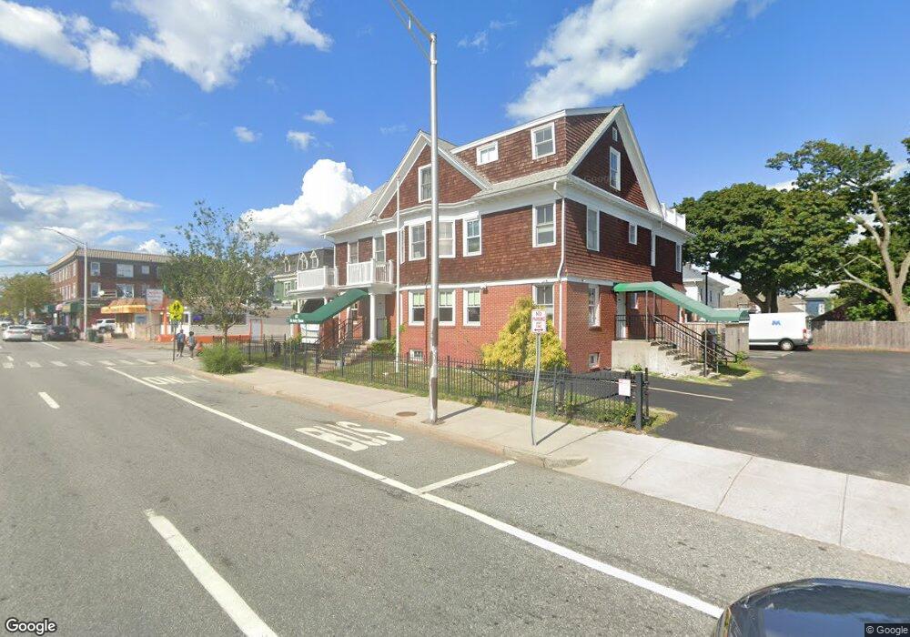
622 Elmwood Ave Providence, RI 02907
Elmwood NeighborhoodEstimated Value: $474,180
10
Beds
3
Baths
2,700
Sq Ft
$176/Sq Ft
Est. Value
About This Home
This home is located at 622 Elmwood Ave, Providence, RI 02907 and is currently estimated at $474,180, approximately $175 per square foot. 622 Elmwood Ave is a home located in Providence County with nearby schools including Paul Cuffee High School and Sophia Academy.
Ownership History
Date
Name
Owned For
Owner Type
Purchase Details
Closed on
Mar 21, 2000
Sold by
Rusconi Robert L and Garda Aldo
Bought by
Cornerstone Const Corp
Current Estimated Value
Create a Home Valuation Report for This Property
The Home Valuation Report is an in-depth analysis detailing your home's value as well as a comparison with similar homes in the area
Home Values in the Area
Average Home Value in this Area
Purchase History
| Date | Buyer | Sale Price | Title Company |
|---|---|---|---|
| Cornerstone Const Corp | $125,000 | -- |
Source: Public Records
Mortgage History
| Date | Status | Borrower | Loan Amount |
|---|---|---|---|
| Open | Cornerstone Const Corp | $200,000 | |
| Open | Cornerstone Const Corp | $400,000 | |
| Closed | Cornerstone Const Corp | $300,000 | |
| Closed | Cornerstone Const Corp | $45,000 |
Source: Public Records
Tax History Compared to Growth
Tax History
| Year | Tax Paid | Tax Assessment Tax Assessment Total Assessment is a certain percentage of the fair market value that is determined by local assessors to be the total taxable value of land and additions on the property. | Land | Improvement |
|---|---|---|---|---|
| 2025 | -- | $863,300 | $239,700 | $623,600 |
| 2024 | -- | $664,800 | $145,200 | $519,600 |
| 2023 | $0 | $664,800 | $145,200 | $519,600 |
| 2022 | $0 | $664,800 | $145,200 | $519,600 |
| 2021 | $0 | $591,900 | $133,200 | $458,700 |
| 2020 | $0 | $591,900 | $133,200 | $458,700 |
| 2019 | $0 | $591,900 | $133,200 | $458,700 |
| 2018 | $0 | $559,900 | $133,200 | $426,700 |
| 2017 | $0 | $559,900 | $133,200 | $426,700 |
| 2016 | -- | $559,900 | $133,200 | $426,700 |
| 2015 | -- | $516,000 | $126,900 | $389,100 |
| 2014 | -- | $516,000 | $126,900 | $389,100 |
| 2013 | -- | $516,000 | $126,900 | $389,100 |
Source: Public Records
Map
Nearby Homes
- 182 Adelaide Ave Unit 3
- 246 Sackett St
- 187 Warrington St
- 154 Gallatin St Unit 156
- 132 Atlantic Ave
- 354 Adelaide Ave
- 35 Humes St
- 29 Crescent St
- 76 Adelaide Ave
- 131 Mitchell St
- 98 Sackett St
- 31 Carter St Unit 33
- 33 Adelaide Ave
- 8 Atlantic Ave
- 41 Rounds Ave
- 31 Burrows St
- 32 Stadden St
- 561 Potters Ave
- 143 Houston St
- 136 Houston St
- 254 Lenox Ave
- 1055 Elmwood Ave
- 0 Hunnington Ave Unit 968079
- 257 Lenox Ave
- 257 Lenox Ave Unit 1
- 257 Lenox Ave Unit 3
- 638 Elmwood Ave
- 246 Lenox Ave
- 15 Kipling St
- 610 Elmwood Ave
- 261 Lenox Ave
- 261 Lenox Ave Unit 2
- 261 Lenox Ave Unit 3
- 261 Lenox Ave Unit 1
- 261 Lenox Ave Unit 4
- 251 Lenox Ave
- 17 Kipling St
- 609 Elmwood Ave
- 23 Kipling St
- 242 Lenox Ave