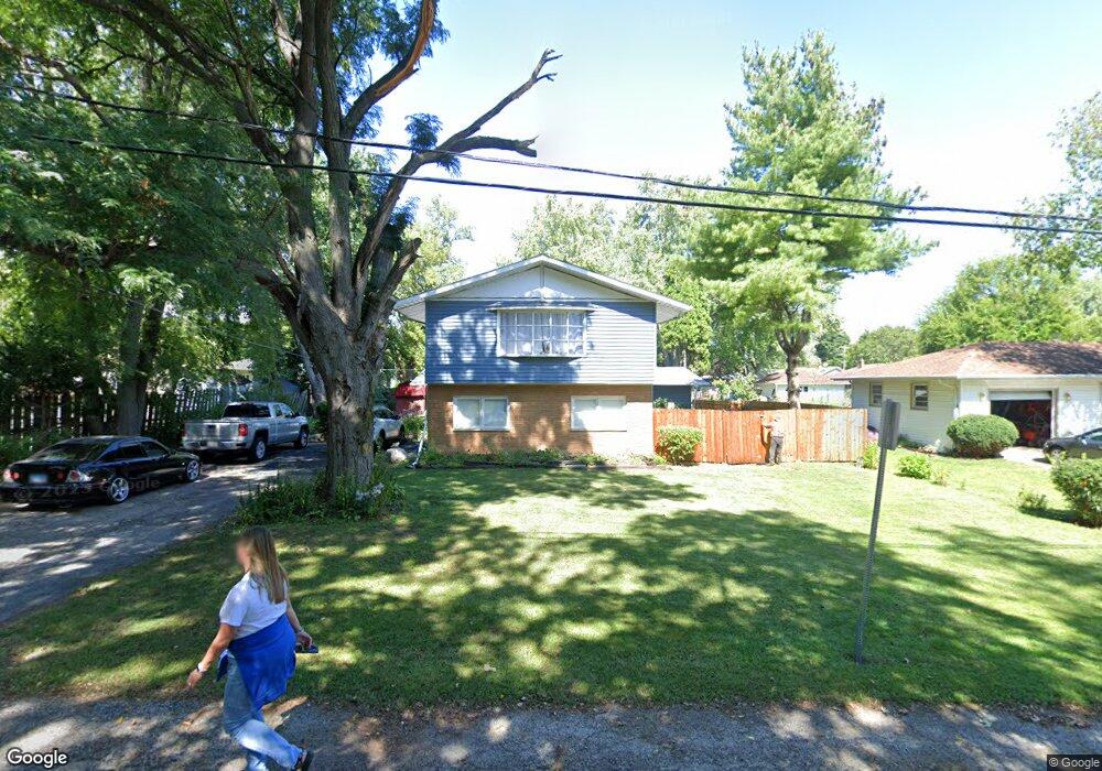
622 Forrest Ave Woodstock, IL 60098
Estimated Value: $328,157 - $406,000
3
Beds
--
Bath
2,688
Sq Ft
$134/Sq Ft
Est. Value
About This Home
This home is located at 622 Forrest Ave, Woodstock, IL 60098 and is currently estimated at $359,039, approximately $133 per square foot. 622 Forrest Ave is a home located in McHenry County with nearby schools including Dean Street Elementary School, Creekside Middle School, and Woodstock High School.
Ownership History
Date
Name
Owned For
Owner Type
Purchase Details
Closed on
Dec 27, 2010
Sold by
Guzman Ishmael and Guzman Maria
Bought by
The Ismael & Maria Guzman Declaration Of
Current Estimated Value
Create a Home Valuation Report for This Property
The Home Valuation Report is an in-depth analysis detailing your home's value as well as a comparison with similar homes in the area
Home Values in the Area
Average Home Value in this Area
Purchase History
| Date | Buyer | Sale Price | Title Company |
|---|---|---|---|
| The Ismael & Maria Guzman Declaration Of | -- | None Available |
Source: Public Records
Tax History Compared to Growth
Tax History
| Year | Tax Paid | Tax Assessment Tax Assessment Total Assessment is a certain percentage of the fair market value that is determined by local assessors to be the total taxable value of land and additions on the property. | Land | Improvement |
|---|---|---|---|---|
| 2024 | $8,516 | $100,433 | $8,430 | $92,003 |
| 2023 | $8,102 | $90,823 | $7,623 | $83,200 |
| 2022 | $7,134 | $75,195 | $6,765 | $68,430 |
| 2021 | $6,781 | $70,256 | $6,321 | $63,935 |
| 2020 | $6,528 | $66,758 | $6,006 | $60,752 |
| 2019 | $6,333 | $63,725 | $5,733 | $57,992 |
| 2018 | $5,701 | $57,147 | $6,540 | $50,607 |
| 2017 | $5,589 | $53,785 | $6,155 | $47,630 |
| 2016 | $5,528 | $49,801 | $5,699 | $44,102 |
| 2013 | -- | $57,061 | $12,145 | $44,916 |
Source: Public Records
Map
Nearby Homes
- 104 Stewart Ave
- 125 Forest Ave
- 421 W Kimball Ave
- 1004 Golden Ave
- 155 Lee Ann Ln
- 415 Dean St
- 908 Bunker St
- 331 Chestnut St
- 389 Lincoln Ave
- 601 S Jefferson St
- 1288 Prairie Ridge Trail
- 3848 Riverwoods Dr
- 3902 Riverwoods Dr
- 3842 Riverwoods Dr
- 3839 Riverwoods Dr
- Townsend Plan at Clublands of Antioch - Horizon Series
- Napa Plan at Clublands of Antioch - Andare Series
- 1249 Prairie Ridge Trail
- 3851 Riverwoods Dr
- 3827 Riverwoods Dr