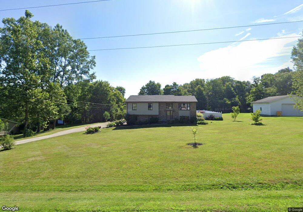
622 Laver Rd Mansfield, OH 44905
Estimated Value: $248,000 - $334,000
3
Beds
3
Baths
2,012
Sq Ft
$143/Sq Ft
Est. Value
About This Home
This home is located at 622 Laver Rd, Mansfield, OH 44905 and is currently estimated at $288,649, approximately $143 per square foot. 622 Laver Rd is a home located in Richland County with nearby schools including Madison High School, St. Mary Catholic School, and Temple-Christian School.
Ownership History
Date
Name
Owned For
Owner Type
Purchase Details
Closed on
Nov 5, 2024
Sold by
Moore Dorothy A J and Byrd Eugene C
Bought by
Moore Dorothy A J and Byrd Eugene C
Current Estimated Value
Purchase Details
Closed on
May 17, 2016
Sold by
Moore Dorothy A J
Bought by
Moore Dorothy A J and Byrd Eugene C
Purchase Details
Closed on
Aug 1, 2012
Sold by
Blevins Ronald A and Blevins Kara A
Bought by
Moore Dorothy A J
Purchase Details
Closed on
Oct 7, 1991
Sold by
Eatmon Lonnie
Bought by
Eatmon Lonnie
Purchase Details
Closed on
Apr 26, 1990
Create a Home Valuation Report for This Property
The Home Valuation Report is an in-depth analysis detailing your home's value as well as a comparison with similar homes in the area
Home Values in the Area
Average Home Value in this Area
Purchase History
| Date | Buyer | Sale Price | Title Company |
|---|---|---|---|
| Moore Dorothy A J | -- | Doma Title | |
| Moore Dorothy A J | -- | Chicago Title | |
| Moore Dorothy A J | $152,000 | Chicago Title | |
| Eatmon Lonnie | -- | -- | |
| -- | $5,000 | -- |
Source: Public Records
Tax History
| Year | Tax Paid | Tax Assessment Tax Assessment Total Assessment is a certain percentage of the fair market value that is determined by local assessors to be the total taxable value of land and additions on the property. | Land | Improvement |
|---|---|---|---|---|
| 2024 | $3,682 | $74,370 | $8,910 | $65,460 |
| 2023 | $3,836 | $74,370 | $8,910 | $65,460 |
| 2022 | $2,886 | $51,350 | $7,140 | $44,210 |
| 2021 | $2,885 | $51,350 | $7,140 | $44,210 |
| 2020 | $2,907 | $51,350 | $7,140 | $44,210 |
| 2019 | $2,623 | $43,200 | $6,000 | $37,200 |
| 2018 | $2,602 | $43,200 | $6,000 | $37,200 |
| 2017 | $2,601 | $43,200 | $6,000 | $37,200 |
| 2016 | $2,649 | $43,770 | $5,700 | $38,070 |
| 2015 | $2,607 | $43,770 | $5,700 | $38,070 |
| 2014 | $2,597 | $43,770 | $5,700 | $38,070 |
| 2012 | $2,507 | $46,080 | $6,000 | $40,080 |
Source: Public Records
Map
Nearby Homes
- 620 Running Brook Way
- 1674 Honeysuckle Dr
- 474 Biscayne Dr
- 0 McBride Road Parcel # 1 Unit 9066028
- 1476 Park Ave E
- 0 Mcelroy Rd
- 2385 Bryonaire Dr
- 632 Coachman Rd
- 683 Coachman Rd
- 602 Champion Rd
- 2264 Crider Rd
- 615 Champion Rd
- 1226 Evergreen Ave W
- 690 Ashland Rd
- 644 Skyline Rd
- 1303 Park Ave E
- 607 Skyline Rd
- 646 Fleetwood Rd
- 1217 Evergreen Ave W
- 1168 ConcheMcO St
Your Personal Tour Guide
Ask me questions while you tour the home.