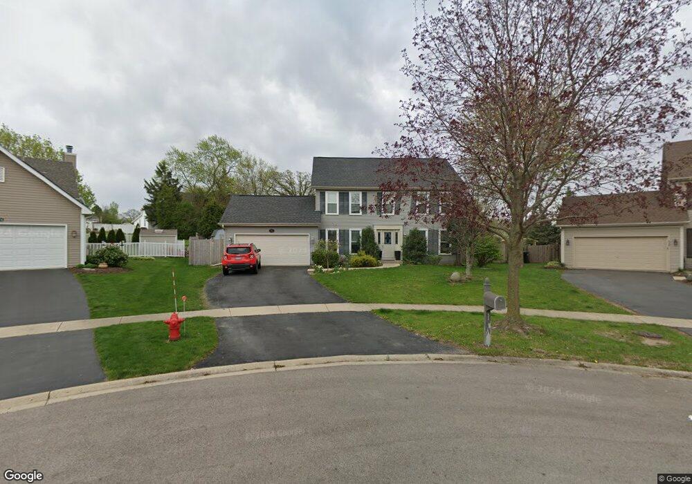
622 Lindsay Cir North Aurora, IL 60542
Estimated Value: $431,000 - $451,088
4
Beds
4
Baths
2,100
Sq Ft
$210/Sq Ft
Est. Value
About This Home
This home is located at 622 Lindsay Cir, North Aurora, IL 60542 and is currently estimated at $441,022, approximately $210 per square foot. 622 Lindsay Cir is a home located in Kane County with nearby schools including Schneider Elementary School, Herget Middle School, and West Aurora High School.
Ownership History
Date
Name
Owned For
Owner Type
Purchase Details
Closed on
Dec 20, 2018
Sold by
Weber Matthew D and Marinucci Stacey
Bought by
Perri Jason
Current Estimated Value
Home Financials for this Owner
Home Financials are based on the most recent Mortgage that was taken out on this home.
Original Mortgage
$207,824
Outstanding Balance
$182,913
Interest Rate
4.75%
Mortgage Type
FHA
Estimated Equity
$258,109
Purchase Details
Closed on
Mar 26, 2010
Sold by
Muszynski Kirk P and Muszynski Jodi L
Bought by
Weber Matthew D and Marinucci Stacey
Home Financials for this Owner
Home Financials are based on the most recent Mortgage that was taken out on this home.
Original Mortgage
$172,000
Interest Rate
5.01%
Mortgage Type
New Conventional
Purchase Details
Closed on
Sep 8, 2000
Sold by
Anderson Michael E and Anderson Yolanda E
Bought by
Chase Mtg Company and Chemical Mtg Company
Create a Home Valuation Report for This Property
The Home Valuation Report is an in-depth analysis detailing your home's value as well as a comparison with similar homes in the area
Home Values in the Area
Average Home Value in this Area
Purchase History
| Date | Buyer | Sale Price | Title Company |
|---|---|---|---|
| Perri Jason | $215,000 | Attorney | |
| Weber Matthew D | $215,000 | Baird & Warner Title Service | |
| Chase Mtg Company | -- | -- |
Source: Public Records
Mortgage History
| Date | Status | Borrower | Loan Amount |
|---|---|---|---|
| Open | Perri Jason | $207,824 | |
| Previous Owner | Weber Matthew D | $172,000 |
Source: Public Records
Tax History Compared to Growth
Tax History
| Year | Tax Paid | Tax Assessment Tax Assessment Total Assessment is a certain percentage of the fair market value that is determined by local assessors to be the total taxable value of land and additions on the property. | Land | Improvement |
|---|---|---|---|---|
| 2024 | $9,464 | $124,348 | $25,147 | $99,201 |
| 2023 | $9,158 | $111,105 | $22,469 | $88,636 |
| 2022 | $8,494 | $101,373 | $20,501 | $80,872 |
| 2021 | $8,150 | $94,380 | $19,087 | $75,293 |
| 2020 | $7,713 | $87,665 | $17,729 | $69,936 |
| 2019 | $7,514 | $81,224 | $16,426 | $64,798 |
| 2018 | $6,911 | $78,211 | $15,194 | $63,017 |
| 2017 | $7,178 | $78,896 | $17,714 | $61,182 |
| 2016 | $6,969 | $74,635 | $15,184 | $59,451 |
| 2015 | -- | $70,602 | $13,057 | $57,545 |
| 2014 | -- | $66,058 | $12,558 | $53,500 |
| 2013 | -- | $66,936 | $12,379 | $54,557 |
Source: Public Records
Map
Nearby Homes
- 616 Pinehurst Dr
- 719 Pinecreek Dr
- 302 Dee Rd
- 202 Linn Ct Unit C
- 331 Sussex Ln
- 215 Dee Rd
- 203 Lilac Ln
- 810 Columbia Cir Unit 3
- 122 E State St
- 509 Wingfoot Dr
- 114 Briar Ln Unit 2
- 273 Ridley St
- 105 April Ln Unit 2
- 24 S Grant St
- 733 Wind Energy Pass
- 2856 Church Rd
- 3S201 S Raddant Rd
- 12 N Lincolnway
- 148 N Lincolnway
- 1580 Wind Energy Pass
- 620 Lindsay Cir
- 624 Lindsay Cir
- 618 Lindsay Cir
- 35W160 Butterfield Rd
- 626 Lindsay Cir
- 616 Lindsay Cir Unit 1
- 628 Lindsay Cir
- 614 Lindsay Cir
- 621 Lindsay Cir
- 617 Lindsay Cir
- 630 Lindsay Cir
- 625 Lindsay Cir
- 84 Flynn Ct
- 612 Lindsay Cir
- 613 Lindsay Cir
- 76 Flynn Ct
- 12 Oak Creek Ct
- 91 Flynn Ct
- 689 Chesterfield Ln
- 629 Lindsay Cir