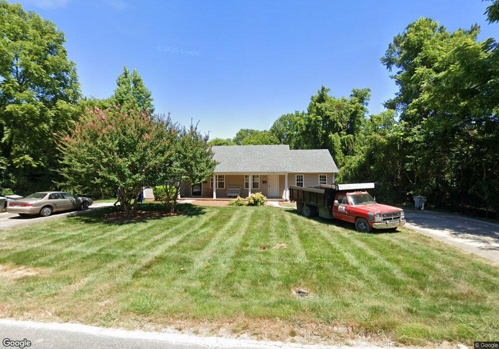
622 Meadowbrook Rd Asheboro, NC 27203
Estimated Value: $156,000 - $214,848
--
Bed
2
Baths
1,830
Sq Ft
$99/Sq Ft
Est. Value
About This Home
This home is located at 622 Meadowbrook Rd, Asheboro, NC 27203 and is currently estimated at $181,962, approximately $99 per square foot. 622 Meadowbrook Rd is a home located in Randolph County with nearby schools including Charles W. McCrary Elementary School, North Asheboro Middle School, and Asheboro High School.
Ownership History
Date
Name
Owned For
Owner Type
Purchase Details
Closed on
Aug 7, 2019
Sold by
The Harton H & L Llc
Bought by
J Paul Thomas Revocable Trust
Current Estimated Value
Purchase Details
Closed on
Sep 17, 2003
Bought by
H & L Partnership
Purchase Details
Closed on
Apr 10, 1992
Bought by
H & L Partnership
Create a Home Valuation Report for This Property
The Home Valuation Report is an in-depth analysis detailing your home's value as well as a comparison with similar homes in the area
Home Values in the Area
Average Home Value in this Area
Purchase History
| Date | Buyer | Sale Price | Title Company |
|---|---|---|---|
| J Paul Thomas Revocable Trust | $89,000 | None Available | |
| H & L Partnership | $112,500 | -- | |
| H & L Partnership | $9,000 | -- |
Source: Public Records
Tax History Compared to Growth
Tax History
| Year | Tax Paid | Tax Assessment Tax Assessment Total Assessment is a certain percentage of the fair market value that is determined by local assessors to be the total taxable value of land and additions on the property. | Land | Improvement |
|---|---|---|---|---|
| 2024 | $2,120 | $139,780 | $17,160 | $122,620 |
| 2023 | $2,120 | $139,780 | $17,160 | $122,620 |
| 2022 | $1,429 | $99,130 | $14,650 | $84,480 |
| 2021 | $1,429 | $99,130 | $14,650 | $84,480 |
| 2020 | $1,429 | $99,130 | $14,650 | $84,480 |
| 2019 | $1,429 | $99,130 | $14,650 | $84,480 |
| 2018 | $1,312 | $89,420 | $16,530 | $72,890 |
| 2016 | $1,312 | $89,416 | $16,530 | $72,886 |
| 2015 | $1,314 | $89,416 | $16,530 | $72,886 |
| 2014 | -- | $89,416 | $16,530 | $72,886 |
Source: Public Records
Map
Nearby Homes
- 443 E Pritchard St
- 611 Tucker St
- 000 W Presnell St
- 00 Hillsdale Dr
- 127 N Randolph Ave
- 255 Liberty St
- 401 Worth St
- 330 13 W Presnell St
- 0 Salisbury St Unit 1087524
- 0 Salisbury St Unit 1047979
- 330 W Presnell St Unit 37
- 575 Twain Dr
- 914 Tamworth Rd
- 0 Amity Rd
- 00 E Presnell St
- 830 Cool Springs Rd
- 310 S High St
- 243 S Elm St
- 0 E Allred St Unit 1125495
- 222 Gardiner Rd
- 624 Meadowbrook Rd
- 622 Meadowbrook Rd
- 632 Meadowbrook Rd
- 509 E Presnell St
- 507 E Presnell St
- 640 Meadowbrook Rd
- 617 Pennwood Dr
- 525 E Presnell St
- 623 Pennwood Dr
- 648 Meadowbrook Rd
- 421 E Presnell St
- 647 Meadowbrook Rd
- 531 E Presnell St
- 657 Meadowbrook Rd
- 419 E Presnell St
- 502 E Presnell St
- 618 Pennwood Dr
- 543 E Presnell St
- 560 Meadowbrook Rd
- 522 E Presnell St