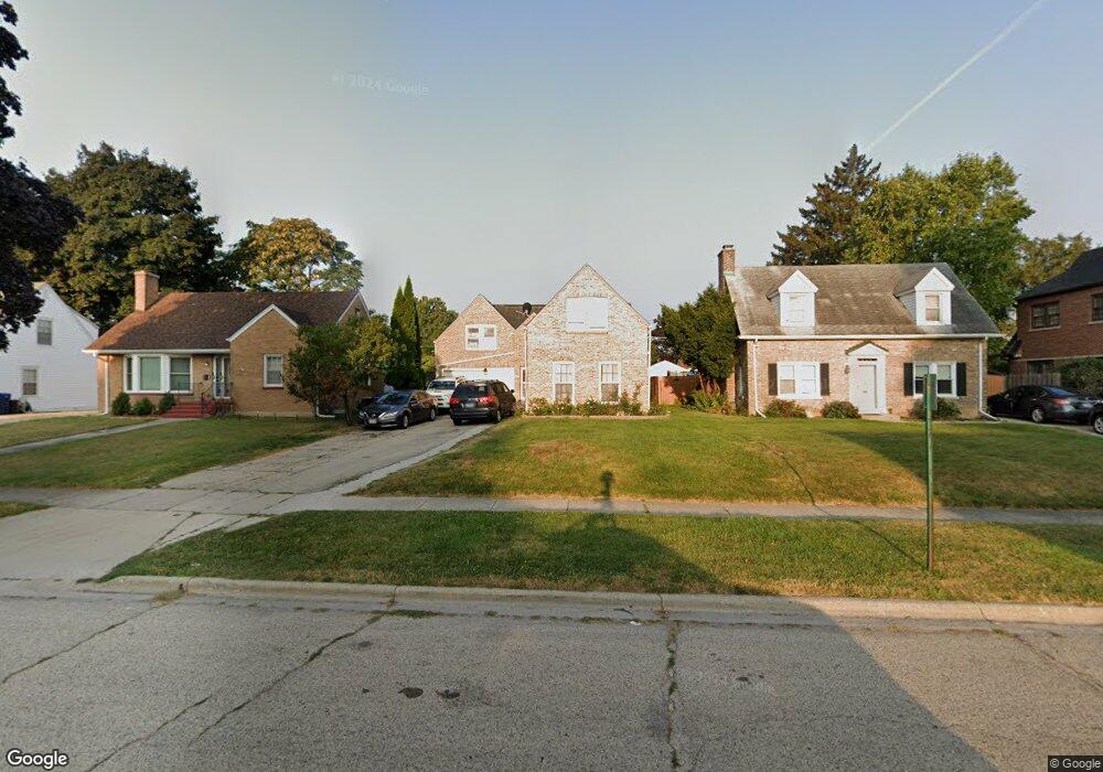
622 N Martin Ave Waukegan, IL 60085
West Waukegan NeighborhoodEstimated Value: $265,000 - $294,000
3
Beds
2
Baths
1,763
Sq Ft
$158/Sq Ft
Est. Value
About This Home
This home is located at 622 N Martin Ave, Waukegan, IL 60085 and is currently estimated at $277,930, approximately $157 per square foot. 622 N Martin Ave is a home located in Lake County with nearby schools including Whittier Elementary School, Robert E. Abbott Middle School, and Waukegan High School.
Ownership History
Date
Name
Owned For
Owner Type
Purchase Details
Closed on
Dec 28, 2011
Sold by
Fannie Mae
Bought by
Deoca Osvaldo Montes
Current Estimated Value
Purchase Details
Closed on
Nov 23, 2011
Sold by
Ellis Mary and Bac Home Loans Servicing Lp
Bought by
Federal National Mortgage Association
Purchase Details
Closed on
Oct 22, 1998
Sold by
Dean Anthony M and Harding Susan K
Bought by
Ellis Mary and Ellis Morris
Home Financials for this Owner
Home Financials are based on the most recent Mortgage that was taken out on this home.
Original Mortgage
$113,000
Interest Rate
6.72%
Create a Home Valuation Report for This Property
The Home Valuation Report is an in-depth analysis detailing your home's value as well as a comparison with similar homes in the area
Home Values in the Area
Average Home Value in this Area
Purchase History
| Date | Buyer | Sale Price | Title Company |
|---|---|---|---|
| Deoca Osvaldo Montes | $62,000 | Attorneys Title Guaranty Fun | |
| Federal National Mortgage Association | -- | None Available | |
| Ellis Mary | $119,000 | -- |
Source: Public Records
Mortgage History
| Date | Status | Borrower | Loan Amount |
|---|---|---|---|
| Previous Owner | Ellis Mary | $113,000 |
Source: Public Records
Tax History Compared to Growth
Tax History
| Year | Tax Paid | Tax Assessment Tax Assessment Total Assessment is a certain percentage of the fair market value that is determined by local assessors to be the total taxable value of land and additions on the property. | Land | Improvement |
|---|---|---|---|---|
| 2024 | $4,677 | $64,331 | $10,375 | $53,956 |
| 2023 | $4,469 | $57,596 | $9,289 | $48,307 |
| 2022 | $4,469 | $51,718 | $7,904 | $43,814 |
| 2021 | $4,497 | $49,130 | $7,312 | $41,818 |
| 2020 | $4,508 | $45,770 | $6,812 | $38,958 |
| 2019 | $4,484 | $41,941 | $6,242 | $35,699 |
| 2018 | $3,952 | $36,946 | $8,031 | $28,915 |
| 2017 | $3,796 | $32,687 | $7,105 | $25,582 |
| 2016 | $3,462 | $28,404 | $6,174 | $22,230 |
| 2015 | $3,281 | $25,422 | $5,526 | $19,896 |
| 2014 | $2,394 | $19,686 | $6,069 | $13,617 |
| 2012 | $2,361 | $21,329 | $6,576 | $14,753 |
Source: Public Records
Map
Nearby Homes
- 615 Tiffany Dr
- 1213 Grand Ave
- 1005 N Lewis Ave
- 0 Brookside Ave
- 1023 N Elmwood Ave
- 1038 Indiana Ave
- 824 N Butrick St
- 132 Dorchester Ct
- 1117 Judge Ave
- 12787 W Grove Ave
- 1000 Pine St
- 1109 Massena Ave
- 1416 Hamilton Ct
- 917 N Linden Ave
- 1504 W Glen Flora Ave
- 24 Washington Terrace
- 49 S Lewis Ave
- 12352 W Atlantic Ave
- 1105 Woodlawn Cir
- 2009 Harding Ave
- 618 N Martin Ave
- 626 N Martin Ave
- 614 N Martin Ave
- 630 N Martin Ave
- 623 N Berwick Blvd
- 619 N Berwick Blvd
- 627 N Berwick Blvd
- 610 N Martin Ave
- 615 N Berwick Blvd
- 632 N Martin Ave
- 635 N Berwick Blvd
- 623 N Martin Ave
- 604 N Martin Ave
- 619 N Martin Ave
- 627 N Martin Ave
- 611 N Berwick Blvd
- 615 N Martin Ave
- 639 N Berwick Blvd
- 611 N Martin Ave
- 635 N Martin Ave