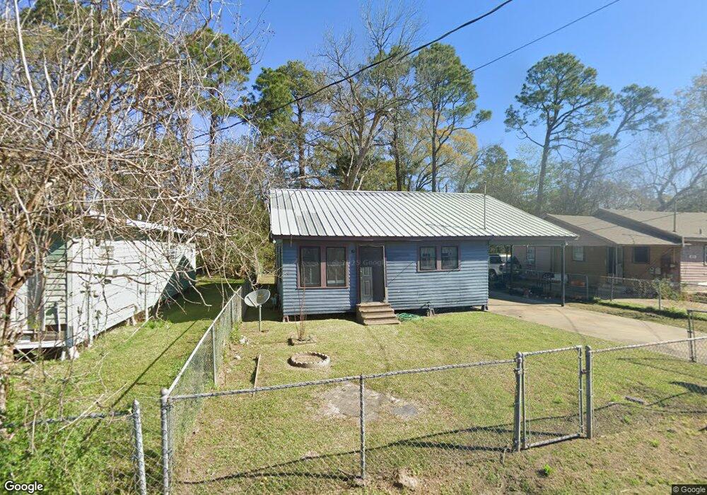
622 Pershing St Lafayette, LA 70501
Pa Davis Park NeighborhoodEstimated Value: $75,000 - $132,000
Studio
--
Bath
1,166
Sq Ft
$87/Sq Ft
Est. Value
About This Home
This home is located at 622 Pershing St, Lafayette, LA 70501 and is currently estimated at $101,775, approximately $87 per square foot. 622 Pershing St is a home located in Lafayette Parish with nearby schools including Dr. Raphael A. Baranco Elementary School, Paul Breaux Middle School, and Northside High School.
Ownership History
Date
Name
Owned For
Owner Type
Purchase Details
Closed on
Jul 18, 2007
Sold by
Wells Fargo Bank
Bought by
Ross Roxie Ann
Current Estimated Value
Home Financials for this Owner
Home Financials are based on the most recent Mortgage that was taken out on this home.
Original Mortgage
$60,300
Outstanding Balance
$38,140
Interest Rate
6.73%
Mortgage Type
Future Advance Clause Open End Mortgage
Estimated Equity
$63,635
Purchase Details
Closed on
May 5, 2006
Sold by
Jolivette Susan A
Bought by
Amber Jack Investments Llc
Create a Home Valuation Report for This Property
The Home Valuation Report is an in-depth analysis detailing your home's value as well as a comparison with similar homes in the area
Home Values in the Area
Average Home Value in this Area
Purchase History
| Date | Buyer | Sale Price | Title Company |
|---|---|---|---|
| Ross Roxie Ann | $39,900 | None Available | |
| Amber Jack Investments Llc | $413 | None Available |
Source: Public Records
Mortgage History
| Date | Status | Borrower | Loan Amount |
|---|---|---|---|
| Open | Ross Roxie Ann | $60,300 |
Source: Public Records
Tax History
| Year | Tax Paid | Tax Assessment Tax Assessment Total Assessment is a certain percentage of the fair market value that is determined by local assessors to be the total taxable value of land and additions on the property. | Land | Improvement |
|---|---|---|---|---|
| 2024 | $97 | $5,226 | $1,435 | $3,791 |
| 2023 | $97 | $5,046 | $1,435 | $3,611 |
| 2022 | $528 | $5,046 | $1,435 | $3,611 |
| 2021 | $530 | $5,046 | $1,435 | $3,611 |
| 2020 | $528 | $5,046 | $1,435 | $3,611 |
| 2019 | $91 | $5,046 | $1,435 | $3,611 |
| 2018 | $90 | $5,046 | $1,435 | $3,611 |
| 2017 | $90 | $5,046 | $1,435 | $3,611 |
| 2015 | $65 | $3,640 | $500 | $3,140 |
| 2013 | -- | $3,640 | $500 | $3,140 |
Source: Public Records
Map
Nearby Homes
- 116 Iantha St
- 121 N General Marshall St
- 304 Marne St
- 316 E Foch St
- 210 Marne St
- 1007 Carmel Dr
- 222 Pershing Ave
- 304 Carmel Dr
- 207 Haig St
- 205 Haig St
- 321 Verdun St
- 113 Dorian Dr
- 1110 Louisiana Ave
- 3605 E SiMcOe St
- 113 Texas St
- 218 Frank St Unit A & B
- 211 Teurlings Dr
- 2100 Blk E Pinhook Rd
- 2200 Blk E Pinhook Rd
- 108 Saint Margarite St
- 626 Pershing St
- 623 Pershing St
- 617 Pershing St
- 602 Pershing St
- 624 Pershing St
- 619 Pershing St
- 618 Pershing St
- 615 Pershing St
- 616 Pershing St
- 611 Pershing St
- 302 Belleau St
- 628 Pershing St
- 301 Allen St
- 295 Allen St
- 302 Pershing St
- 299 Allen St
- 230 Belleau St
- 229 Allen St
- 104 Iantha St
- 227 Allen St
Your Personal Tour Guide
Ask me questions while you tour the home.