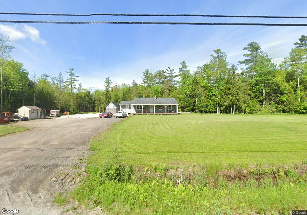
622 Prescott Rd Manchester, ME 04351
Estimated Value: $235,000 - $363,491
3
Beds
2
Baths
1,518
Sq Ft
$208/Sq Ft
Est. Value
About This Home
This home is located at 622 Prescott Rd, Manchester, ME 04351 and is currently estimated at $315,123, approximately $207 per square foot. 622 Prescott Rd is a home.
Ownership History
Date
Name
Owned For
Owner Type
Purchase Details
Closed on
Sep 30, 2022
Sold by
Szady Gary
Bought by
Vachon Emily A
Current Estimated Value
Home Financials for this Owner
Home Financials are based on the most recent Mortgage that was taken out on this home.
Original Mortgage
$112,121
Interest Rate
5.13%
Mortgage Type
Purchase Money Mortgage
Purchase Details
Closed on
Jun 6, 2022
Sold by
Vachon Emily A
Bought by
Szady Shain P and Vachon Emily A
Home Financials for this Owner
Home Financials are based on the most recent Mortgage that was taken out on this home.
Original Mortgage
$75,000
Interest Rate
6.94%
Mortgage Type
Purchase Money Mortgage
Purchase Details
Closed on
Aug 16, 2018
Sold by
Szady Gary
Bought by
Szady Gary and Szady Erica M
Purchase Details
Closed on
Mar 22, 2007
Sold by
Furlong Alan D
Bought by
Szady Gary
Create a Home Valuation Report for This Property
The Home Valuation Report is an in-depth analysis detailing your home's value as well as a comparison with similar homes in the area
Home Values in the Area
Average Home Value in this Area
Purchase History
| Date | Buyer | Sale Price | Title Company |
|---|---|---|---|
| Vachon Emily A | $111,000 | None Available | |
| Vachon Emily A | $111,000 | None Available | |
| Szady Shain P | -- | None Available | |
| Szady Shain P | -- | None Available | |
| Szady Shain P | -- | None Available | |
| Szady Gary | -- | -- | |
| Szady Gary | -- | -- | |
| Szady Gary | -- | -- | |
| Szady Gary | -- | -- | |
| Szady Gary | -- | -- |
Source: Public Records
Mortgage History
| Date | Status | Borrower | Loan Amount |
|---|---|---|---|
| Previous Owner | Vachon Emily A | $112,121 | |
| Previous Owner | Szady Shain P | $75,000 |
Source: Public Records
Tax History Compared to Growth
Tax History
| Year | Tax Paid | Tax Assessment Tax Assessment Total Assessment is a certain percentage of the fair market value that is determined by local assessors to be the total taxable value of land and additions on the property. | Land | Improvement |
|---|---|---|---|---|
| 2024 | $1,969 | $118,600 | $38,200 | $80,400 |
| 2023 | $1,969 | $118,600 | $38,200 | $80,400 |
| 2022 | $1,868 | $118,600 | $38,200 | $80,400 |
| 2021 | $1,898 | $118,600 | $38,200 | $80,400 |
| 2020 | $2,076 | $118,600 | $38,200 | $80,400 |
| 2019 | $2,087 | $118,600 | $38,200 | $80,400 |
| 2017 | $1,933 | $114,400 | $38,200 | $76,200 |
| 2016 | $1,583 | $96,500 | $38,200 | $58,300 |
| 2015 | $1,305 | $81,800 | $30,000 | $51,800 |
| 2013 | $1,079 | $72,200 | $27,700 | $44,500 |
Source: Public Records
Map
Nearby Homes
- 772 Prescott Rd
- 165 Wade Rd
- 0 Allen Hill Ln
- 6 Cecile Ave
- 26 Peggy Ln
- 1 Stony Brook Rd
- 0 Ingraham St
- 693- B Western Ave
- 0 Anthony Ave Map 5 Lot 110a
- 0 Cross St
- 896 Summerhaven Rd
- 369 Civic Center Dr
- 309 Civic Center Dr
- 1227 Prescott Rd
- 35 Estates Dr Unit 3
- 43 Estates Dr Unit 1
- 157 Belgrade Rd
- 127 Bond Brook Rd
- 120 Bond Brook Rd
- 2549 US Route 202
- Lot 1, 736 Prescott Rd
- lot 31f1a Prescott Rd
- 613 Prescott Rd
- 605 Prescott Rd
- 598 Prescott Rd
- 639 Prescott Rd
- 588 Prescott Rd
- 652 Prescott Rd
- 12 Summerhaven Rd
- 584 Prescott Rd
- 32 Summerhaven Rd
- 40 Summerhaven Rd
- 00 Summerhaven
- 0 Summerhaven Rd
- 46 Summerhaven Rd
- 5 Summerhaven Rd
- 1 Summerhaven Rd
- 576 Prescott Rd
- 25 Summerhaven Rd
- TBD Prescott Rd