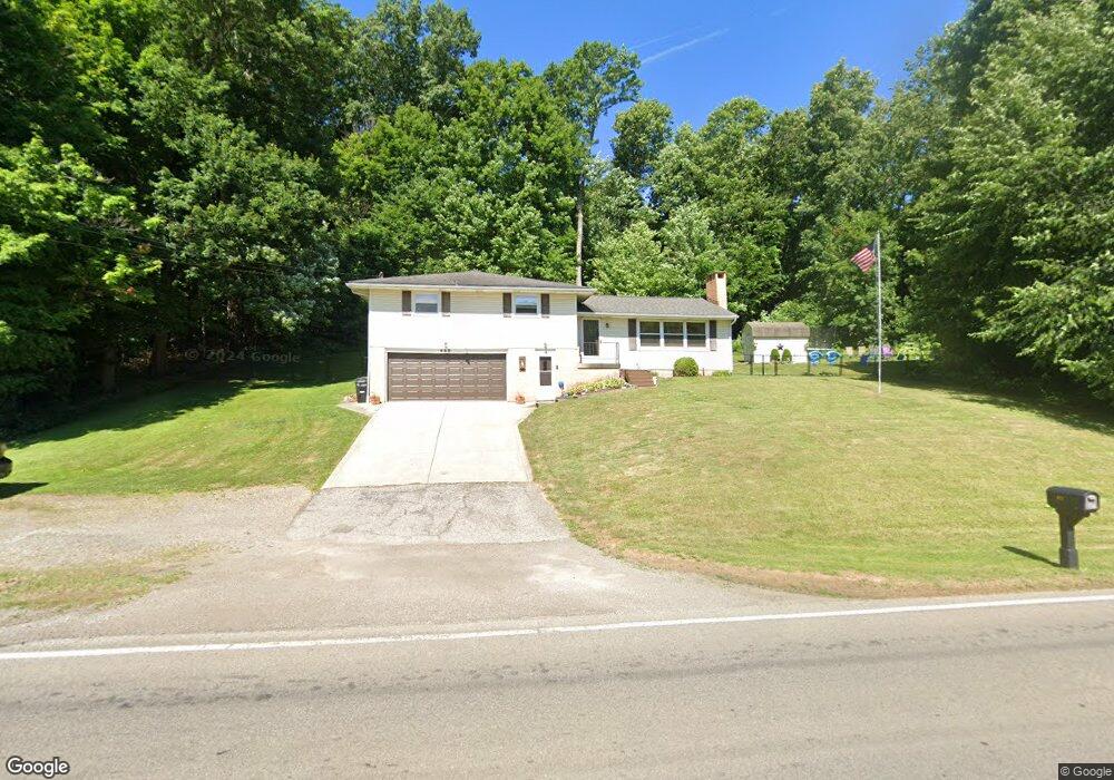
622 S Illinois Ave Mansfield, OH 44907
Estimated Value: $144,000 - $213,000
4
Beds
2
Baths
1,384
Sq Ft
$128/Sq Ft
Est. Value
About This Home
This home is located at 622 S Illinois Ave, Mansfield, OH 44907 and is currently estimated at $177,644, approximately $128 per square foot. 622 S Illinois Ave is a home located in Richland County with nearby schools including Madison High School, St. Peter's Elementary/Montessori School, and Temple-Christian School.
Ownership History
Date
Name
Owned For
Owner Type
Purchase Details
Closed on
Jan 27, 2003
Sold by
Kalis Margie A
Bought by
Levingston Dale E and Levingston Teresa A
Current Estimated Value
Home Financials for this Owner
Home Financials are based on the most recent Mortgage that was taken out on this home.
Original Mortgage
$84,500
Outstanding Balance
$36,664
Interest Rate
6.13%
Mortgage Type
New Conventional
Estimated Equity
$140,980
Purchase Details
Closed on
Aug 19, 1996
Sold by
Coleman Brian
Bought by
Pasheilich Steven and Pasheilich Jennifer
Create a Home Valuation Report for This Property
The Home Valuation Report is an in-depth analysis detailing your home's value as well as a comparison with similar homes in the area
Home Values in the Area
Average Home Value in this Area
Purchase History
| Date | Buyer | Sale Price | Title Company |
|---|---|---|---|
| Levingston Dale E | $89,900 | -- | |
| Pasheilich Steven | $6,500 | -- |
Source: Public Records
Mortgage History
| Date | Status | Borrower | Loan Amount |
|---|---|---|---|
| Open | Levingston Dale E | $84,500 |
Source: Public Records
Tax History Compared to Growth
Tax History
| Year | Tax Paid | Tax Assessment Tax Assessment Total Assessment is a certain percentage of the fair market value that is determined by local assessors to be the total taxable value of land and additions on the property. | Land | Improvement |
|---|---|---|---|---|
| 2024 | $2,011 | $41,480 | $7,490 | $33,990 |
| 2023 | $2,011 | $41,480 | $7,490 | $33,990 |
| 2022 | $1,724 | $31,590 | $6,690 | $24,900 |
| 2021 | $1,724 | $31,590 | $6,690 | $24,900 |
| 2020 | $1,737 | $31,590 | $6,690 | $24,900 |
| 2019 | $1,656 | $26,770 | $5,670 | $21,100 |
| 2018 | $1,548 | $26,770 | $5,670 | $21,100 |
| 2017 | $1,532 | $26,770 | $5,670 | $21,100 |
| 2016 | $1,549 | $26,440 | $5,390 | $21,050 |
| 2015 | $1,477 | $26,440 | $5,390 | $21,050 |
| 2014 | $1,472 | $26,440 | $5,390 | $21,050 |
| 2012 | $731 | $27,820 | $5,670 | $22,150 |
Source: Public Records
Map
Nearby Homes
- 716 Mansfield Washington Rd
- 794 Mansfield Washington Rd
- 419 Pearl Ave
- 405 Plainview Ave
- 62 Bahl Ave
- 780 Park Ave E
- 519 S Diamond St
- 430 Beethoven St
- 353 Home Ave
- 138 Cliffbrook Dr
- 953 Park Ave E
- 305 Home Ave
- 0 Madison Rd
- 28 Stewart Rd N
- 36 Ridge Rd S
- 0 State Route 39 & I-71 Southeast Quadrant
- 1875 Mansfield Lucas Rd
- 0 State Route 39 & I-71 Northeast Quadrant
- 0 Smith Ave
- 261 Superior St
- 569 S Illinois Ave
- 700 S Illinois Ave
- 519 S Illinois Ave
- 641 Mayer Dr
- 651 Mayer Dr
- 661 Mayer Dr
- 671 Mayer Dr
- 679 Mayer Dr
- 765 S Illinois Ave
- 689 Mayer Dr
- 707 Mayer Dr
- 650 Mayer Dr
- 697 Mayer Dr
- 717 Mayer Dr
- 0 Mayer Dr Unit 3434516
- 0 Mayer Dr Unit 3434513
- 0 Mayer Dr Unit 607204
- 0 Mayer Dr Unit 604168
- 0 Mayer Dr Unit 215946
- 0 Mayer Dr Unit 204322