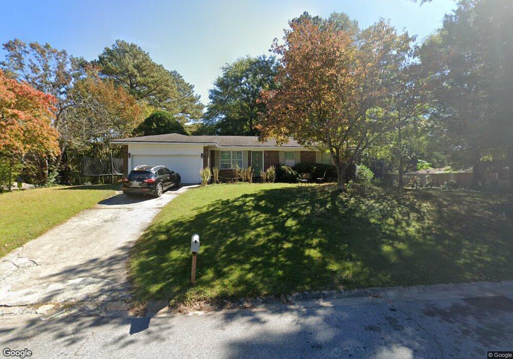
622 Sheffield Rd Norcross, GA 30071
Estimated Value: $314,000 - $339,620
3
Beds
2
Baths
1,341
Sq Ft
$244/Sq Ft
Est. Value
About This Home
This home is located at 622 Sheffield Rd, Norcross, GA 30071 and is currently estimated at $327,155, approximately $243 per square foot. 622 Sheffield Rd is a home with nearby schools including Baldwin Elementary, Summerour Middle School, and Paul Duke STEM High School.
Ownership History
Date
Name
Owned For
Owner Type
Purchase Details
Closed on
Dec 31, 2014
Sold by
Shewbert Jeanette Osowski
Bought by
Shewbert Keith and Shewbert Jeanette M
Current Estimated Value
Home Financials for this Owner
Home Financials are based on the most recent Mortgage that was taken out on this home.
Original Mortgage
$88,000
Outstanding Balance
$67,361
Interest Rate
3.98%
Mortgage Type
New Conventional
Estimated Equity
$259,794
Purchase Details
Closed on
Oct 12, 2007
Sold by
Shewbert Keith
Bought by
Shewbert Keith and Osowski-Shewbert Jeanette
Home Financials for this Owner
Home Financials are based on the most recent Mortgage that was taken out on this home.
Original Mortgage
$94,500
Interest Rate
6.44%
Mortgage Type
New Conventional
Purchase Details
Closed on
Jul 13, 2007
Sold by
Castle Barbara J
Bought by
Shewbert Keith
Create a Home Valuation Report for This Property
The Home Valuation Report is an in-depth analysis detailing your home's value as well as a comparison with similar homes in the area
Home Values in the Area
Average Home Value in this Area
Purchase History
| Date | Buyer | Sale Price | Title Company |
|---|---|---|---|
| Shewbert Keith | -- | -- | |
| Shewbert Keith | -- | -- | |
| Shewbert Keith | $93,000 | -- |
Source: Public Records
Mortgage History
| Date | Status | Borrower | Loan Amount |
|---|---|---|---|
| Open | Shewbert Keith | $88,000 | |
| Previous Owner | Shewbert Keith | $94,500 |
Source: Public Records
Tax History Compared to Growth
Tax History
| Year | Tax Paid | Tax Assessment Tax Assessment Total Assessment is a certain percentage of the fair market value that is determined by local assessors to be the total taxable value of land and additions on the property. | Land | Improvement |
|---|---|---|---|---|
| 2025 | $3,688 | $116,720 | $25,840 | $90,880 |
| 2024 | $3,895 | $121,720 | $25,600 | $96,120 |
| 2023 | $3,895 | $106,000 | $20,800 | $85,200 |
| 2022 | $3,180 | $99,080 | $20,800 | $78,280 |
| 2021 | $2,860 | $66,480 | $14,320 | $52,160 |
| 2020 | $2,197 | $66,480 | $14,320 | $52,160 |
| 2019 | $2,558 | $58,600 | $12,000 | $46,600 |
| 2018 | $1,940 | $58,600 | $12,000 | $46,600 |
| 2016 | $1,431 | $43,280 | $9,200 | $34,080 |
| 2015 | $1,387 | $30,160 | $8,000 | $22,160 |
| 2014 | -- | $22,560 | $8,000 | $14,560 |
Source: Public Records
Map
Nearby Homes
- 2848 Wild Laurel Ct
- 5645 Hammond Dr
- 5766 Buford Hwy
- 2199 Summertown Dr
- 5457 Rails Way
- 5596 Buford Hwy
- 5670 Hollow Ridge Ln
- 5479 Windy Creek Ln
- 392 Price Place NW
- 5639 Chatham Cir
- 6023 Skellig St
- 2798 Maddison Towns Ave
- 2375 Beaver Falls Dr
- 5381 Station Cir Unit 3
- 90 W Peachtree St
- 622 Summer Place
- 5364 Hickory Knoll
- 5358 Beaver Branch
- 5357 Beaver Branch
- 2009 Hoot Owl Trail
- 858 E Glochester Place Unit 1
- E E Glochester Place NW
- E E Glochester Place NW Unit 14
- 642 Sheffield Rd Unit 1
- 861 N Hampton Dr Unit 1
- 804 E Glochester Place
- 874 E Glochester Place
- 883 N Hampton Dr Unit 1
- 829 E Glochester Place
- 849 E Glochester Place Unit 1
- 655 Sheffield Rd Unit 1
- 813 E Glochester Place
- 892 E Glochester Place Unit 1
- 863 E Glochester Place
- 899 N Hampton Dr Unit 1
- 784 E Glochester Place
- 797 E Glochester Place
- 836 N Hampton Dr
- 879 E Glochester Place
- 677 Sheffield Rd