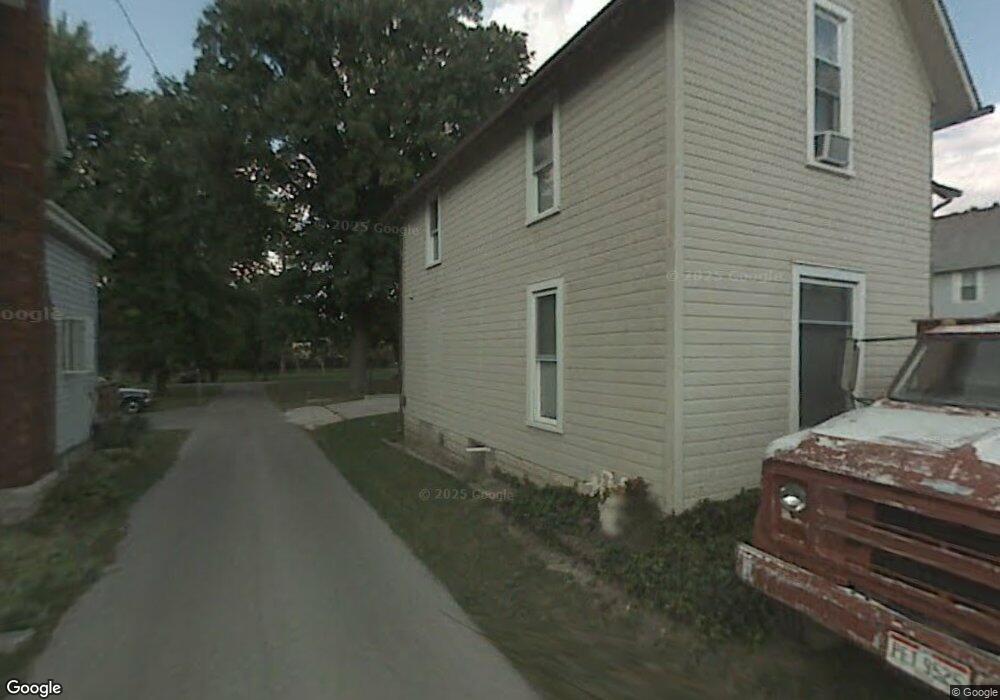
622 W Fremont St Fostoria, OH 44830
Estimated Value: $127,000 - $144,000
3
Beds
2
Baths
1,393
Sq Ft
$95/Sq Ft
Est. Value
About This Home
This home is located at 622 W Fremont St, Fostoria, OH 44830 and is currently estimated at $132,012, approximately $94 per square foot. 622 W Fremont St is a home located in Hancock County with nearby schools including Fostoria Intermediate Elementary School and Fostoria Junior/Senior High School.
Ownership History
Date
Name
Owned For
Owner Type
Purchase Details
Closed on
Apr 3, 1998
Sold by
Miller Thomas
Bought by
Amlin Michael and Holman Renee
Current Estimated Value
Home Financials for this Owner
Home Financials are based on the most recent Mortgage that was taken out on this home.
Original Mortgage
$54,150
Outstanding Balance
$10,270
Interest Rate
7.09%
Mortgage Type
New Conventional
Estimated Equity
$121,742
Purchase Details
Closed on
Jan 24, 1990
Bought by
Miller Thomas J and Miller Alecia M
Create a Home Valuation Report for This Property
The Home Valuation Report is an in-depth analysis detailing your home's value as well as a comparison with similar homes in the area
Home Values in the Area
Average Home Value in this Area
Purchase History
| Date | Buyer | Sale Price | Title Company |
|---|---|---|---|
| Amlin Michael | $59,000 | -- | |
| Miller Thomas J | $30,000 | -- |
Source: Public Records
Mortgage History
| Date | Status | Borrower | Loan Amount |
|---|---|---|---|
| Open | Amlin Michael | $54,150 |
Source: Public Records
Tax History Compared to Growth
Tax History
| Year | Tax Paid | Tax Assessment Tax Assessment Total Assessment is a certain percentage of the fair market value that is determined by local assessors to be the total taxable value of land and additions on the property. | Land | Improvement |
|---|---|---|---|---|
| 2024 | $1,277 | $25,660 | $5,690 | $19,970 |
| 2023 | $1,274 | $25,660 | $5,690 | $19,970 |
| 2022 | $1,388 | $25,660 | $5,690 | $19,970 |
| 2021 | $1,080 | $19,210 | $5,710 | $13,500 |
| 2020 | $1,085 | $19,210 | $5,710 | $13,500 |
| 2019 | $1,080 | $19,210 | $5,710 | $13,500 |
| 2018 | $947 | $16,430 | $3,570 | $12,860 |
| 2017 | $473 | $16,430 | $3,570 | $12,860 |
| 2016 | $832 | $16,430 | $3,570 | $12,860 |
| 2015 | $551 | $10,920 | $2,370 | $8,550 |
| 2014 | $551 | $10,920 | $2,370 | $8,550 |
| 2012 | $649 | $12,790 | $2,370 | $10,420 |
Source: Public Records
Map
Nearby Homes
- 509 College Ave
- 603 N Vine St
- 203 N Union St
- 520 N Union St
- 723 N Union St
- 348 W South St
- 351 W South St
- 211 Summit St
- 931 N Union St
- 901 Central Ave
- 892 N Countyline St
- 435 Park Ave
- 900 N Countyline St
- 0 W South Route 12
- 633 Maple St
- 411 Monticello Dr
- 540 N Poplar St
- 418 W Ridge Dr
- 727 Eisenhower Dr
- 321 Mcdougal St
- 614 W Fremont St
- 624 W Fremont St
- 606 W Fremont St
- 634 W Fremont St
- 600 W Fremont St
- 617 W Fremont St
- 642 W Fremont St
- 623 W Fremont St
- 635 W Fremont St
- 631 W Fremont St
- 615 W Fremont St
- 410 N Vine St
- 603 W Fremont St
- 609 W Fremont St
- 645 W Fremont St
- 565 W Fremont St
- 558 W Fremont St
- 558 W Fremont St
- 334 N Vine St
- 309 Jennifer Dr