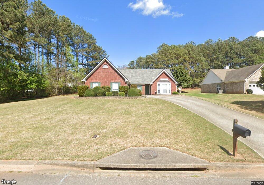
6220 Rock Port Dr Flowery Branch, GA 30542
Estimated Value: $404,472 - $468,000
3
Beds
2
Baths
2,042
Sq Ft
$211/Sq Ft
Est. Value
About This Home
This home is located at 6220 Rock Port Dr, Flowery Branch, GA 30542 and is currently estimated at $429,868, approximately $210 per square foot. 6220 Rock Port Dr is a home located in Hall County with nearby schools including Flowery Branch Elementary School, West Hall Middle School, and West Hall High School.
Ownership History
Date
Name
Owned For
Owner Type
Purchase Details
Closed on
May 8, 2013
Sold by
Burkett Harry E
Bought by
Burkett Harry Allen
Current Estimated Value
Purchase Details
Closed on
Oct 30, 1995
Sold by
Bowen Bowen Const Co Inc
Bought by
Burkett Harry E
Purchase Details
Closed on
Aug 1, 1995
Create a Home Valuation Report for This Property
The Home Valuation Report is an in-depth analysis detailing your home's value as well as a comparison with similar homes in the area
Home Values in the Area
Average Home Value in this Area
Purchase History
| Date | Buyer | Sale Price | Title Company |
|---|---|---|---|
| Burkett Harry Allen | -- | -- | |
| Burkett Harry E | $127,900 | -- | |
| -- | $18,800 | -- |
Source: Public Records
Mortgage History
| Date | Status | Borrower | Loan Amount |
|---|---|---|---|
| Closed | Burkett Harry E | $0 |
Source: Public Records
Tax History Compared to Growth
Tax History
| Year | Tax Paid | Tax Assessment Tax Assessment Total Assessment is a certain percentage of the fair market value that is determined by local assessors to be the total taxable value of land and additions on the property. | Land | Improvement |
|---|---|---|---|---|
| 2024 | $4,065 | $161,720 | $27,200 | $134,520 |
| 2023 | $3,208 | $127,000 | $25,080 | $101,920 |
| 2022 | $3,035 | $115,080 | $25,080 | $90,000 |
| 2021 | $2,620 | $97,080 | $16,560 | $80,520 |
| 2020 | $2,444 | $87,760 | $11,480 | $76,280 |
| 2019 | $2,326 | $82,640 | $11,480 | $71,160 |
| 2018 | $2,200 | $75,480 | $11,480 | $64,000 |
| 2017 | $2,135 | $73,960 | $11,480 | $62,480 |
| 2016 | $1,927 | $68,160 | $11,480 | $56,680 |
| 2015 | $1,571 | $54,628 | $9,200 | $45,428 |
| 2014 | $1,571 | $54,628 | $9,200 | $45,428 |
Source: Public Records
Map
Nearby Homes
- 6228 Rock Port Dr
- 6284 Brookridge Dr
- 6354 Brookridge Dr
- 6201 Southport Dr
- 6241 Brookridge Dr
- 6306 Water Haven Way
- 6121 Stillwater Trail
- 6225 S Port Dr
- 5388 Frazer Rd
- 6237 Stillwater Place
- 6103 Portsmouth Dr
- 5904 Clipper Bay
- 6104 Saddlehorse Dr
- 5220 Wild Cedar Dr
- 4235 Crestwood Bend Cir
- 6262 Laurel Wood Trail
- 6214 Rock Port Dr
- 6236 Rock Port Dr
- 6210 Rock Port Dr
- 6264 Rock Port Dr
- 6268 Rock Port Dr
- 6223 Rock Port Dr
- 6227 Rock Port Dr
- 6250 Rock Port Dr
- 6272 Rock Port Dr
- 6233 Rock Port Dr
- 0 Rock Port Dr Unit 7573124
- 0 Rock Port Dr Unit 7226643
- 0 Rock Port Dr Unit 7165079
- 0 Rock Port Dr Unit 7553109
- 6237 Rock Port Dr
- 6129 Mount Salem Cir
- 6276 Rock Port Dr
- 6109 Back Bay Cir
- 6241 Rock Port Dr
- 6115 Back Bay Cir