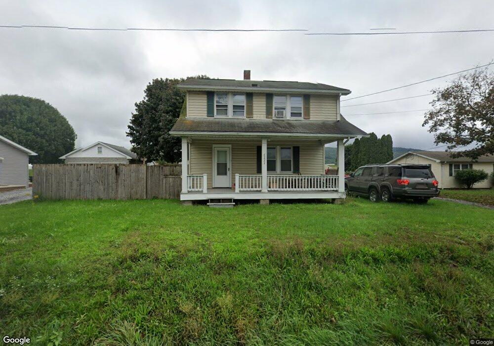
6222 Anthony Hwy Waynesboro, PA 17268
Estimated Value: $150,357 - $244,000
--
Bed
--
Bath
1,236
Sq Ft
$160/Sq Ft
Est. Value
About This Home
This home is located at 6222 Anthony Hwy, Waynesboro, PA 17268 and is currently estimated at $198,089, approximately $160 per square foot. 6222 Anthony Hwy is a home located in Franklin County with nearby schools including Waynesboro Area Senior High School and Providence School - Pigeon Hill Building.
Ownership History
Date
Name
Owned For
Owner Type
Purchase Details
Closed on
Mar 7, 2006
Sold by
Russell Jason J and Russell Shannon M
Bought by
Poffenberger Neal T and Poffenberger Donna L
Current Estimated Value
Home Financials for this Owner
Home Financials are based on the most recent Mortgage that was taken out on this home.
Original Mortgage
$127,120
Outstanding Balance
$72,309
Interest Rate
6.28%
Mortgage Type
New Conventional
Estimated Equity
$125,780
Create a Home Valuation Report for This Property
The Home Valuation Report is an in-depth analysis detailing your home's value as well as a comparison with similar homes in the area
Home Values in the Area
Average Home Value in this Area
Purchase History
| Date | Buyer | Sale Price | Title Company |
|---|---|---|---|
| Poffenberger Neal T | $158,900 | None Available |
Source: Public Records
Mortgage History
| Date | Status | Borrower | Loan Amount |
|---|---|---|---|
| Open | Poffenberger Neal T | $127,120 |
Source: Public Records
Tax History Compared to Growth
Tax History
| Year | Tax Paid | Tax Assessment Tax Assessment Total Assessment is a certain percentage of the fair market value that is determined by local assessors to be the total taxable value of land and additions on the property. | Land | Improvement |
|---|---|---|---|---|
| 2025 | $1,472 | $10,090 | $800 | $9,290 |
| 2024 | $1,427 | $10,090 | $800 | $9,290 |
| 2023 | $1,242 | $9,030 | $800 | $8,230 |
| 2022 | $1,206 | $9,030 | $800 | $8,230 |
| 2021 | $1,170 | $9,030 | $800 | $8,230 |
| 2020 | $1,170 | $9,030 | $800 | $8,230 |
| 2019 | $1,142 | $9,030 | $800 | $8,230 |
| 2018 | $1,104 | $9,030 | $800 | $8,230 |
| 2017 | $1,079 | $9,030 | $800 | $8,230 |
| 2016 | $259 | $9,030 | $800 | $8,230 |
| 2015 | $241 | $9,030 | $800 | $8,230 |
| 2014 | $241 | $9,030 | $800 | $8,230 |
Source: Public Records
Map
Nearby Homes
- 286 Verdier St
- 6 S Main St
- 207 University Dr
- 111 Poplar St
- 7468 Anthony Hwy
- 5434 Manheim Rd
- 7205 Fairway Dr S
- 6158 Merion Dr
- 6337 Medina Ridge Dr
- 3891 Alfalfa Ln
- 6396 Saucon Valley Dr
- 7136 Sandwich Ln
- 7130 St Annes Dr
- 7059 Duck Hook Ln
- 3881 Farmstead Dr
- 7121 Sandwich Ln
- 7060 Duck Hook Ln
- 6352 Penn National Dr
- 6852 Lytham Ln
- 3826 Farmstead Dr
- 6190 Anthony Hwy
- 6236 Anthony Hwy
- 6192 Anthony Hwy
- 6250 Anthony Hwy
- 6217 Anthony Hwy
- 6280 Anthony Hwy
- 6172 Anthony Hwy
- 6266 Anthony Hwy
- 0 Anthony Hwy Unit FL5460179
- 2168 Mont Alto Rd
- 6113 Anthony Hwy
- 5985 Stamey Hill Rd
- 6085 Anthony Hwy
- 6085 Anthony Hwy
- 6057 Anthony Hwy
- 601 W Main St
- 601 S Anthony Hwy
- 6410 Anthony Hwy
- 100 Walnut St
- 0 Aspen Dr Unit PAFL160932