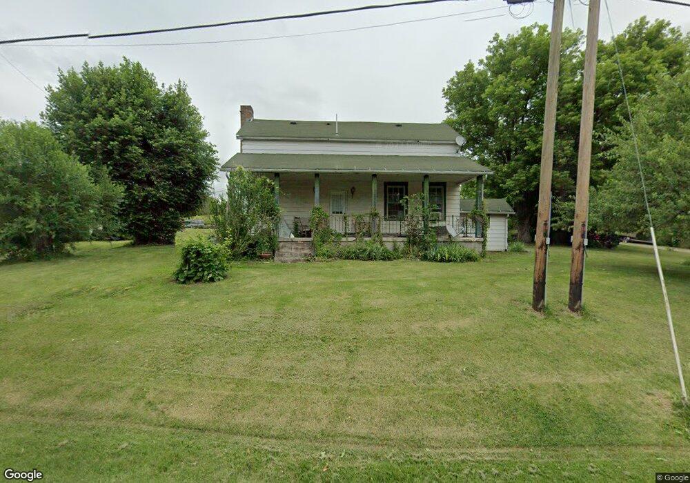
62231 Us Highway 50 Mc Arthur, OH 45651
Estimated Value: $164,684 - $312,000
--
Bed
--
Bath
1,610
Sq Ft
$151/Sq Ft
Est. Value
About This Home
This home is located at 62231 Us Highway 50, Mc Arthur, OH 45651 and is currently estimated at $242,421, approximately $150 per square foot. 62231 Us Highway 50 is a home with nearby schools including Vinton County High School.
Ownership History
Date
Name
Owned For
Owner Type
Purchase Details
Closed on
Sep 12, 2025
Sold by
Mcdaniel Christina M and Funk Shawn
Bought by
Mcdaniel David D and Mcdaniel Trina C
Current Estimated Value
Purchase Details
Closed on
Sep 21, 2019
Sold by
Mcdaniel David P
Bought by
Mcdaniel Christina
Purchase Details
Closed on
May 9, 2019
Sold by
Mcdaniel David D and Mcdaniel Katrina
Bought by
Mcdaniel Christina
Create a Home Valuation Report for This Property
The Home Valuation Report is an in-depth analysis detailing your home's value as well as a comparison with similar homes in the area
Home Values in the Area
Average Home Value in this Area
Purchase History
| Date | Buyer | Sale Price | Title Company |
|---|---|---|---|
| Mcdaniel David D | -- | None Listed On Document | |
| Mcdaniel David D | -- | None Listed On Document | |
| Mcdaniel Christina | -- | None Available | |
| Mcdaniel Christina | -- | None Available |
Source: Public Records
Tax History Compared to Growth
Tax History
| Year | Tax Paid | Tax Assessment Tax Assessment Total Assessment is a certain percentage of the fair market value that is determined by local assessors to be the total taxable value of land and additions on the property. | Land | Improvement |
|---|---|---|---|---|
| 2024 | $773 | $45,310 | $25,480 | $19,830 |
| 2023 | $619 | $33,190 | $17,700 | $15,490 |
| 2022 | $1,243 | $33,190 | $17,700 | $15,490 |
| 2021 | $1,237 | $33,190 | $17,700 | $15,490 |
| 2020 | $1,079 | $27,540 | $14,560 | $12,980 |
| 2019 | $1,077 | $27,540 | $14,560 | $12,980 |
| 2018 | $1,063 | $27,540 | $14,560 | $12,980 |
| 2017 | $992 | $25,030 | $13,230 | $11,800 |
| 2016 | $989 | $25,030 | $13,230 | $11,800 |
| 2015 | $879 | $23,600 | $13,480 | $10,120 |
| 2014 | $879 | $23,600 | $13,480 | $10,120 |
Source: Public Records
Map
Nearby Homes
- 61823 U S 50
- 62722 U S 50
- 62436 Bolar Rd
- 62160 Bolar Rd
- 32103 State Route 93
- 59938 Bolar Rd
- 0 Wolf Hill Rd Unit (Tract 7 Wolf Hill)
- 0 Wolf Hill Rd Unit 25468491
- 0 Wolf Hill Rd Unit (Tract 3 Wolf Hill)
- 0 Wolf Hill Rd Unit 25469221
- 0 Wolf Hill Rd Unit (Tract 4 Wolf Hill)
- 0 Wolf Hill Rd Unit (Tract 2 Wolf Hill)
- 0 Wolf Hill Rd Unit 25026051
- 0 Wolf Hill Rd Unit (Tract 5 Wolf Hill)
- 0 Wolf Hill Rd Unit (Tract 6 Wolf Hill)
- 0 Wolf Hill Rd Unit 25469218
- 0 Wolf Hill Rd Unit 25041313
- 403 W High St
- 626 Engle Dr
- 33747 Wolf Hill Rd Unit (Wolf Hill House)
- 62467 Us Highway 50
- 62235 Us Highway 50
- 62534 Us Highway 50
- 62534 Us Highway 50
- 62059 Us Highway 50
- 31575 Overview Dr
- 62015 Us Highway 50
- 62562 Us Highway 50
- 62562 Us Highway 50
- 62562 Us Highway 50
- 62562 Us Highway 50
- 31625 Overview Dr
- 31600 Overview Dr
- 61916 Us Highway 50
- 61916 Us Highway 50
- 61916 Us Hwy 50
- 62592 Us Highway 50
- 62049 Us Highway 50
- 31500 Overview Dr
- 31675 Overview Dr