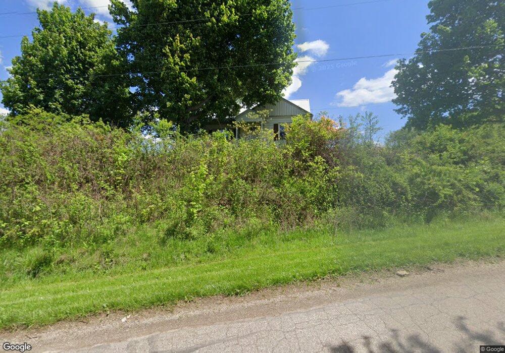
62232 Savage Rd Cambridge, OH 43725
Estimated Value: $149,748 - $222,000
--
Bed
--
Bath
1,042
Sq Ft
$188/Sq Ft
Est. Value
About This Home
This home is located at 62232 Savage Rd, Cambridge, OH 43725 and is currently estimated at $195,937, approximately $188 per square foot. 62232 Savage Rd is a home with nearby schools including Pike Elementary School, Larry Miller Intermediate Elementary School, and East Muskingum Middle School.
Ownership History
Date
Name
Owned For
Owner Type
Purchase Details
Closed on
Nov 28, 2017
Sold by
Morris Vicki Lynn
Bought by
Reis Tara M
Current Estimated Value
Home Financials for this Owner
Home Financials are based on the most recent Mortgage that was taken out on this home.
Original Mortgage
$80,000
Outstanding Balance
$67,353
Interest Rate
3.94%
Mortgage Type
New Conventional
Estimated Equity
$128,584
Create a Home Valuation Report for This Property
The Home Valuation Report is an in-depth analysis detailing your home's value as well as a comparison with similar homes in the area
Home Values in the Area
Average Home Value in this Area
Purchase History
| Date | Buyer | Sale Price | Title Company |
|---|---|---|---|
| Reis Tara M | $100,000 | Elitel Land Title |
Source: Public Records
Mortgage History
| Date | Status | Borrower | Loan Amount |
|---|---|---|---|
| Open | Reis Tara M | $80,000 |
Source: Public Records
Tax History Compared to Growth
Tax History
| Year | Tax Paid | Tax Assessment Tax Assessment Total Assessment is a certain percentage of the fair market value that is determined by local assessors to be the total taxable value of land and additions on the property. | Land | Improvement |
|---|---|---|---|---|
| 2024 | $1,185 | $29,827 | $6,307 | $23,520 |
| 2023 | $1,185 | $23,863 | $5,047 | $18,816 |
| 2022 | $1,034 | $23,860 | $5,040 | $18,820 |
| 2021 | $1,001 | $23,860 | $5,040 | $18,820 |
| 2020 | $1,044 | $24,610 | $3,800 | $20,810 |
| 2019 | $969 | $24,610 | $3,800 | $20,810 |
| 2018 | $947 | $24,610 | $3,800 | $20,810 |
| 2017 | $910 | $21,320 | $3,300 | $18,020 |
| 2016 | $900 | $21,320 | $3,300 | $18,020 |
| 2015 | $905 | $21,320 | $3,300 | $18,020 |
| 2014 | $845 | $19,290 | $2,910 | $16,380 |
| 2013 | $852 | $19,290 | $2,910 | $16,380 |
Source: Public Records
Map
Nearby Homes
- 62063 Savage Rd
- 4480 Peters Creek Rd
- 63041 Ridgewood Dr
- 3859 Mayfair Ln
- 5617 Skyline Dr
- 6065 Skyline Dr
- 148 Merrick Rd
- 61342 High Hill Rd
- 4896 High Hill Rd
- 0 Haught Rd Unit LOTWP001 24504411
- 0 Haught Rd
- 59915 Craig Rd
- 64391 Morrison Rd
- 5628 Bloomfield Rd
- 61220 Kadon Dr
- 209 Jefferson Ave
- 0 Water St
- 518 Jefferson Ave
- Lot 18 & 19 Greenbriar Dr
- 708 S 7th St
- 62205 Savage Rd
- 62145 Savage Rd
- 62172 Savage Rd
- 62314 Savage Rd
- 62121 Savage Rd
- 61802 Colvin Ln
- 61926 Colvin Ln
- 62089 Savage Rd
- 61908 Colvin Ln
- 5049 Heather Hills Dr
- 0 Glenn Hwy Unit 3970477
- 5077 Heather Hills Dr
- 5101 Heather Hills Dr
- 5155 Heather Hills Dr
- 61905 Savage Rd
- 5190 Heather Hills Dr
- 4821 Glenn Hwy
- 5199 Heather Hills Dr
- 4729 Glenn Hwy
- 0 Glenn Hwy Unit 3439660