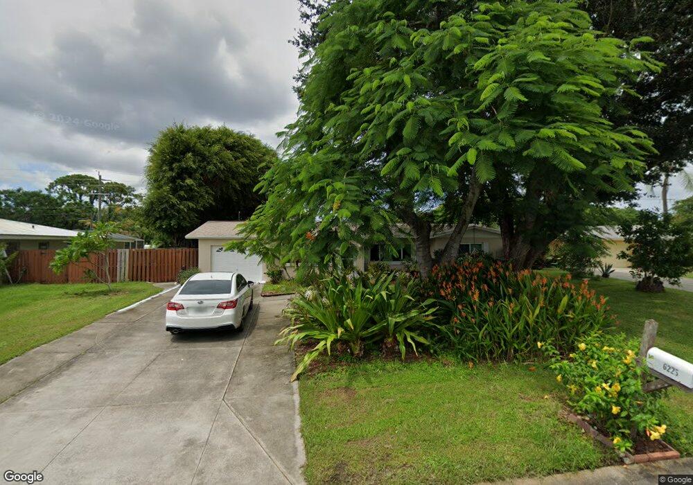
6225 Saint Andrews Cir N Fort Myers, FL 33919
Whiskey Creek NeighborhoodEstimated Value: $311,566 - $401,000
3
Beds
2
Baths
1,628
Sq Ft
$219/Sq Ft
Est. Value
About This Home
This home is located at 6225 Saint Andrews Cir N, Fort Myers, FL 33919 and is currently estimated at $356,142, approximately $218 per square foot. 6225 Saint Andrews Cir N is a home located in Lee County with nearby schools including Orangewood Elementary School, Allen Park Elementary School, and Edison Park Creative & Expressive Arts School.
Ownership History
Date
Name
Owned For
Owner Type
Purchase Details
Closed on
Jul 10, 2013
Sold by
Berg Thomas
Bought by
Stuntz Michael C and Kuleshova Irina
Current Estimated Value
Home Financials for this Owner
Home Financials are based on the most recent Mortgage that was taken out on this home.
Original Mortgage
$120,000
Outstanding Balance
$87,221
Interest Rate
3.91%
Mortgage Type
New Conventional
Estimated Equity
$268,921
Create a Home Valuation Report for This Property
The Home Valuation Report is an in-depth analysis detailing your home's value as well as a comparison with similar homes in the area
Home Values in the Area
Average Home Value in this Area
Purchase History
| Date | Buyer | Sale Price | Title Company |
|---|---|---|---|
| Stuntz Michael C | $148,000 | Old Florida Title |
Source: Public Records
Mortgage History
| Date | Status | Borrower | Loan Amount |
|---|---|---|---|
| Open | Stuntz Michael C | $120,000 |
Source: Public Records
Tax History Compared to Growth
Tax History
| Year | Tax Paid | Tax Assessment Tax Assessment Total Assessment is a certain percentage of the fair market value that is determined by local assessors to be the total taxable value of land and additions on the property. | Land | Improvement |
|---|---|---|---|---|
| 2025 | $1,437 | $127,642 | -- | -- |
| 2024 | $1,388 | $124,045 | -- | -- |
| 2023 | $1,388 | $120,432 | $0 | $0 |
| 2022 | $1,470 | $116,924 | $0 | $0 |
| 2021 | $1,409 | $194,075 | $52,517 | $141,558 |
| 2020 | $1,394 | $111,951 | $0 | $0 |
| 2019 | $1,362 | $109,434 | $0 | $0 |
| 2018 | $1,362 | $107,394 | $0 | $0 |
| 2017 | $1,346 | $105,185 | $0 | $0 |
| 2016 | $1,328 | $148,538 | $36,574 | $111,964 |
| 2015 | $1,339 | $118,491 | $33,558 | $84,933 |
| 2014 | -- | $101,494 | $18,487 | $83,007 |
| 2013 | -- | $75,805 | $12,000 | $63,805 |
Source: Public Records
Map
Nearby Homes
- 1420 Mandel Rd
- 1358 Hopedale Dr
- 8327 Riviera Ave
- 1427 Davis Dr
- 1442 Byron Rd
- 6011 Fountain Way
- 5034 Westminster Dr
- 1212 Twin Palm Dr
- 8451 Casa Del Rio Ln
- 6005 W Riverside Dr
- 1457 Byron Rd
- 1221 La Faunce Way
- 19 Winewood Ct
- 8297 San Marcos
- 20 Catalpa Ct
- 1250 Kasamada Dr
- 5216 Cedarbend Dr Unit 3
- 1348 Woodmere Ln
- 1563 Covington Cir E
- 1515 Manchester Blvd
- 6223 Saint Andrews Cir N
- 1410 Charles Ct
- 6227 Saint Andrews Cir N
- 6227 Saint Andrews Cir N
- 1412 Charles Ct
- 6229 Saint Andrews Cir N
- 6224 Saint Andrews Cir N
- 6221 Saint Andrews Cir N
- 1414 Charles Rd
- 6231 Saint Andrews Cir N
- 1429 Rose Ln
- 6222 Saint Andrews Cir N
- 6234 Saint Andrews Cir N
- 1416 Charles Rd
- 6233 Saint Andrews Cir N
- 1520 Fountain Ave
- 1422 Loma Linda Dr
- 6214 Saint Andrews Cir N
- 1409 Charles Ct
- 1454 Argyle Dr