6225 W Locust St Davenport, IA 52804
Outer Davenport/Bettendorf NeighborhoodEstimated payment $11,631/month
Highlights
- 95.1 Acre Lot
- No HOA
- Agricultural
About This Lot
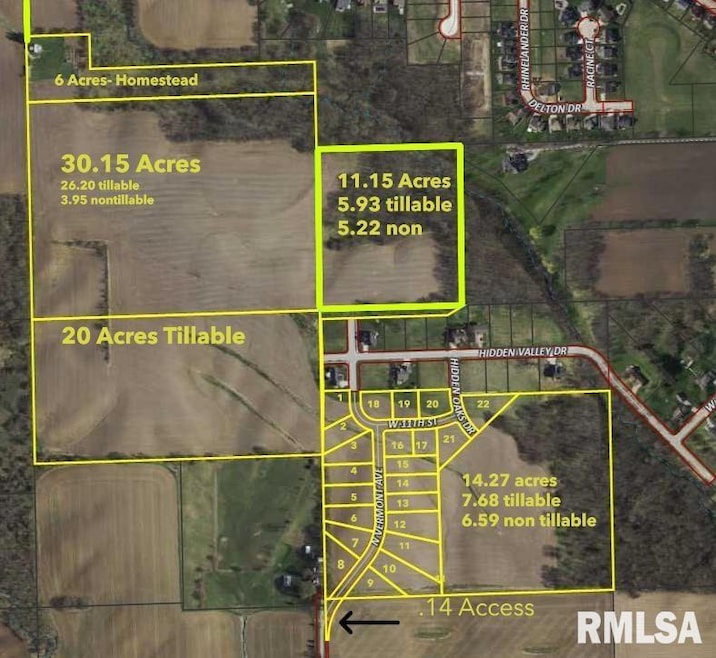
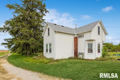
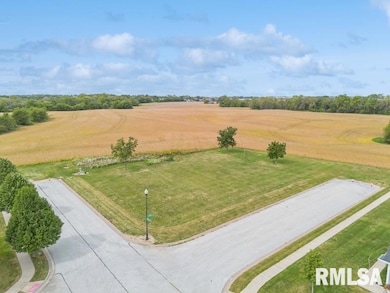
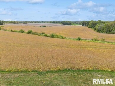
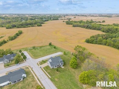
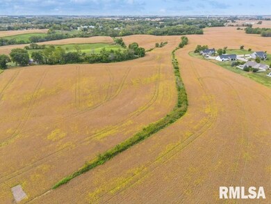
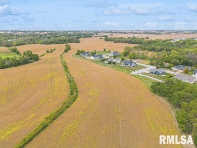
Beautiful & Picturistic 95.10 Acres MOL of Development/Farm Land located in Davenport. An 173 Lot Concept/ Preliminary Plan has been laid out. Purchaser can develop however they see fit. All Structures included are to be sold in as is condition. House is currently rented.
Listing Agent
Ruhl&Ruhl REALTORS Bettendorf Brokerage Phone: 563-441-1776 License #S35594000/475.143448 Listed on: 11/12/2025

Property Details
Property Type
- Land
Est. Annual Taxes
- $4,374
Schools
- Davenport Elementary And Middle School
- Davenport High School
Utilities
- Private Water Source
- Septic System
Additional Features
- 95.1 Acre Lot
- Agricultural
Community Details
- No Home Owners Association
- Buckwalters Subdivision
Listing and Financial Details
- Assessor Parcel Number S3019-02
Map
Home Values in the Area
Average Home Value in this Area
Tax History
| Year | Tax Paid | Tax Assessment Tax Assessment Total Assessment is a certain percentage of the fair market value that is determined by local assessors to be the total taxable value of land and additions on the property. | Land | Improvement |
|---|---|---|---|---|
| 2025 | $1,796 | $114,100 | $9,850 | $104,250 |
| 2024 | $1,750 | $100,920 | $7,540 | $93,380 |
| 2023 | $1,492 | $100,920 | $7,540 | $93,380 |
| 2022 | $1,502 | $69,810 | $6,120 | $63,690 |
| 2021 | $1,502 | $69,810 | $6,120 | $63,690 |
| 2020 | $1,394 | $64,790 | $6,220 | $58,570 |
| 2019 | $1,523 | $67,040 | $8,420 | $58,620 |
| 2018 | $1,396 | $67,040 | $8,420 | $58,620 |
| 2017 | $1,328 | $67,040 | $8,420 | $58,620 |
| 2016 | $1,324 | $58,410 | $0 | $0 |
| 2015 | $1,372 | $15,000 | $0 | $0 |
| 2014 | $164 | $16,500 | $0 | $0 |
| 2013 | $176 | $0 | $0 | $0 |
| 2012 | -- | $12,200 | $10,700 | $1,500 |
Property History
| Date | Event | Price | List to Sale | Price per Sq Ft |
|---|---|---|---|---|
| 11/12/2025 11/12/25 | For Sale | $2,137,500 | -- | -- |
Source: RMLS Alliance
MLS Number: QC4269304
APN: S3019-02
Disclaimer: Certain information contained herein is derived from information provided by parties other than Homes.com. All information provided is deemed reliable, but is not guaranteed to be accurate and should be independently verified.
![]() IDX information is provided exclusively for personal, non-commercial use, and may not be used for any purpose other than to identify prospective properties consumers may be interested in purchasing. Information is deemed reliable but not guaranteed.
IDX information is provided exclusively for personal, non-commercial use, and may not be used for any purpose other than to identify prospective properties consumers may be interested in purchasing. Information is deemed reliable but not guaranteed.
- 1335 N Utah Ave
- 5910 Austin Ave
- 1729 Jenna Dr
- 5908 Alec Ave
- 1536 Rhinelander Dr
- 1634 Rhinelander Ct
- 1515 Rhinelander Dr
- 1422 Racine Ct
- 5529 Baraboo Ct
- 5521 Baraboo Ct
- 5321 Friendship Dr Unit 5320
- 4738 W 11th St
- 1210 Eagle's Crest Dr
- 4836 W Pleasant St
- 4703 W 13th St
- 4620 W 11th St
- 2025 Emerald Dr
- 1310 Calvin St
- 1215 Calvin St
- 1139 Calvin St
- 1115 N Utah Ave Unit lower lvl apartment
- 1115 N Utah Ave
- 1701 Eagles Crest Ave
- 3235 W 16th St
- 3117 Schuetzen Ln
- 1000 Blythwood Place
- 3637 Johnson Ave
- 3803 Pearl Ave
- 3439 Hillandale Rd
- 3320 W 42nd St
- 2930 N Lincoln Ave
- 2002 W 4th St
- 2002 W 4th St Unit Main
- 2002 W 4th St Unit A
- 201 S Howell St Unit 201 Half
- 201 S Howell St
- 201 S Howell St Unit 1/2
- 2154 W 36th St
- 6204 W Kimberly Rd Unit 6204 A
- 627 N Division St