62266 Us Highway 136 Tecumseh, NE 68450
Estimated Value: $275,784 - $331,000
3
Beds
3
Baths
1,369
Sq Ft
$223/Sq Ft
Est. Value
About This Home
This home is located at 62266 Us Highway 136, Tecumseh, NE 68450 and is currently estimated at $304,946, approximately $222 per square foot. 62266 Us Highway 136 is a home located in Johnson County with nearby schools including Johnson County Central Elementary School - Tecumseh, Johnson County Central Elementary School - Cook, and Johnson County Central Middle School.
Ownership History
Date
Name
Owned For
Owner Type
Purchase Details
Closed on
Nov 2, 2017
Sold by
Miller Randy L
Bought by
Miller Justin D and Miller Katherine J
Current Estimated Value
Purchase Details
Closed on
Sep 10, 2011
Sold by
Turnbull Katherine Lea
Bought by
Miller Randy L and Miller Kerri L
Purchase Details
Closed on
Oct 31, 2007
Sold by
Boese Frank and Boese Dolores
Bought by
Turnbull Katherine Lea
Create a Home Valuation Report for This Property
The Home Valuation Report is an in-depth analysis detailing your home's value as well as a comparison with similar homes in the area
Home Values in the Area
Average Home Value in this Area
Purchase History
| Date | Buyer | Sale Price | Title Company |
|---|---|---|---|
| Miller Justin D | $75,000 | -- | |
| Miller Randy L | $130,000 | -- | |
| Turnbull Katherine Lea | $145,000 | -- |
Source: Public Records
Tax History Compared to Growth
Tax History
| Year | Tax Paid | Tax Assessment Tax Assessment Total Assessment is a certain percentage of the fair market value that is determined by local assessors to be the total taxable value of land and additions on the property. | Land | Improvement |
|---|---|---|---|---|
| 2024 | $2,305 | $220,855 | $32,000 | $188,855 |
| 2023 | $2,227 | $153,876 | $22,000 | $131,876 |
| 2022 | $2,164 | $151,376 | $19,500 | $131,876 |
| 2021 | $2,042 | $150,827 | $19,500 | $131,327 |
| 2020 | $2,037 | $153,705 | $19,500 | $134,205 |
| 2019 | $1,829 | $138,269 | $14,800 | $123,469 |
| 2018 | $1,795 | $138,269 | $14,800 | $123,469 |
| 2017 | $1,544 | $135,585 | $14,800 | $120,785 |
| 2016 | $1,544 | $120,964 | $13,600 | $107,364 |
| 2015 | $1,624 | $126,383 | $13,464 | $112,919 |
| 2014 | $1,763 | $126,360 | $12,300 | $114,060 |
Source: Public Records
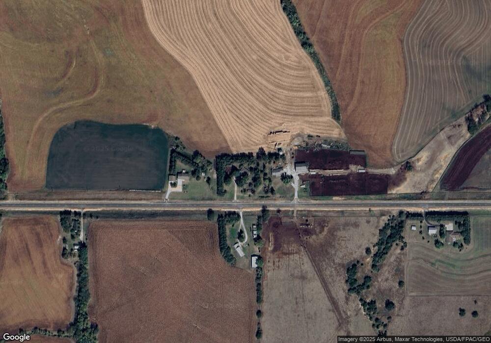
Map
Nearby Homes
- 412 N 13th St
- 588 Shawnee Blvd
- 73070 624 Ave
- Navajo Plan at Shawnee Ridge
- Nantucket II Plan at Shawnee Ridge
- Vista II Plan at Shawnee Ridge
- Dakota Plan at Shawnee Ridge
- Inca Plan at Shawnee Ridge
- Denver Plan at Shawnee Ridge
- Vail II Plan at Shawnee Ridge
- Vail Plan at Shawnee Ridge
- Mesa Plan at Shawnee Ridge
- Nantucket Plan at Shawnee Ridge
- Durango Plan at Shawnee Ridge
- Otoe Plan at Shawnee Ridge
- Boulder Plan at Shawnee Ridge
- Vista Plan at Shawnee Ridge
- Breckenridge Plan at Shawnee Ridge
- 971 Prairie Dr
- 612.5 Ave Us Highway 136
- 62266 Us Highway 136
- 62266 U S 136
- 62272 Us Highway 136
- 62258 Us Highway 136
- 62267 Us Highway 136
- 62249 Us Highway 136
- 62289 Us Highway 136
- 72806 623 Ave
- 72822 623 Ave
- 62226 Us Highway 136
- 62326 Us Highway 136
- 72852 623 Ave
- 72863 623 Ave
- 72784 622 Ave
- 72785 622 Ave
- 72777 622 Ave
- 72852 622 Ave
- 62182 Us Highway 136
- 72745 622 Ave
- 72714 623 Ave