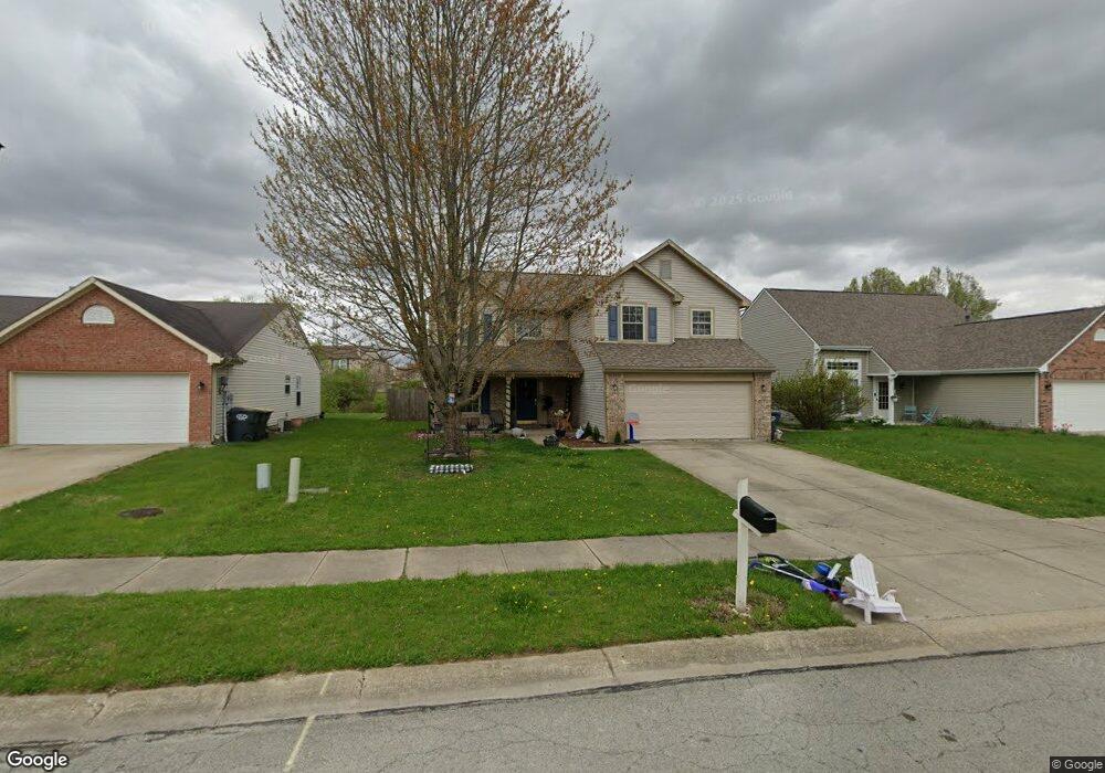
6227 Boulder Dr Anderson, IN 46013
Estimated Value: $190,000 - $263,983
4
Beds
3
Baths
2,220
Sq Ft
$105/Sq Ft
Est. Value
About This Home
This home is located at 6227 Boulder Dr, Anderson, IN 46013 and is currently estimated at $231,996, approximately $104 per square foot. 6227 Boulder Dr is a home located in Madison County with nearby schools including Erskine Elementary School, Highland Middle School, and Anderson High School.
Ownership History
Date
Name
Owned For
Owner Type
Purchase Details
Closed on
Sep 5, 2023
Sold by
Burkett Michaelp and Burkett Sheree L
Bought by
Bolenbaugh Joseph A
Current Estimated Value
Home Financials for this Owner
Home Financials are based on the most recent Mortgage that was taken out on this home.
Original Mortgage
$189,150
Outstanding Balance
$185,024
Interest Rate
6.81%
Mortgage Type
New Conventional
Estimated Equity
$46,972
Purchase Details
Closed on
Mar 23, 2010
Sold by
Burkett Michael P and Lapierre Martha E
Bought by
Burkett Michael P and Burkett Sheree L
Home Financials for this Owner
Home Financials are based on the most recent Mortgage that was taken out on this home.
Original Mortgage
$75,500
Interest Rate
5.1%
Mortgage Type
New Conventional
Purchase Details
Closed on
Jan 12, 2009
Sold by
Secretary Of Hud
Bought by
Burkett Michael P and Lapierre Martha E
Home Financials for this Owner
Home Financials are based on the most recent Mortgage that was taken out on this home.
Original Mortgage
$74,100
Interest Rate
5.19%
Mortgage Type
New Conventional
Purchase Details
Closed on
Jul 1, 2008
Sold by
Countrywide Home Loans Inc
Bought by
Secretary Of Hud
Purchase Details
Closed on
May 9, 2008
Sold by
Zachary Randy A
Bought by
Countrywide Home Loans Inc
Create a Home Valuation Report for This Property
The Home Valuation Report is an in-depth analysis detailing your home's value as well as a comparison with similar homes in the area
Home Values in the Area
Average Home Value in this Area
Purchase History
| Date | Buyer | Sale Price | Title Company |
|---|---|---|---|
| Bolenbaugh Joseph A | -- | Lenders Escrow & Title | |
| Burkett Michael P | -- | -- | |
| Burkett Michael P | -- | -- | |
| Secretary Of Hud | -- | -- | |
| Countrywide Home Loans Inc | $137,422 | -- |
Source: Public Records
Mortgage History
| Date | Status | Borrower | Loan Amount |
|---|---|---|---|
| Open | Bolenbaugh Joseph A | $189,150 | |
| Previous Owner | Burkett Michael P | $75,500 | |
| Previous Owner | Burkett Michael P | $74,100 |
Source: Public Records
Tax History Compared to Growth
Tax History
| Year | Tax Paid | Tax Assessment Tax Assessment Total Assessment is a certain percentage of the fair market value that is determined by local assessors to be the total taxable value of land and additions on the property. | Land | Improvement |
|---|---|---|---|---|
| 2024 | $2,134 | $193,200 | $22,900 | $170,300 |
| 2023 | $1,948 | $176,500 | $21,800 | $154,700 |
| 2022 | $3,967 | $177,300 | $21,000 | $156,300 |
| 2021 | $3,447 | $153,200 | $17,800 | $135,400 |
| 2020 | $3,319 | $146,900 | $17,000 | $129,900 |
| 2019 | $3,173 | $140,300 | $17,000 | $123,300 |
| 2018 | $3,021 | $130,900 | $17,000 | $113,900 |
| 2017 | $2,520 | $126,000 | $16,300 | $109,700 |
| 2016 | $2,490 | $124,500 | $16,300 | $108,200 |
| 2014 | $2,276 | $113,800 | $15,000 | $98,800 |
| 2013 | $2,276 | $110,900 | $15,000 | $95,900 |
Source: Public Records
Map
Nearby Homes
- 6233 Boulder Dr
- 6216 Rocky Rd
- 5749 Granite Dr
- 916 Harold St
- 6905 Hendricks St
- 0 Sheridan St Unit MBR22051619
- 6807 Fairview St
- 6912 Fairview St
- 905 Country Ln
- 810 Ernie Lu Ave
- 310 Stoner Dr
- 806 Country Ln
- 4912 Dawn St
- 6709 Jackson St
- 814 Rustic Rd
- 6440 Main St
- 328 W 53rd St Unit 17
- 328 W 53rd St Unit 46
- 328 W 53rd St Unit 86
- 328 W 53rd St Unit 52
- 6301 Boulder Dr
- 6215 Boulder Dr
- 6230 Arrowhead Dr
- 6224 Arrowhead Dr
- 6306 Arrowhead Dr
- 6209 Boulder Dr
- 6307 Boulder Dr
- 6224 Boulder Dr
- 6216 Arrowhead Dr
- 6216 Boulder Dr
- 6302 Boulder Dr
- 6208 Arrowhead Dr
- 6312 Arrowhead Dr
- 6203 Boulder Dr
- 6210 Boulder Dr
- 6308 Boulder Dr
- 6202 Arrowhead Dr
- 1026 Redrock Dr
- 6319 Boulder Dr
- 1035 Redrock Dr