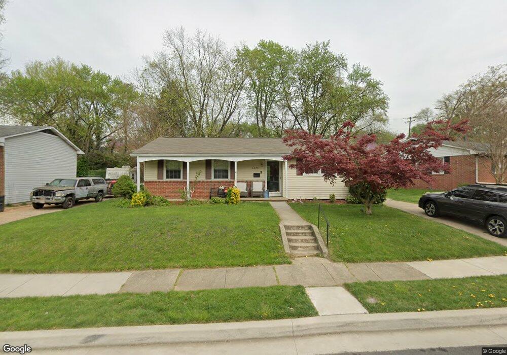
6228 Commons Rd Rosedale, MD 21237
Estimated Value: $297,000 - $314,000
Studio
2
Baths
1,066
Sq Ft
$285/Sq Ft
Est. Value
About This Home
This home is located at 6228 Commons Rd, Rosedale, MD 21237 and is currently estimated at $304,029, approximately $285 per square foot. 6228 Commons Rd is a home located in Baltimore County with nearby schools including Red House Run Elementary School, Golden Ring Middle School, and Overlea High School.
Ownership History
Date
Name
Owned For
Owner Type
Purchase Details
Closed on
May 12, 2023
Sold by
Savage John P and Savage Sarah M
Bought by
Musante Nicole M
Current Estimated Value
Home Financials for this Owner
Home Financials are based on the most recent Mortgage that was taken out on this home.
Original Mortgage
$287,250
Interest Rate
7.18%
Mortgage Type
FHA
Purchase Details
Closed on
Sep 22, 2009
Sold by
Savage John P
Bought by
Savage John P and Savage Sarah M
Purchase Details
Closed on
Apr 6, 2005
Sold by
Pilquist Margaret M
Bought by
Savage John P and Betkey Sarah M
Home Financials for this Owner
Home Financials are based on the most recent Mortgage that was taken out on this home.
Original Mortgage
$161,100
Interest Rate
5.78%
Mortgage Type
New Conventional
Purchase Details
Closed on
Nov 9, 2001
Sold by
Misek Margaret E
Bought by
Pilquist Margaret M
Create a Home Valuation Report for This Property
The Home Valuation Report is an in-depth analysis detailing your home's value as well as a comparison with similar homes in the area
Home Values in the Area
Average Home Value in this Area
Purchase History
| Date | Buyer | Sale Price | Title Company |
|---|---|---|---|
| Musante Nicole M | $292,550 | Stewart Title | |
| Savage John P | -- | -- | |
| Savage John P | $201,400 | -- | |
| Pilquist Margaret M | -- | -- |
Source: Public Records
Mortgage History
| Date | Status | Borrower | Loan Amount |
|---|---|---|---|
| Previous Owner | Musante Nicole M | $287,250 | |
| Previous Owner | Savage John P | $161,100 | |
| Previous Owner | Savage John P | $40,300 |
Source: Public Records
Tax History
| Year | Tax Paid | Tax Assessment Tax Assessment Total Assessment is a certain percentage of the fair market value that is determined by local assessors to be the total taxable value of land and additions on the property. | Land | Improvement |
|---|---|---|---|---|
| 2025 | $3,187 | $225,400 | -- | -- |
| 2024 | $3,187 | $210,900 | -- | -- |
| 2023 | $3,018 | $196,400 | $80,400 | $116,000 |
| 2022 | $3,032 | $192,067 | $0 | $0 |
| 2021 | $2,786 | $187,733 | $0 | $0 |
| 2020 | $2,786 | $183,400 | $80,400 | $103,000 |
| 2019 | $2,747 | $179,333 | $0 | $0 |
| 2018 | $2,634 | $175,267 | $0 | $0 |
| 2017 | $2,937 | $171,200 | $0 | $0 |
| 2016 | $2,027 | $164,467 | $0 | $0 |
| 2015 | $2,027 | $157,733 | $0 | $0 |
| 2014 | $2,027 | $151,000 | $0 | $0 |
Source: Public Records
Map
Nearby Homes
- 1813 Hanford Rd
- 1814 Weyburn Rd
- 5543 Lanham Way
- 6515 Hazelwood Ct
- 2031 Wintergreen Place
- 6420 Kenwood Ave
- 5104 Mcfaul Rd
- 3 Morning Star Ct
- 5510 Daybreak Terrace
- 8204 Analee Ave
- 8143 Bartholomew Ct
- 8105 Candle Ln
- 8141 Bartholomew Ct
- 8139 Bartholomew Ct
- 8151 Bartholomew Ct
- 8135 Bartholomew Ct
- 8153 Bartholomew Ct
- 8133 Bartholomew Ct
- 8155 Bartholomew Ct
- 8131 Bartholomew Ct
- 6226 Commons Rd
- 6230 Commons Rd
- 1750 Ellinwood Rd
- 1752 Ellinwood Rd
- 1800 Ellinwood Rd
- 6224 Commons Rd
- 6229 Commons Rd
- 6231 Commons Rd
- 1703 Greencastle Dr
- 6233 Commons Rd
- 6227 Commons Rd
- 1802 Ellinwood Rd
- 1743 Ellinwood Rd
- 1744 Ellinwood Rd
- 1747 Ellinwood Rd
- 1745 Ellinwood Rd
- 1804 Ellinwood Rd
- 1749 Ellinwood Rd
- 6225 Commons Rd
- 1742 Ellinwood Rd
Your Personal Tour Guide
Ask me questions while you tour the home.