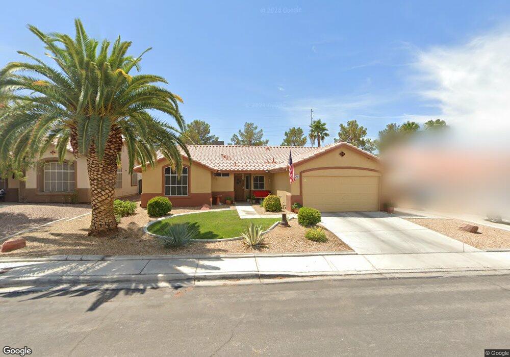
6229 Dundee Port Ave Las Vegas, NV 89110
Estimated Value: $405,344 - $459,000
3
Beds
2
Baths
1,565
Sq Ft
$271/Sq Ft
Est. Value
About This Home
This home is located at 6229 Dundee Port Ave, Las Vegas, NV 89110 and is currently estimated at $424,586, approximately $271 per square foot. 6229 Dundee Port Ave is a home located in Clark County with nearby schools including Eileen Brookman Elementary School, Dr. William H. Bailey Middle School, and Eldorado High School.
Ownership History
Date
Name
Owned For
Owner Type
Purchase Details
Closed on
Mar 17, 1999
Sold by
Lawson Bryant A and Lawson Dawna G
Bought by
Corl James and Corl Teresita
Current Estimated Value
Home Financials for this Owner
Home Financials are based on the most recent Mortgage that was taken out on this home.
Original Mortgage
$132,873
Interest Rate
6.96%
Mortgage Type
FHA
Purchase Details
Closed on
Jan 16, 1998
Sold by
Lewis Homes Of Nevada
Bought by
Lawson Bryant A and Lawson Dawna G
Home Financials for this Owner
Home Financials are based on the most recent Mortgage that was taken out on this home.
Original Mortgage
$122,188
Interest Rate
7.14%
Mortgage Type
FHA
Create a Home Valuation Report for This Property
The Home Valuation Report is an in-depth analysis detailing your home's value as well as a comparison with similar homes in the area
Home Values in the Area
Average Home Value in this Area
Purchase History
| Date | Buyer | Sale Price | Title Company |
|---|---|---|---|
| Corl James | $134,000 | Land Title | |
| Lawson Bryant A | $124,000 | Nevada Title Company |
Source: Public Records
Mortgage History
| Date | Status | Borrower | Loan Amount |
|---|---|---|---|
| Previous Owner | Corl James | $132,873 | |
| Previous Owner | Lawson Bryant A | $122,188 |
Source: Public Records
Tax History Compared to Growth
Tax History
| Year | Tax Paid | Tax Assessment Tax Assessment Total Assessment is a certain percentage of the fair market value that is determined by local assessors to be the total taxable value of land and additions on the property. | Land | Improvement |
|---|---|---|---|---|
| 2025 | $1,358 | $91,279 | $31,150 | $60,129 |
| 2024 | $1,319 | $91,279 | $31,150 | $60,129 |
| 2023 | $1,319 | $89,302 | $32,200 | $57,102 |
| 2022 | $1,281 | $78,858 | $26,600 | $52,258 |
| 2021 | $1,243 | $72,836 | $23,100 | $49,736 |
| 2020 | $1,204 | $71,821 | $22,400 | $49,421 |
| 2019 | $1,190 | $68,000 | $19,250 | $48,750 |
| 2018 | $1,135 | $62,712 | $15,750 | $46,962 |
| 2017 | $1,807 | $61,614 | $14,000 | $47,614 |
| 2016 | $1,064 | $50,114 | $10,500 | $39,614 |
| 2015 | $1,061 | $41,758 | $8,750 | $33,008 |
| 2014 | $1,030 | $34,057 | $7,000 | $27,057 |
Source: Public Records
Map
Nearby Homes
- 6312 Seton Hall Ct
- 6343 Mahogany Peak Ave
- 768 Santree Cir
- 1083 Devon Lake St
- 563 Moon Chase St
- 6449 Elizabethtown Ave
- 6465 Sugar Knoll Ct
- 920 N Sloan Ln Unit 204
- 720 N Sloan Ln
- 940 N Sloan Ln Unit 102
- 6538 Astorville Ct
- 6488 New Brunswick Ave
- 6440 Spanish Garden Ct
- 5923 Halehaven Dr
- 0 Linden Ave
- 6400 Stewart Ave
- 431 N Fogg St
- 5836 Dunedin Ct
- 1083 Sterling Peak St
- 1185 Warm Sun Ct
- 6239 Dundee Port Ave
- 6249 Dundee Port Ave
- 6209 Dundee Port Ave
- 6228 Dundee Port Ave
- 6238 Dundee Port Ave
- 6218 Dundee Port Ave
- 791 Theatre Ct
- 6248 Dundee Port Ave
- 6259 Dundee Port Ave
- 6195 Dundee Port Ave
- 6208 Dundee Port Ave
- 790 Theatre Ct
- 6258 Dundee Port Ave
- 6229 Seagirt Cir
- 6217 Seagirt Cir
- 6188 Dundee Port Ave
- 6237 Seagirt Cir
- 6269 Dundee Port Ave
- 6205 Seagirt Cir