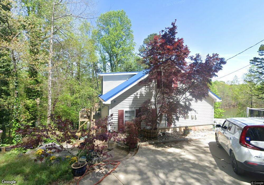
6229 Shoreland Cir Buford, GA 30518
Estimated Value: $395,671 - $744,000
2
Beds
2
Baths
1,512
Sq Ft
$338/Sq Ft
Est. Value
About This Home
This home is located at 6229 Shoreland Cir, Buford, GA 30518 and is currently estimated at $510,668, approximately $337 per square foot. 6229 Shoreland Cir is a home located in Hall County with nearby schools including Friendship Elementary School, C.W. Davis Middle School, and Flowery Branch High School.
Ownership History
Date
Name
Owned For
Owner Type
Purchase Details
Closed on
Mar 31, 1999
Sold by
Banks Willis
Bought by
Banks Willis
Current Estimated Value
Home Financials for this Owner
Home Financials are based on the most recent Mortgage that was taken out on this home.
Original Mortgage
$78,400
Outstanding Balance
$19,918
Interest Rate
7.08%
Mortgage Type
New Conventional
Estimated Equity
$490,750
Purchase Details
Closed on
Jun 7, 1991
Sold by
Osburn Ronald L and Osburn Charlotte M
Bought by
Banks Willis
Create a Home Valuation Report for This Property
The Home Valuation Report is an in-depth analysis detailing your home's value as well as a comparison with similar homes in the area
Home Values in the Area
Average Home Value in this Area
Purchase History
| Date | Buyer | Sale Price | Title Company |
|---|---|---|---|
| Banks Willis | -- | -- | |
| Banks Willis | $50,000 | -- |
Source: Public Records
Mortgage History
| Date | Status | Borrower | Loan Amount |
|---|---|---|---|
| Open | Banks Willis | $78,400 |
Source: Public Records
Tax History Compared to Growth
Tax History
| Year | Tax Paid | Tax Assessment Tax Assessment Total Assessment is a certain percentage of the fair market value that is determined by local assessors to be the total taxable value of land and additions on the property. | Land | Improvement |
|---|---|---|---|---|
| 2024 | $3,640 | $146,440 | $40,240 | $106,200 |
| 2023 | $3,120 | $141,200 | $40,240 | $100,960 |
| 2022 | $3,220 | $124,200 | $40,240 | $83,960 |
| 2021 | $3,127 | $118,400 | $40,240 | $78,160 |
| 2020 | $3,132 | $115,240 | $40,240 | $75,000 |
| 2019 | $3,036 | $110,720 | $40,240 | $70,480 |
| 2018 | $2,839 | $100,200 | $36,920 | $63,280 |
| 2017 | $2,688 | $95,840 | $36,920 | $58,920 |
| 2016 | $2,586 | $95,840 | $36,920 | $58,920 |
| 2015 | $2,607 | $94,440 | $36,920 | $57,520 |
| 2014 | $2,607 | $94,440 | $36,920 | $57,520 |
Source: Public Records
Map
Nearby Homes
- 6181 Shoreland Cir
- 6313 Shoreland Cir
- 3374 Lee Dr
- 3394 Lee Dr
- 6120 Hutchins Dr
- 6132 Hutchins Dr
- 3441 Shoreland Dr
- 6111 Blackberry Ln
- 6095 Blackberry Ln
- 3617 Shoreland Dr
- 3180 Lee Dr
- 5989 Lanier Islands Pkwy
- 0 McEver Rd Unit 10506093
- 6205 Bridgewood Dr
- 6225 Bridgewood Dr
- 6119 Bethany View Trail
- 6732 Willowbrook Trail
- 6604 Windbrook Way
- 6235 Shoreland Cir
- 6231 Shoreland Cir
- 6230 Shoreland Cir
- 6233 Shoreland Cir
- 6377 Shoreland Cir
- 6220 Shoreland Cir
- 6294 Shoreland Cir
- 6221 Shoreland Cir
- 6295 Shoreland Cir
- 6277 Shoreland Cir
- 6277 Shoreland Cir Unit 8
- 6182 Hutchins Dr
- 6211 Shoreland Cir
- 6304 Shoreland Cir
- 6172 Hutchins Dr
- 6191 Hutchins Dr
- 0 Shoreland Cir Unit 7355686
- 0 Shoreland Cir Unit 7297460
- 0 Shoreland Cir Unit 7235728
- 0 Shoreland Cir Unit 8004347