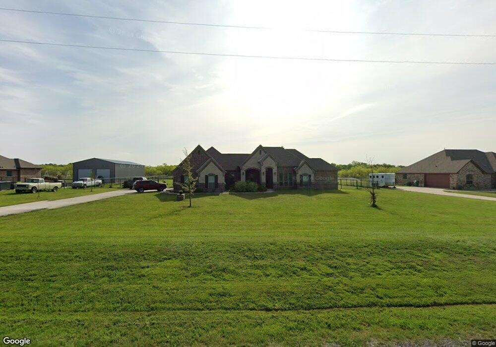
623 Dill Rd Weatherford, TX 76085
Estimated Value: $519,817 - $549,000
4
Beds
2
Baths
2,398
Sq Ft
$225/Sq Ft
Est. Value
About This Home
This home is located at 623 Dill Rd, Weatherford, TX 76085 and is currently estimated at $539,204, approximately $224 per square foot. 623 Dill Rd is a home located in Parker County with nearby schools including Crockett Elementary School, Tison Middle School, and Weatherford High School.
Ownership History
Date
Name
Owned For
Owner Type
Purchase Details
Closed on
Nov 24, 2020
Sold by
Dishroom Thomas David and Dishroom Jamie
Bought by
Hank Monte Lewis and Hank Brenda Kay
Current Estimated Value
Home Financials for this Owner
Home Financials are based on the most recent Mortgage that was taken out on this home.
Original Mortgage
$352,240
Outstanding Balance
$313,444
Interest Rate
2.8%
Mortgage Type
VA
Estimated Equity
$225,760
Purchase Details
Closed on
Apr 11, 2018
Sold by
Davidson Reconstruction Inc
Bought by
Disheroon Thomas David
Home Financials for this Owner
Home Financials are based on the most recent Mortgage that was taken out on this home.
Original Mortgage
$246,400
Interest Rate
4.46%
Mortgage Type
New Conventional
Purchase Details
Closed on
Feb 28, 2017
Sold by
Baty John Steven and Baty Linda Ann
Bought by
Davidson Reconstruction Inc
Create a Home Valuation Report for This Property
The Home Valuation Report is an in-depth analysis detailing your home's value as well as a comparison with similar homes in the area
Home Values in the Area
Average Home Value in this Area
Purchase History
| Date | Buyer | Sale Price | Title Company |
|---|---|---|---|
| Hank Monte Lewis | -- | Stewart | |
| Disheroon Thomas David | -- | None Available | |
| Davidson Reconstruction Inc | -- | None Available |
Source: Public Records
Mortgage History
| Date | Status | Borrower | Loan Amount |
|---|---|---|---|
| Open | Hank Monte Lewis | $352,240 | |
| Previous Owner | Disheroon Thomas David | $246,400 |
Source: Public Records
Tax History Compared to Growth
Tax History
| Year | Tax Paid | Tax Assessment Tax Assessment Total Assessment is a certain percentage of the fair market value that is determined by local assessors to be the total taxable value of land and additions on the property. | Land | Improvement |
|---|---|---|---|---|
| 2025 | $5,675 | $453,157 | -- | -- |
| 2024 | $5,675 | $411,961 | -- | -- |
| 2023 | $5,675 | $374,510 | $0 | $0 |
| 2022 | $6,339 | $340,470 | $50,000 | $290,470 |
| 2021 | $6,858 | $340,470 | $50,000 | $290,470 |
| 2020 | $6,001 | $295,850 | $32,000 | $263,850 |
| 2019 | $6,402 | $295,850 | $32,000 | $263,850 |
| 2018 | $5,009 | $230,270 | $32,000 | $198,270 |
| 2017 | $710 | $32,000 | $32,000 | $0 |
| 2016 | $666 | $30,000 | $30,000 | $0 |
Source: Public Records
Map
Nearby Homes
- 265 Dill Rd
- 1040 Ray's Way
- 2000 Collin St
- 1009 Sabrina Ct
- 5885-A Old Springtown Rd
- 5885-B Old Springtown Rd
- 5885-C Old Springtown Rd
- 5885-E Old Springtown Rd
- 5885-D Old Springtown Rd
- 1000 Rays Way
- 4951 N Fm 51
- 152 Katy Ranch Dr
- 319 Denton Heights Ln
- 505 Aermotor Loop
- 181 Fan Mill Trail
- 197 Fan Mill Trail
- 209 Timber Valley Ct
- TBD Murray Rd
- TBD Lot 42 Blk 2 Timber Valley Ln
- TBD Lot 43 Blk 2 Timber Valley Ln