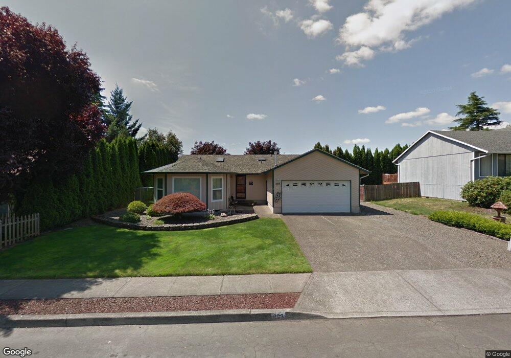
623 SW Mawrcrest Dr Gresham, OR 97080
Hollybrook NeighborhoodEstimated Value: $451,000 - $463,000
3
Beds
2
Baths
1,580
Sq Ft
$289/Sq Ft
Est. Value
About This Home
This home is located at 623 SW Mawrcrest Dr, Gresham, OR 97080 and is currently estimated at $456,803, approximately $289 per square foot. 623 SW Mawrcrest Dr is a home located in Multnomah County with nearby schools including Hollydale Elementary School, Clear Creek Middle School, and Gresham High School.
Ownership History
Date
Name
Owned For
Owner Type
Purchase Details
Closed on
Aug 6, 1999
Sold by
Clift Raymond Michael and Clift Kathleen Gail
Bought by
Krum Brian L and Krum Sherry L
Current Estimated Value
Home Financials for this Owner
Home Financials are based on the most recent Mortgage that was taken out on this home.
Original Mortgage
$155,624
Outstanding Balance
$44,074
Interest Rate
7.7%
Mortgage Type
FHA
Estimated Equity
$412,729
Create a Home Valuation Report for This Property
The Home Valuation Report is an in-depth analysis detailing your home's value as well as a comparison with similar homes in the area
Home Values in the Area
Average Home Value in this Area
Purchase History
| Date | Buyer | Sale Price | Title Company |
|---|---|---|---|
| Krum Brian L | $156,950 | Fidelity National Title Co |
Source: Public Records
Mortgage History
| Date | Status | Borrower | Loan Amount |
|---|---|---|---|
| Open | Krum Brian L | $155,624 |
Source: Public Records
Tax History Compared to Growth
Tax History
| Year | Tax Paid | Tax Assessment Tax Assessment Total Assessment is a certain percentage of the fair market value that is determined by local assessors to be the total taxable value of land and additions on the property. | Land | Improvement |
|---|---|---|---|---|
| 2025 | $4,990 | $245,190 | -- | -- |
| 2024 | $4,776 | $238,050 | -- | -- |
| 2023 | $4,351 | $231,120 | $0 | $0 |
| 2022 | $4,230 | $224,390 | $0 | $0 |
| 2021 | $4,123 | $217,860 | $0 | $0 |
| 2020 | $3,880 | $211,520 | $0 | $0 |
| 2019 | $3,778 | $205,360 | $0 | $0 |
| 2018 | $3,602 | $199,380 | $0 | $0 |
| 2017 | $3,456 | $193,580 | $0 | $0 |
| 2016 | $3,047 | $187,950 | $0 | $0 |
Source: Public Records
Map
Nearby Homes
- 21 NW Mawrcrest Ave
- 63 NW Mawrcrest Ave
- 85 NW Mawrcrest Ave
- 1960 SW 13th Ct
- 317 SW Angeline Ave
- 181 NW Mawrcrest Ave
- 185 NW Mawrcrest Ave
- 2543 NW 2nd Terrace
- 256 NW Mawrcrest Ave
- 272 NW Mawrcrest Ave
- 296 NW Mawrcrest Ave
- 284 NW Mawrcrest Ave
- 0 W Powell Loop
- 2513 NW 3rd Terrace
- 275 SW Towle Ave
- 2360 NW 3rd St
- 3412 NW 1st St
- 3198 SW 16th Cir
- 3756 SW 7th Ct
- 3749 SW 6th St
- 613 SW Mawrcrest Dr
- 705 SW Mawrcrest Dr
- 603 SW Mawrcrest Dr
- 725 SW Mawrcrest Dr
- 622 SW Mawrcrest Dr
- 735 SW Mawrcrest Dr
- 708 SW Mawrcrest Dr
- 612 SW Mawrcrest Dr
- 749 SW Mawrcrest Dr
- 531 SW Mawrcrest Dr
- 738 SW Mawrcrest Dr
- 602 SW Mawrcrest Dr
- 623 SW Lillyben Ave
- 613 SW Lillyben Ave
- 761 SW Mawrcrest Place
- 521 SW Mawrcrest Dr
- 522 SW Mawrcrest Dr
- 756 SW Mawrcrest Dr
- 603 SW Lillyben Ave
- 701 SW Lillyben Ave