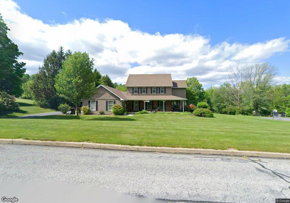
6230 Acorn Dr Emmaus, PA 18049
Lower Milford NeighborhoodEstimated Value: $554,000 - $613,000
4
Beds
3
Baths
2,424
Sq Ft
$240/Sq Ft
Est. Value
About This Home
This home is located at 6230 Acorn Dr, Emmaus, PA 18049 and is currently estimated at $580,902, approximately $239 per square foot. 6230 Acorn Dr is a home located in Lehigh County with nearby schools including Southern Lehigh High School and St Ann Elementary School.
Ownership History
Date
Name
Owned For
Owner Type
Purchase Details
Closed on
Oct 31, 1991
Sold by
Hoenl Thomas E and Hoenl Sandra M
Bought by
Spehalski Robert S and Spehalski Julia E
Current Estimated Value
Purchase Details
Closed on
Jul 29, 1988
Sold by
L J Developers K
Bought by
Hoenl Thomas E and Hoenl Sandra M
Purchase Details
Closed on
Jul 15, 1987
Sold by
Derby Fred W
Bought by
L J Developers K
Purchase Details
Closed on
Dec 30, 1986
Bought by
Derby Fred W
Create a Home Valuation Report for This Property
The Home Valuation Report is an in-depth analysis detailing your home's value as well as a comparison with similar homes in the area
Home Values in the Area
Average Home Value in this Area
Purchase History
| Date | Buyer | Sale Price | Title Company |
|---|---|---|---|
| Spehalski Robert S | $235,000 | -- | |
| Hoenl Thomas E | $234,900 | -- | |
| L J Developers K | $175,000 | -- | |
| Derby Fred W | $120,000 | -- |
Source: Public Records
Tax History Compared to Growth
Tax History
| Year | Tax Paid | Tax Assessment Tax Assessment Total Assessment is a certain percentage of the fair market value that is determined by local assessors to be the total taxable value of land and additions on the property. | Land | Improvement |
|---|---|---|---|---|
| 2025 | $6,242 | $283,000 | $74,200 | $208,800 |
| 2024 | $6,242 | $283,000 | $74,200 | $208,800 |
| 2023 | $6,242 | $283,000 | $74,200 | $208,800 |
| 2022 | $6,148 | $283,000 | $208,800 | $74,200 |
| 2021 | $6,009 | $283,000 | $74,200 | $208,800 |
| 2020 | $5,891 | $283,000 | $74,200 | $208,800 |
| 2019 | $5,795 | $283,000 | $74,200 | $208,800 |
| 2018 | $5,795 | $283,000 | $74,200 | $208,800 |
| 2017 | $5,738 | $283,000 | $74,200 | $208,800 |
| 2016 | -- | $283,000 | $74,200 | $208,800 |
| 2015 | -- | $283,000 | $74,200 | $208,800 |
| 2014 | -- | $283,000 | $74,200 | $208,800 |
Source: Public Records
Map
Nearby Homes
- 6173 Rizzuto Way Unit Lot 21
- 6169 LOT 19 Rizzuto Way
- 6167 LOT 18 Rizzuto Way
- 6169 Rizzuto Way Unit Lot 19
- 6167 Rizzuto Way Unit Lot 18
- 6173 LOT 21 Rizzuto Way
- 6408 Dekrane Dr
- 6469 Dekrane Dr Unit 2
- 5031 Hunter Ln
- 2571 Brunner Rd
- 3307 Bleiler Rd
- 6460 Blue Church Rd
- 1500 Gable Dr
- 1483 Gable Dr
- 2349 Edna Ave
- 6596 Chestnut Hill Church Rd
- 4479 N Sunset Dr
- 7302 Leh St
- 4956 Chestnut Hill Rd
- 4360 Hillary Dr
- 6242 Acorn Dr
- 6227 Acorn Dr
- 6218 Acorn Dr
- 6243 Acorn Dr
- 5782 Harwich Ct
- 6215 Acorn Dr
- 5771 Harwich Ct
- 6201 Acorn Dr
- 5763 Harwich Ct
- 2409 Saucon Cir
- 2391 Saucon Cir
- 5754 Harwich Ct
- 5751 Harwich Ct
- 6190 Acorn Dr
- 5909 Chestnut Hill Church Rd
- 2427 Saucon Cir
- 2334 Coventry Ct
- 2338 Coventry Ct
- 2353 Saucon Cir
- 6181 Acorn Dr