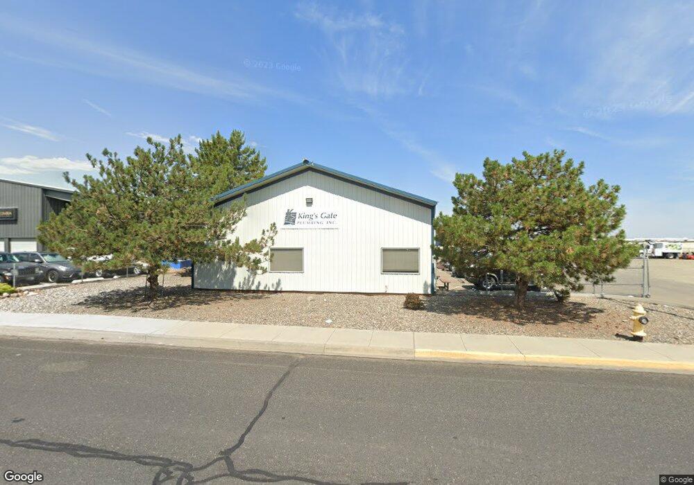
6232 W Okanogan Ave Kennewick, WA 99336
Estimated Value: $688,373
--
Bed
--
Bath
3,360
Sq Ft
$205/Sq Ft
Est. Value
About This Home
This home is located at 6232 W Okanogan Ave, Kennewick, WA 99336 and is currently estimated at $688,373, approximately $204 per square foot. 6232 W Okanogan Ave is a home located in Benton County with nearby schools including Sunset View Elementary School, Kamiakin High School, and SKYLAR EDUCATION ACADEMY.
Ownership History
Date
Name
Owned For
Owner Type
Purchase Details
Closed on
Jan 11, 2022
Sold by
Frost Richard E
Bought by
Advodah Llc
Current Estimated Value
Purchase Details
Closed on
Oct 25, 2007
Sold by
Mcintosh Kelly and Frost Kelly K
Bought by
Frost Richard E
Home Financials for this Owner
Home Financials are based on the most recent Mortgage that was taken out on this home.
Original Mortgage
$98,500
Interest Rate
6.29%
Mortgage Type
Commercial
Create a Home Valuation Report for This Property
The Home Valuation Report is an in-depth analysis detailing your home's value as well as a comparison with similar homes in the area
Home Values in the Area
Average Home Value in this Area
Purchase History
| Date | Buyer | Sale Price | Title Company |
|---|---|---|---|
| Advodah Llc | $715,490 | Benton Franklin Title | |
| Frost Richard E | -- | First American Title Ins Co |
Source: Public Records
Mortgage History
| Date | Status | Borrower | Loan Amount |
|---|---|---|---|
| Previous Owner | Frost Richard E | $98,500 |
Source: Public Records
Tax History Compared to Growth
Tax History
| Year | Tax Paid | Tax Assessment Tax Assessment Total Assessment is a certain percentage of the fair market value that is determined by local assessors to be the total taxable value of land and additions on the property. | Land | Improvement |
|---|---|---|---|---|
| 2024 | $2,442 | $311,760 | $150,280 | $161,480 |
| 2023 | $2,442 | $303,770 | $134,600 | $169,170 |
| 2022 | $2,933 | $299,850 | $130,680 | $169,170 |
| 2021 | $2,771 | $299,850 | $130,680 | $169,170 |
| 2020 | $2,894 | $274,530 | $130,680 | $143,850 |
| 2019 | $2,829 | $274,530 | $130,680 | $143,850 |
| 2018 | $3,452 | $274,530 | $130,680 | $143,850 |
| 2017 | $3,172 | $274,530 | $130,680 | $143,850 |
| 2016 | $3,225 | $274,530 | $130,680 | $143,850 |
| 2015 | $2,936 | $274,530 | $130,680 | $143,850 |
| 2014 | -- | $247,960 | $130,680 | $117,280 |
| 2013 | -- | $247,960 | $130,680 | $117,280 |
Source: Public Records
Map
Nearby Homes
- 519 N Jefferson St
- 460 N Roosevelt St
- 480 N Roosevelt St
- 1136 N Harrison Place
- 595 N Irving Place
- 1087 N Grant St
- 1103 N Grant St
- 1149 N Harrison Place
- 1161 N Harrison Place
- 1109 N Grant St
- 412 N Jefferson St
- 1072 N Grant St
- 5512 W Metaline Ave
- 580 N Harrison Place
- 5512 W Hood Ave
- 6330 W Victoria Ave
- 6533 W Arrowhead Ave
- 308 S Roosevelt Place
- 6511 W 4th Place
- 5001 W Rio Grande Ave
- 6300 W Okanogan Ave
- 6425 W John Day Ave
- 6415 W John Day Ave
- 6503 W Okanogan Suit E
- 6503 W Okanogan Ave
- 6503 W Okanogan Ave
- 6503 W Okanogan Ave Unit B
- 6503 W Okanogan Ave Unit F
- 6503 W Okanogan Ave Unit E
- 6503 W Okanogan Ave Unit A
- 6503 W Okanogan Ave
- 6503 W Okanogan Ave Unit A&B
- 6512 W Hood Place Unit Ste A
- 6512 W Hood Place Unit 140
- 6512 W Hood Place
- 6512 W Hood Place
- 6600 W Deschutes Ave
- 815 N Kellogg St
- 6511 W Hood Place
- 6205 W Okanogan Ave