Estimated Value: $209,000 - $238,000
4
Beds
2
Baths
1,940
Sq Ft
$114/Sq Ft
Est. Value
About This Home
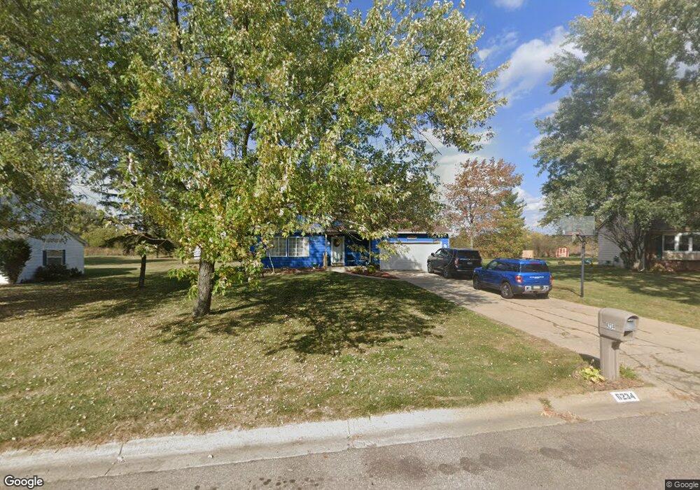
This home is located at 6234 Lancaster Dr, Flint, MI 48532 and is currently estimated at $221,736, approximately $114 per square foot. 6234 Lancaster Dr is a home located in Genesee County with nearby schools including Carman-Ainsworth High School, Genesee STEM Academy, and Genesee Academy.
Ownership History
Date
Name
Owned For
Owner Type
Purchase Details
Closed on
Sep 27, 2006
Sold by
Shivers Gregory and Shivers Brenda
Bought by
Cochran Kenneth R and Cochran Cheryl L
Current Estimated Value
Purchase Details
Closed on
May 11, 2005
Sold by
Shivers Brenda
Bought by
Shivers Gregory and Shivers Brenda
Purchase Details
Closed on
Jan 8, 2003
Sold by
Thorne Veronica and Thorne James
Bought by
Shivers Brenda
Purchase Details
Closed on
Feb 12, 2001
Sold by
Davidson David A and Davidson Kimberley A
Bought by
Thorne James and Thorne Veronica
Home Financials for this Owner
Home Financials are based on the most recent Mortgage that was taken out on this home.
Original Mortgage
$115,000
Interest Rate
6.91%
Create a Home Valuation Report for This Property
The Home Valuation Report is an in-depth analysis detailing your home's value as well as a comparison with similar homes in the area
Home Values in the Area
Average Home Value in this Area
Purchase History
| Date | Buyer | Sale Price | Title Company |
|---|---|---|---|
| Cochran Kenneth R | $138,900 | First American Title Ins Co | |
| Shivers Gregory | -- | First American Title Ins Co | |
| Shivers Brenda | $143,000 | First American Title | |
| Thorne James | $129,900 | First American Title Ins Co |
Source: Public Records
Mortgage History
| Date | Status | Borrower | Loan Amount |
|---|---|---|---|
| Previous Owner | Thorne James | $115,000 |
Source: Public Records
Tax History
| Year | Tax Paid | Tax Assessment Tax Assessment Total Assessment is a certain percentage of the fair market value that is determined by local assessors to be the total taxable value of land and additions on the property. | Land | Improvement |
|---|---|---|---|---|
| 2025 | $2,043 | $97,300 | $0 | $0 |
| 2024 | $1,060 | $95,600 | $0 | $0 |
| 2023 | $1,011 | $81,000 | $0 | $0 |
| 2022 | $899 | $73,900 | $0 | $0 |
| 2021 | $1,829 | $67,200 | $0 | $0 |
| 2020 | $909 | $56,800 | $0 | $0 |
| 2019 | $895 | $49,900 | $0 | $0 |
| 2018 | $1,667 | $43,300 | $0 | $0 |
| 2017 | $1,629 | $43,300 | $0 | $0 |
| 2016 | $1,670 | $41,500 | $0 | $0 |
| 2015 | $1,504 | $38,900 | $0 | $0 |
| 2014 | $892 | $37,400 | $0 | $0 |
| 2012 | -- | $44,400 | $44,400 | $0 |
Source: Public Records
Map
Nearby Homes
- 6272 W Court St
- 6172 W Court St
- 6090 Lancaster Dr
- oo Walnut Creek Dr
- 1192 Citation Dr
- 1184 Citation Dr
- 00 Graham St
- 0 Country Ridge Trail
- 6142 Noel Dr
- 000 Corunna Rd
- 00 Corunna Rd
- 1066 Ramsgate Rd
- 1442 Mintola Ave
- 1417 Mintola Ave
- 5526 Corunna Rd
- 1417 Grassmere Ave
- 6007 Corunna Rd
- 7035 Saratoga Dr
- 7030 Saratoga Dr
- 7042 Saratoga Dr
- 6244 Lancaster Dr
- 6220 Lancaster Dr
- 6254 Lancaster Dr
- 6208 Lancaster Dr
- 6233 Lancaster Dr
- 6164 Trenton Dr
- 6247 Lancaster Dr
- 6209 Lancaster Dr
- 6264 Lancaster Dr
- 6263 Lancaster Dr
- 6156 Trenton Dr
- 6204 Trenton Dr
- 1307 Yorktown Dr
- 6169 Trenton Dr
- 6185 Lancaster Dr
- 1272 Yorktown Dr
- 6150 Trenton Dr
- 1317 Yorktown Dr
- 1282 Yorktown Dr
- 6216 Trenton Dr
Your Personal Tour Guide
Ask me questions while you tour the home.