
Seller's Agent in 2025
John Kurfess
RE/MAX
(419) 260-4205
6 in this area
176 Total Sales
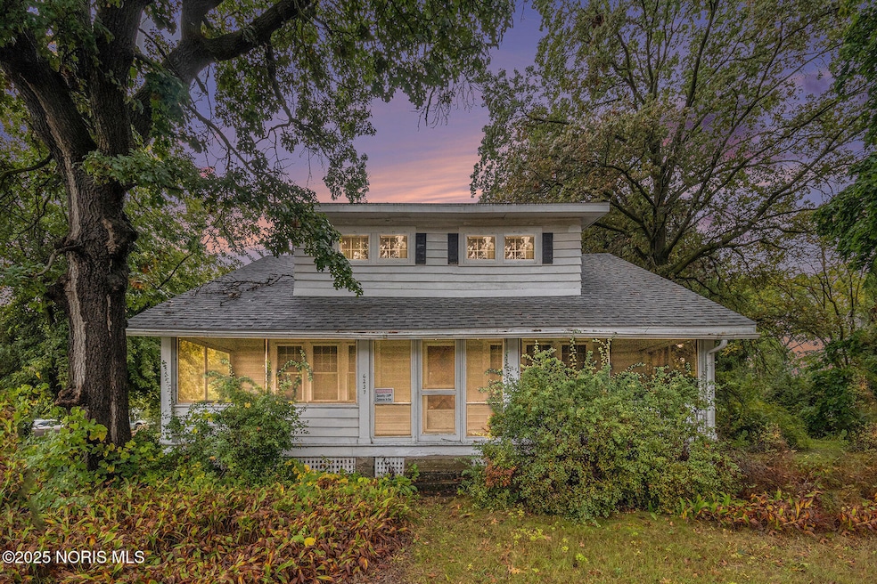


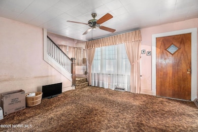

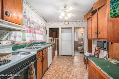

** Open House Cancelled** This 4-bedroom home is now available as a traditional listing for $100,000. With a versatile floor plan, it's ideal for either homeowners or investors. Situated on just over half an acre, the property features a large three-car garage and includes three parcels (2011704, 2011707, 2011701). Where else will you find this large of a home, on this much land, at this fair of a price?! Don't miss out on this great opportunity!
Last Agent to Sell the Property
RE/MAX Preferred Associates License #2020001173 Listed on: 11/07/2025
| Date | Type | Sale Price | Title Company |
|---|---|---|---|
| Fiduciary Deed | $90,000 | None Listed On Document | |
| Warranty Deed | -- | None Available | |
| Interfamily Deed Transfer | -- | -- |
| Date | Status | Loan Amount | Loan Type |
|---|---|---|---|
| Open | $135,000 | Construction |
| Date | Event | Price | List to Sale | Price per Sq Ft |
|---|---|---|---|---|
| 12/08/2025 12/08/25 | Sold | $90,000 | -10.0% | $55 / Sq Ft |
| 11/14/2025 11/14/25 | Pending | -- | -- | -- |
| 11/07/2025 11/07/25 | For Sale | $100,000 | -- | $62 / Sq Ft |
| Year | Tax Paid | Tax Assessment Tax Assessment Total Assessment is a certain percentage of the fair market value that is determined by local assessors to be the total taxable value of land and additions on the property. | Land | Improvement |
|---|---|---|---|---|
| 2025 | $1,561 | $48,160 | $7,980 | $40,180 |
| 2024 | $1,361 | $48,160 | $7,980 | $40,180 |
| 2023 | $2,122 | $36,190 | $7,350 | $28,840 |
| 2022 | $2,102 | $36,190 | $7,350 | $28,840 |
| 2021 | $2,180 | $36,190 | $7,350 | $28,840 |
| 2020 | $2,028 | $29,715 | $6,055 | $23,660 |
| 2019 | $1,938 | $29,785 | $6,125 | $23,660 |
| 2018 | $1,984 | $29,785 | $6,125 | $23,660 |
| 2017 | $1,887 | $29,085 | $7,525 | $21,560 |
| 2016 | $1,948 | $83,100 | $21,500 | $61,600 |
| 2015 | $2,014 | $83,100 | $21,500 | $61,600 |
| 2014 | $1,279 | $29,090 | $7,530 | $21,560 |
| 2013 | $1,279 | $29,090 | $7,530 | $21,560 |
Seller's Agent in 2025
John Kurfess
RE/MAX
(419) 260-4205
6 in this area
176 Total Sales
Buyer's Agent in 2025
Chirley Lima
LPG Realty
(614) 600-0428
14 in this area
240 Total Sales
Source: Northwest Ohio Real Estate Information Service (NORIS)
MLS Number: 10001169
APN: 20-11704
Disclaimer: Certain information contained herein is derived from information provided by parties other than Homes.com. All information provided is deemed reliable, but is not guaranteed to be accurate and should be independently verified.
![]() IDX information is provided exclusively for personal, non-commercial use, and may not be used for any purpose other than to identify prospective properties consumers may be interested in purchasing. Information is deemed reliable but not guaranteed. ©2026 NORIS. All rights reserved.
IDX information is provided exclusively for personal, non-commercial use, and may not be used for any purpose other than to identify prospective properties consumers may be interested in purchasing. Information is deemed reliable but not guaranteed. ©2026 NORIS. All rights reserved.
Ask me questions while you tour the home.