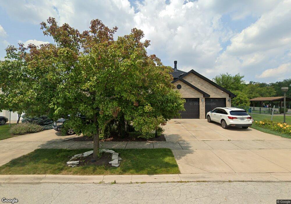
6238 Daniels Ln Oak Forest, IL 60452
Estimated Value: $476,000 - $508,928
4
Beds
3
Baths
3,401
Sq Ft
$146/Sq Ft
Est. Value
About This Home
This home is located at 6238 Daniels Ln, Oak Forest, IL 60452 and is currently estimated at $496,982, approximately $146 per square foot. 6238 Daniels Ln is a home located in Cook County with nearby schools including Lee R Foster Elementary School, Jack Hille Middle School, and Oak Forest High School.
Ownership History
Date
Name
Owned For
Owner Type
Purchase Details
Closed on
Jul 22, 2008
Sold by
Kienzle Kelly Ann
Bought by
Kienzle Kelly Ann
Current Estimated Value
Purchase Details
Closed on
May 2, 2008
Sold by
Kienzle Kelly Ann
Bought by
Rosignal Scott Joseph
Purchase Details
Closed on
Jul 12, 2005
Sold by
Rosignal Scott
Bought by
Rosignal Scott and Rosignal Kelly Kienzle
Purchase Details
Closed on
May 21, 2002
Sold by
State Bank Of Countryside
Bought by
Rosignal Scott
Home Financials for this Owner
Home Financials are based on the most recent Mortgage that was taken out on this home.
Original Mortgage
$238,000
Interest Rate
6.93%
Purchase Details
Closed on
Oct 12, 1999
Sold by
Fsla Midland
Bought by
State Bank Of Countryside and Trust #90-678
Create a Home Valuation Report for This Property
The Home Valuation Report is an in-depth analysis detailing your home's value as well as a comparison with similar homes in the area
Home Values in the Area
Average Home Value in this Area
Purchase History
| Date | Buyer | Sale Price | Title Company |
|---|---|---|---|
| Kienzle Kelly Ann | -- | None Available | |
| Rosignal Scott Joseph | -- | None Available | |
| Rosignal Scott | -- | -- | |
| Rosignal Scott | $310,000 | Enterprise Land Title Ltd | |
| State Bank Of Countryside | $59,000 | -- |
Source: Public Records
Mortgage History
| Date | Status | Borrower | Loan Amount |
|---|---|---|---|
| Previous Owner | Rosignal Scott | $238,000 |
Source: Public Records
Tax History Compared to Growth
Tax History
| Year | Tax Paid | Tax Assessment Tax Assessment Total Assessment is a certain percentage of the fair market value that is determined by local assessors to be the total taxable value of land and additions on the property. | Land | Improvement |
|---|---|---|---|---|
| 2024 | $12,624 | $43,664 | $6,797 | $36,867 |
| 2023 | $10,820 | $43,664 | $6,797 | $36,867 |
| 2022 | $10,820 | $29,191 | $5,859 | $23,332 |
| 2021 | $10,589 | $29,190 | $5,859 | $23,331 |
| 2020 | $11,141 | $31,401 | $5,859 | $25,542 |
| 2019 | $14,613 | $39,709 | $5,390 | $34,319 |
| 2018 | $14,364 | $39,709 | $5,390 | $34,319 |
| 2017 | $14,436 | $39,709 | $5,390 | $34,319 |
| 2016 | $12,317 | $32,473 | $4,687 | $27,786 |
| 2015 | $11,971 | $32,473 | $4,687 | $27,786 |
| 2014 | $11,645 | $32,473 | $4,687 | $27,786 |
| 2013 | $9,776 | $30,635 | $4,687 | $25,948 |
Source: Public Records
Map
Nearby Homes
- 15007 Moorings Ln
- 6345 Parkwood Ct
- 6233 El Morro Ln
- 14630 Club Circle Dr
- 6501 Forestview Dr
- 15200 Pine Dr
- 14810 Massasoit Ave
- 15201 Briar Ln
- 14825 Parkside Ave
- 6230 Boca Rio Dr
- 15143 Geoffrey Rd
- 5813 Midlothian Turnpike
- 14511 Central Ct Unit M2
- 14525 Walden Ct Unit PH4
- 14515 Central Ct Unit M3
- 5726 Lancaster Dr
- 5756 Lancaster Dr
- 6151 Victoria Dr
- 6860 W Winding Trail Unit 204
- 6840 W Winding Trail Unit 204
- 6244 Daniels Ln
- 6250 Daniels Ln
- 14807 Harbor Dr
- 14808 Moorings Ln
- 6256 Daniels Ln
- 14813 Harbor Dr
- 14814 Moorings Ln
- 14808 Harbor Dr
- 6304 Daniels Ln
- 14819 Harbor Dr
- 14814 Harbor Dr
- 14820 Moorings Ln
- 14807 Landings Ln
- 14820 Harbor Dr
- 14825 Harbor Dr
- 14826 Moorings Ln
- 6310 Daniels Ln
- 14813 Landings Ln
- 14826 Harbor Dr
- 14819 Landings Ln