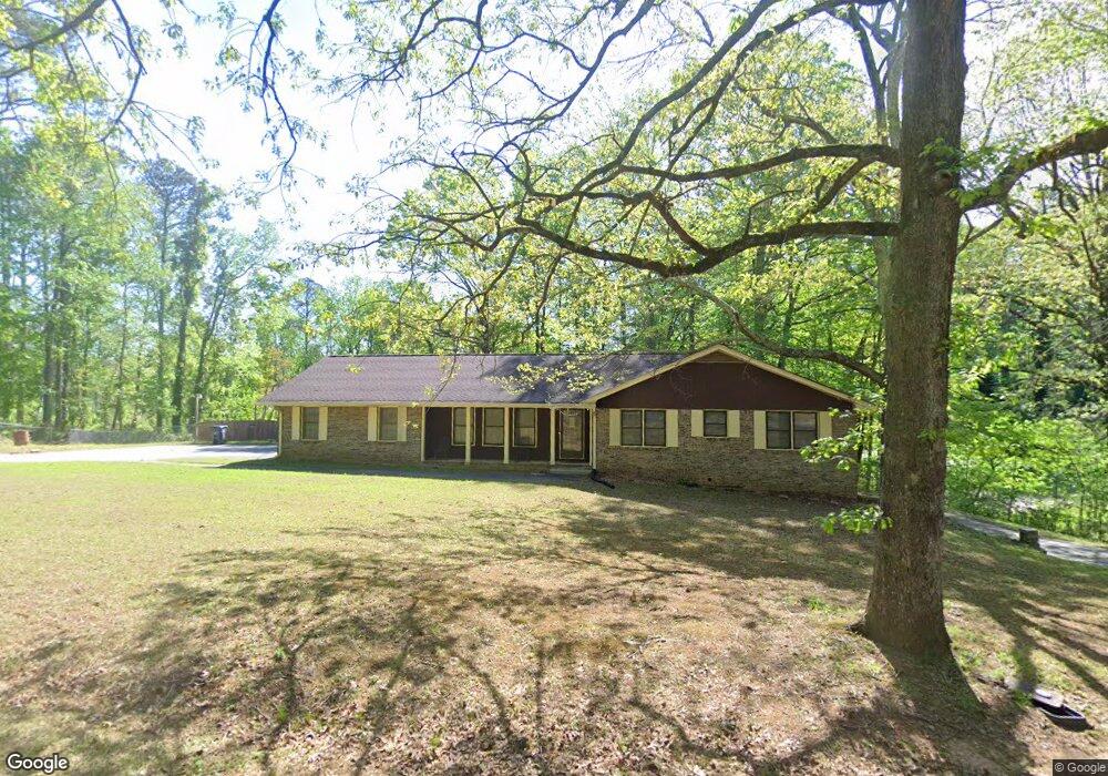
6238 Forrest Ave Union City, GA 30291
Estimated Value: $244,000 - $302,707
3
Beds
2
Baths
1,758
Sq Ft
$153/Sq Ft
Est. Value
About This Home
This home is located at 6238 Forrest Ave, Union City, GA 30291 and is currently estimated at $269,677, approximately $153 per square foot. 6238 Forrest Ave is a home located in Fulton County with nearby schools including Campbell Elementary School, Renaissance Middle School, and Creekside High School.
Ownership History
Date
Name
Owned For
Owner Type
Purchase Details
Closed on
Mar 12, 2025
Sold by
Storrs Shelley A
Bought by
Shelley White Revocable Trust and White Shelley Trust
Current Estimated Value
Purchase Details
Closed on
May 27, 1999
Sold by
Secretary Of Va
Bought by
Storrs Shelley A
Home Financials for this Owner
Home Financials are based on the most recent Mortgage that was taken out on this home.
Original Mortgage
$119,000
Interest Rate
6.84%
Mortgage Type
VA
Create a Home Valuation Report for This Property
The Home Valuation Report is an in-depth analysis detailing your home's value as well as a comparison with similar homes in the area
Home Values in the Area
Average Home Value in this Area
Purchase History
| Date | Buyer | Sale Price | Title Company |
|---|---|---|---|
| Shelley White Revocable Trust | -- | -- | |
| Storrs Shelley A | $119,000 | -- |
Source: Public Records
Mortgage History
| Date | Status | Borrower | Loan Amount |
|---|---|---|---|
| Previous Owner | Storrs Shelley A | $119,000 |
Source: Public Records
Tax History Compared to Growth
Tax History
| Year | Tax Paid | Tax Assessment Tax Assessment Total Assessment is a certain percentage of the fair market value that is determined by local assessors to be the total taxable value of land and additions on the property. | Land | Improvement |
|---|---|---|---|---|
| 2025 | $1,291 | $117,600 | $12,600 | $105,000 |
| 2024 | $1,291 | $145,200 | $12,600 | $132,600 |
| 2023 | $1,291 | $108,560 | $18,400 | $90,160 |
| 2022 | $670 | $60,120 | $13,280 | $46,840 |
| 2021 | $539 | $45,320 | $9,400 | $35,920 |
| 2020 | $492 | $39,960 | $4,800 | $35,160 |
| 2019 | $1,042 | $39,280 | $4,720 | $34,560 |
| 2018 | $411 | $24,760 | $3,400 | $21,360 |
| 2017 | $382 | $22,320 | $3,280 | $19,040 |
| 2016 | $381 | $22,320 | $3,280 | $19,040 |
| 2015 | $733 | $22,320 | $3,280 | $19,040 |
| 2014 | $464 | $26,560 | $3,880 | $22,680 |
Source: Public Records
Map
Nearby Homes
- 0 Simpson Ave Unit 10470974
- 0 Simpson Ave Unit 7532980
- 0 Ward Rd Unit 7174145
- 0 Ward Rd Unit 20102427
- 6200 Ward Rd
- 6211 Ward Rd
- 5278 Park Ave
- 4458 Manor Hill Dr
- 6385 Lower Dixie Lake Rd
- 4443 Manor Hill Dr
- 4439 Manor Hill Dr Unit 11
- 5207 Dixie Lake Rd
- Sudbury Plan at Pointe Park
- ROBIE Plan at Pointe Park
- ELSTON Plan at Pointe Park
- BELHAVEN Plan at Pointe Park
- AISLE Plan at Pointe Park
- 0 Lower Dixie Lake Rd Unit 22475153
- 0 Lower Dixie Lake Rd Unit 7515143
- 5545 Union Pointe Place
- 0 Forrest Ave Unit 78 10555500
- 0 Forrest Ave Unit 10555500
- 0 Forrest Ave Unit 7608024
- 0 Forrest Ave Unit 7148066
- 0 Forrest Ave Unit 7351000
- 0 Forrest Ave Unit 7172575
- 0 Forrest Ave Unit 7106932
- 0 Forrest Ave Unit 3161941
- 0 Forrest Ave Unit 8528802
- 0 Forrest Ave Unit 8150997
- 0 Forrest Ave Unit 3156733
- 0 Forrest Ave Unit 8727190
- 0 Forrest Ave Unit 3206878
- 0 Forrest Ave Unit 3176109
- 0 Forrest Ave Unit 7291341
- 0 Forrest Ave Unit 7241115
- 0 Forrest Ave Unit 7033907
- 0 Forrest Ave Unit 8166640
- 0 Forrest Ave Unit 7033136
- 0 Forrest Ave Unit 7026397