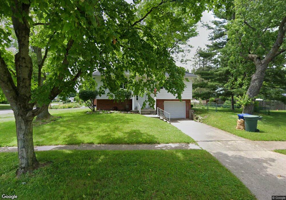
6239 Ambleside Dr Columbus, OH 43229
Devonshire NeighborhoodEstimated Value: $240,040 - $266,000
3
Beds
2
Baths
1,344
Sq Ft
$190/Sq Ft
Est. Value
About This Home
This home is located at 6239 Ambleside Dr, Columbus, OH 43229 and is currently estimated at $255,260, approximately $189 per square foot. 6239 Ambleside Dr is a home located in Franklin County with nearby schools including Devonshire Alternative Elementary School, Woodward Park Middle School, and Beechcroft High School.
Ownership History
Date
Name
Owned For
Owner Type
Purchase Details
Closed on
Feb 26, 2018
Sold by
Davis Matthew W and Us Bank National Assoction
Bought by
Wwsd Llc
Current Estimated Value
Purchase Details
Closed on
Feb 22, 2018
Sold by
Davis Matthew W and Us Bank National Association
Bought by
Wwsd Llc
Purchase Details
Closed on
Aug 23, 2001
Sold by
Davis Matthew W
Bought by
Davis Kim E
Purchase Details
Closed on
Jul 12, 1995
Sold by
Ambrose Rita A
Bought by
Davis Matthew W and Davis Kim E
Home Financials for this Owner
Home Financials are based on the most recent Mortgage that was taken out on this home.
Original Mortgage
$81,950
Interest Rate
7.79%
Mortgage Type
FHA
Purchase Details
Closed on
Aug 22, 1991
Purchase Details
Closed on
Apr 1, 1986
Create a Home Valuation Report for This Property
The Home Valuation Report is an in-depth analysis detailing your home's value as well as a comparison with similar homes in the area
Home Values in the Area
Average Home Value in this Area
Purchase History
| Date | Buyer | Sale Price | Title Company |
|---|---|---|---|
| Wwsd Llc | $90,100 | Sojourners Title Agency | |
| Wwsd Llc | $90,100 | None Available | |
| Davis Kim E | -- | -- | |
| Davis Matthew W | $82,000 | -- | |
| -- | -- | -- | |
| -- | $53,000 | -- |
Source: Public Records
Mortgage History
| Date | Status | Borrower | Loan Amount |
|---|---|---|---|
| Previous Owner | Davis Matthew W | $81,950 |
Source: Public Records
Tax History
| Year | Tax Paid | Tax Assessment Tax Assessment Total Assessment is a certain percentage of the fair market value that is determined by local assessors to be the total taxable value of land and additions on the property. | Land | Improvement |
|---|---|---|---|---|
| 2025 | $3,264 | $71,230 | $17,820 | $53,410 |
| 2024 | $3,264 | $71,230 | $17,820 | $53,410 |
| 2023 | $3,224 | $71,225 | $17,815 | $53,410 |
| 2022 | $1,736 | $32,660 | $11,730 | $20,930 |
| 2021 | $1,739 | $32,660 | $11,730 | $20,930 |
| 2020 | $1,741 | $32,660 | $11,730 | $20,930 |
| 2019 | $2,031 | $32,660 | $11,730 | $20,930 |
| 2018 | $2,072 | $37,390 | $11,730 | $25,660 |
| 2017 | $2,224 | $37,390 | $11,730 | $25,660 |
| 2016 | $2,182 | $32,940 | $8,440 | $24,500 |
| 2015 | $1,981 | $32,940 | $8,440 | $24,500 |
| 2014 | $1,986 | $32,940 | $8,440 | $24,500 |
| 2013 | $1,088 | $36,610 | $9,380 | $27,230 |
Source: Public Records
Map
Nearby Homes
- 6189 Northgap Dr
- 6198 Parkdale Dr
- 6211 Parkdale Dr
- 1288 Oakfield Dr N
- 6162 Oakfield Dr E
- 6191-6193 Ambleside Dr
- 1268 Kildale Ct
- 5990 Ambleside Dr
- 1457 Burnley Square S
- 6336 Archmere Square E
- 1390 E Dublin Granville Rd
- 6035 Karl Rd
- 5844 Thada Ln Unit 5844
- 1322 Bolenhill Ct
- 5733 Satinwood Dr
- 1679 Peardale Rd N
- 5690 Ironwood Ct
- 1635 Tendril Ct
- 1752 Pine Tree St S Unit H
- 5762 Pine Tree St W Unit D
- 6229 Northgap Dr
- 6255 Ambleside Dr
- 6223 Northgap Dr
- 1211 Ambleside Ct
- 1198 Redfield Dr
- 6231 Ambleside Dr
- 6222 Ambleside Dr
- 6220 Northgap Dr
- 1203 Ambleside Ct
- 6216 Northgap Dr
- 1190 Redfield Dr
- 6210 Northgap Dr
- 1218 Ambleside Ct
- 1201 Redfield Dr
- 1199 Ambleside Ct
- 6229 Ambleside Dr
- 1182 Redfield Dr
- 1206 Ambleside Ct
- 1191 Ambleside Ct
- 6201 Northgap Dr