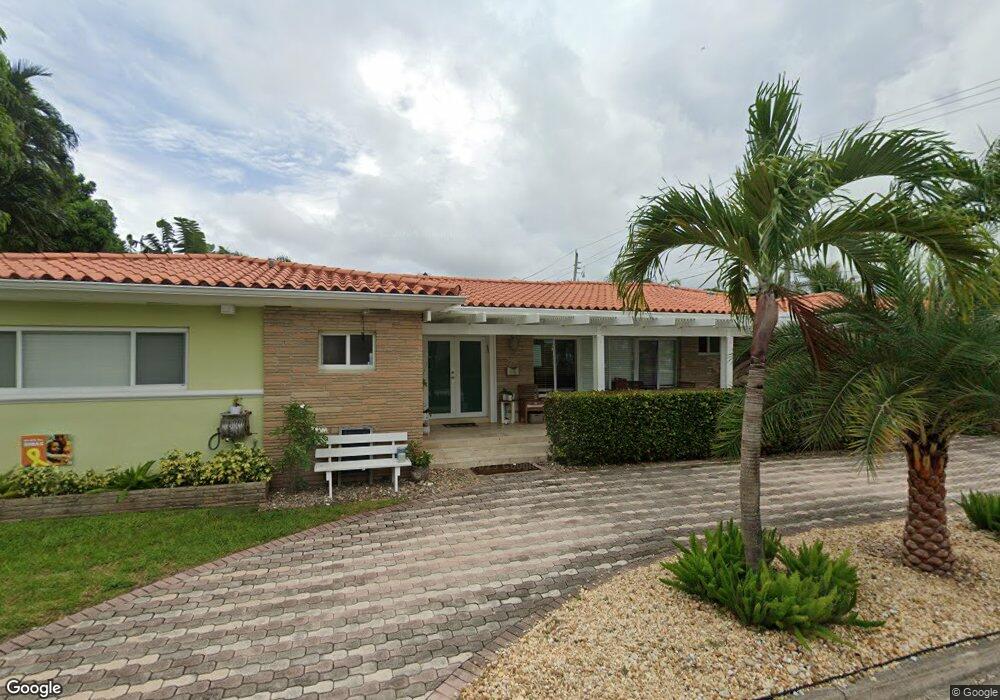
624 92nd St Surfside, FL 33154
Estimated Value: $1,363,000 - $2,091,000
3
Beds
3
Baths
2,300
Sq Ft
$752/Sq Ft
Est. Value
About This Home
This home is located at 624 92nd St, Surfside, FL 33154 and is currently estimated at $1,729,215, approximately $751 per square foot. 624 92nd St is a home located in Miami-Dade County with nearby schools including Ruth K. Broad Bay Harbor K-8 Center, Nautilus Middle School, and Miami Beach Senior High School.
Ownership History
Date
Name
Owned For
Owner Type
Purchase Details
Closed on
Mar 2, 2015
Sold by
Barreras Francisco and Barreras Rosa
Bought by
Weinberg Adam and Weinberg Michelle
Current Estimated Value
Home Financials for this Owner
Home Financials are based on the most recent Mortgage that was taken out on this home.
Original Mortgage
$551,250
Outstanding Balance
$422,358
Interest Rate
3.69%
Mortgage Type
New Conventional
Estimated Equity
$1,306,857
Purchase Details
Closed on
Aug 22, 2003
Sold by
Gregory Alexander G
Bought by
Barreras Francisco and Barreras Rosa
Create a Home Valuation Report for This Property
The Home Valuation Report is an in-depth analysis detailing your home's value as well as a comparison with similar homes in the area
Home Values in the Area
Average Home Value in this Area
Purchase History
| Date | Buyer | Sale Price | Title Company |
|---|---|---|---|
| Weinberg Adam | $737,500 | Coventry Title Inc | |
| Barreras Francisco | $425,000 | Florida Title Express |
Source: Public Records
Mortgage History
| Date | Status | Borrower | Loan Amount |
|---|---|---|---|
| Open | Weinberg Adam | $551,250 |
Source: Public Records
Tax History
| Year | Tax Paid | Tax Assessment Tax Assessment Total Assessment is a certain percentage of the fair market value that is determined by local assessors to be the total taxable value of land and additions on the property. | Land | Improvement |
|---|---|---|---|---|
| 2025 | $10,478 | $598,999 | -- | -- |
| 2024 | $10,268 | $582,118 | -- | -- |
| 2023 | $10,268 | $565,164 | $0 | $0 |
| 2022 | $9,998 | $548,703 | $0 | $0 |
| 2021 | $9,952 | $532,722 | $0 | $0 |
| 2020 | $9,907 | $525,367 | $0 | $0 |
| 2019 | $9,719 | $513,556 | $0 | $0 |
| 2018 | $9,363 | $503,981 | $0 | $0 |
| 2017 | $9,368 | $493,616 | $0 | $0 |
| 2016 | $9,430 | $483,464 | $0 | $0 |
| 2015 | $5,673 | $326,855 | $0 | $0 |
| 2014 | $5,736 | $324,261 | $0 | $0 |
Source: Public Records
Map
Nearby Homes
- 9149 Dickens Ave
- 9148 Carlyle Ave
- 9208 Emerson Ave
- 9117 Carlyle Ave
- 9124 Byron Ave
- 9148 Abbott Ave
- 9073 Dickens Ave
- 9116 Abbott Ave
- 9048 Dickens Ave
- 919 92nd St
- 9057 Emerson Ave
- 9033 Emerson Ave
- 9324 Abbott Ave
- 9348 Byron Ave
- 9165 Harding Ave
- 9008 Dickens Ave
- 9156 Collins Ave Unit 502
- 9308 Harding Ave
- 9172 Collins Ave Unit 302
- 9172 Collins Ave Unit 212
- 9177 Dickens Ave
- 625 92nd St
- 600 92nd St
- 9172 Carlyle Ave
- 9200 Carlyle Ave
- 9209 Dickens Ave
- 9169 Dickens Ave
- 700 92nd St
- 9180 Dickens Ave
- 9208 Carlyle Ave
- 9217 Dickens Ave
- 701 92nd St
- 9172 Dickens Ave
- 9157 Dickens Ave
- 9216 Carlyle Ave
- 9208 Dickens Ave
- 9156 Carlyle Ave
- 9225 Dickens Ave
- 9216 Dickens Ave
Your Personal Tour Guide
Ask me questions while you tour the home.