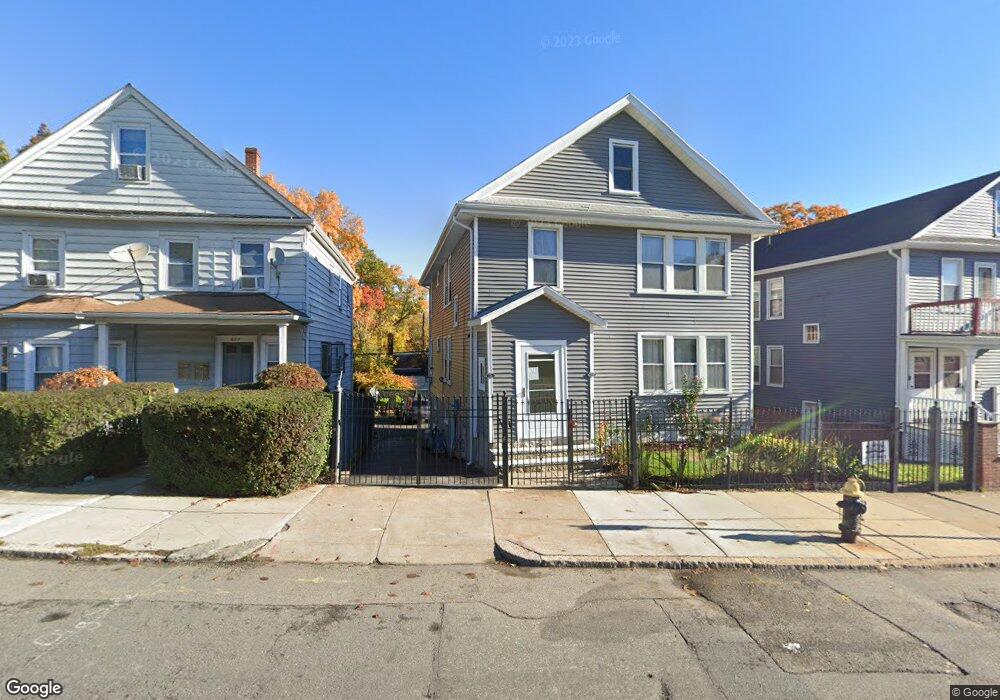
624 Cummins Hwy Unit 626 Mattapan, MA 02126
Southern Mattapan NeighborhoodEstimated Value: $692,397 - $993,000
5
Beds
2
Baths
2,340
Sq Ft
$344/Sq Ft
Est. Value
About This Home
This home is located at 624 Cummins Hwy Unit 626, Mattapan, MA 02126 and is currently estimated at $805,349, approximately $344 per square foot. 624 Cummins Hwy Unit 626 is a home located in Suffolk County with nearby schools including Brooke Charter School Roslindale, Boston Preparatory Charter Public School, and Sacred Heart STEM School.
Ownership History
Date
Name
Owned For
Owner Type
Purchase Details
Closed on
Nov 6, 1996
Sold by
Ferrari Josephine A
Bought by
Syms Rosemarie E
Current Estimated Value
Home Financials for this Owner
Home Financials are based on the most recent Mortgage that was taken out on this home.
Original Mortgage
$125,000
Interest Rate
8.1%
Mortgage Type
Purchase Money Mortgage
Create a Home Valuation Report for This Property
The Home Valuation Report is an in-depth analysis detailing your home's value as well as a comparison with similar homes in the area
Home Values in the Area
Average Home Value in this Area
Purchase History
| Date | Buyer | Sale Price | Title Company |
|---|---|---|---|
| Syms Rosemarie E | $125,000 | -- |
Source: Public Records
Mortgage History
| Date | Status | Borrower | Loan Amount |
|---|---|---|---|
| Open | Syms Rosemarie E | $12,000 | |
| Open | Syms Rosemarie E | $158,000 | |
| Closed | Syms Rosemarie E | $125,000 | |
| Closed | Syms Rosemarie E | $4,000 |
Source: Public Records
Tax History Compared to Growth
Tax History
| Year | Tax Paid | Tax Assessment Tax Assessment Total Assessment is a certain percentage of the fair market value that is determined by local assessors to be the total taxable value of land and additions on the property. | Land | Improvement |
|---|---|---|---|---|
| 2025 | $6,548 | $565,500 | $170,700 | $394,800 |
| 2024 | $5,554 | $509,500 | $151,900 | $357,600 |
| 2023 | $5,163 | $480,700 | $143,300 | $337,400 |
| 2022 | $5,230 | $480,700 | $143,300 | $337,400 |
| 2021 | $4,663 | $437,000 | $130,300 | $306,700 |
| 2020 | $3,816 | $361,400 | $116,000 | $245,400 |
| 2019 | $3,529 | $334,800 | $83,900 | $250,900 |
| 2018 | $3,134 | $299,000 | $83,900 | $215,100 |
| 2017 | $3,045 | $287,500 | $83,900 | $203,600 |
| 2016 | $2,874 | $261,300 | $83,900 | $177,400 |
| 2015 | $3,052 | $252,000 | $101,200 | $150,800 |
| 2014 | $2,935 | $233,300 | $101,200 | $132,100 |
Source: Public Records
Map
Nearby Homes
- 179 Hebron St
- 34 Ridlon Rd
- 265 Hebron St
- 231 Itasca St
- 72 Livermore St
- 839-843 Cummins Hwy
- 0 Tina Ave
- 770 Cummins Hwy Unit 1
- 770 Cummins Hwy Unit 22
- 10 Brockton St
- 100 Itasca St
- 14-14R Kennebec St
- 95 Woodhaven St
- 60 and 64 Monterey Ave
- 20 Monterey Ave
- 90 Hollingsworth St
- 7 Winborough St
- 23 Caton St
- 116 Almont St
- 25 Alpine St Unit 7
- 628 Cummins Hwy Unit 630
- 622 Cummins Hwy
- 632 Cummins Hwy Unit 634
- 640 Cummins Hwy
- 619 Cummins Hwy
- 623 Cummins Hwy Unit F
- 623 Cummins Hwy Unit E
- 623 Cummins Hwy Unit D
- 623 Cummins Hwy Unit C
- 623 Cummins Hwy Unit B
- 623 Cummins Hwy Unit A
- 615 Cummins Hwy Unit 617
- 621 Cummins Hwy Unit F
- 621 Cummins Hwy Unit E
- 621 Cummins Hwy Unit D
- 621 Cummins Hwy Unit C
- 621 Cummins Hwy Unit B
- 621 Cummins Hwy Unit A
- 0 Alabama St
- 0 Alabama St Unit 72097263