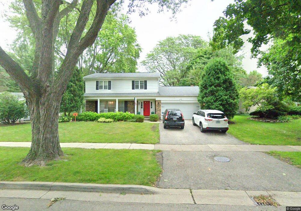
624 Dawes St Libertyville, IL 60048
Cambridge-Liberty Village NeighborhoodEstimated Value: $571,407 - $642,000
--
Bed
3
Baths
2,007
Sq Ft
$303/Sq Ft
Est. Value
About This Home
This home is located at 624 Dawes St, Libertyville, IL 60048 and is currently estimated at $607,602, approximately $302 per square foot. 624 Dawes St is a home located in Lake County with nearby schools including Rockland Elementary School, Highland Middle School, and Libertyville High School.
Ownership History
Date
Name
Owned For
Owner Type
Purchase Details
Closed on
Mar 4, 2014
Sold by
Drain Carole Sue and Wilma Louise Cramer Trust
Bought by
Jackson James P and Hoogheem Mary Jane
Current Estimated Value
Home Financials for this Owner
Home Financials are based on the most recent Mortgage that was taken out on this home.
Original Mortgage
$272,000
Outstanding Balance
$207,412
Interest Rate
4.5%
Mortgage Type
New Conventional
Estimated Equity
$400,190
Create a Home Valuation Report for This Property
The Home Valuation Report is an in-depth analysis detailing your home's value as well as a comparison with similar homes in the area
Home Values in the Area
Average Home Value in this Area
Purchase History
| Date | Buyer | Sale Price | Title Company |
|---|---|---|---|
| Jackson James P | $340,000 | None Available |
Source: Public Records
Mortgage History
| Date | Status | Borrower | Loan Amount |
|---|---|---|---|
| Open | Jackson James P | $272,000 |
Source: Public Records
Tax History Compared to Growth
Tax History
| Year | Tax Paid | Tax Assessment Tax Assessment Total Assessment is a certain percentage of the fair market value that is determined by local assessors to be the total taxable value of land and additions on the property. | Land | Improvement |
|---|---|---|---|---|
| 2024 | $11,877 | $177,239 | $66,439 | $110,800 |
| 2023 | $10,995 | $163,474 | $61,279 | $102,195 |
| 2022 | $10,995 | $148,474 | $58,900 | $89,574 |
| 2021 | $10,575 | $145,278 | $57,632 | $87,646 |
| 2020 | $10,170 | $142,835 | $56,663 | $86,172 |
| 2019 | $9,919 | $141,477 | $56,124 | $85,353 |
| 2018 | $9,296 | $137,660 | $54,799 | $82,861 |
| 2017 | $9,160 | $133,314 | $53,069 | $80,245 |
| 2016 | $8,831 | $126,400 | $50,317 | $76,083 |
| 2015 | $8,718 | $118,142 | $47,030 | $71,112 |
| 2014 | $8,511 | $113,398 | $44,190 | $69,208 |
| 2012 | $8,318 | $114,381 | $44,573 | $69,808 |
Source: Public Records
Map
Nearby Homes
- 777 Garfield Ave Unit A
- 747 Garfield Ave Unit C
- 1017 Juniper Pkwy
- 533 Drake St
- 851 Garfield Ave Unit C
- 0 Ames St
- 323 W Golf Rd
- 423 Ames St
- 501 Hemlock Ln
- 2245 Hazeltime Dr
- 1137 Pine Tree Ln
- 164 W Golf Rd Unit A
- 551 W Park Ave Unit E
- 308 Mckinley Ave
- 1754 Glenmore Rd
- 1330 W Park Ave
- 426 S Milwaukee Ave
- 20924 & 20902 W Park Ave
- 422 Shadow Creek Dr
- 1969 Royal Birkdale Dr
- 626 Dawes St Unit 3
- 622 Dawes St
- 614 Roosevelt Dr
- 620 Dawes St
- 618 Roosevelt Dr
- 736 Fairlawn Ave
- 625 Dawes St
- 710 Fairlawn Ave
- 627 Dawes St
- 610 Roosevelt Dr
- 623 Dawes St
- 621 Dawes St
- 629 Dawes St
- 622 Roosevelt Dr
- 618 Dawes St
- 628 Burdick St Unit 2
- 606 Roosevelt Dr Unit 9
- 828 Crestfield Ave
- 619 Dawes St Unit 1
- 626 Burdick St