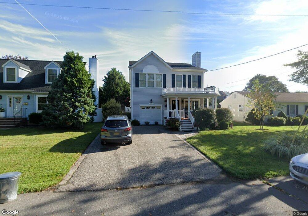
624 Harris Ave Brielle, NJ 08730
Estimated Value: $1,034,000 - $1,146,682
4
Beds
3
Baths
2,141
Sq Ft
$503/Sq Ft
Est. Value
About This Home
This home is located at 624 Harris Ave, Brielle, NJ 08730 and is currently estimated at $1,077,421, approximately $503 per square foot. 624 Harris Ave is a home located in Monmouth County with nearby schools including Brielle Elementary School and St. Peter School.
Ownership History
Date
Name
Owned For
Owner Type
Purchase Details
Closed on
Jul 16, 1998
Sold by
Wall Sheila Brennan
Bought by
Mannion James and Mannion Carolyn
Current Estimated Value
Home Financials for this Owner
Home Financials are based on the most recent Mortgage that was taken out on this home.
Original Mortgage
$164,000
Outstanding Balance
$33,328
Interest Rate
6.92%
Estimated Equity
$1,044,093
Purchase Details
Closed on
Jul 3, 1996
Sold by
Finn Daniel
Bought by
Brennan Sheila
Create a Home Valuation Report for This Property
The Home Valuation Report is an in-depth analysis detailing your home's value as well as a comparison with similar homes in the area
Home Values in the Area
Average Home Value in this Area
Purchase History
| Date | Buyer | Sale Price | Title Company |
|---|---|---|---|
| Mannion James | $205,000 | -- | |
| Brennan Sheila | $200,000 | -- |
Source: Public Records
Mortgage History
| Date | Status | Borrower | Loan Amount |
|---|---|---|---|
| Open | Mannion James | $164,000 |
Source: Public Records
Tax History Compared to Growth
Tax History
| Year | Tax Paid | Tax Assessment Tax Assessment Total Assessment is a certain percentage of the fair market value that is determined by local assessors to be the total taxable value of land and additions on the property. | Land | Improvement |
|---|---|---|---|---|
| 2025 | $10,016 | $828,900 | $449,500 | $379,400 |
| 2024 | $9,751 | $807,100 | $434,600 | $372,500 |
| 2023 | $9,751 | $758,800 | $395,000 | $363,800 |
| 2022 | $9,270 | $666,400 | $320,000 | $346,400 |
| 2021 | $9,270 | $604,700 | $295,000 | $309,700 |
| 2020 | $9,375 | $572,700 | $270,000 | $302,700 |
| 2019 | $9,210 | $571,000 | $270,000 | $301,000 |
| 2018 | $9,101 | $557,000 | $270,000 | $287,000 |
| 2017 | $9,067 | $548,200 | $270,000 | $278,200 |
| 2016 | $9,467 | $552,100 | $270,000 | $282,100 |
| 2015 | $9,308 | $559,700 | $270,000 | $289,700 |
| 2014 | $8,078 | $518,500 | $300,000 | $218,500 |
Source: Public Records
Map
Nearby Homes
- 300 Union Ave
- 549 Woodland Ave
- 308 South St
- 633 Agnes Ave
- 610 Agnes Ave
- 508 Harris Ave
- 3 Courtyard Ln
- 504 Fisk Ave
- 507 Magnolia Ave
- 323-325 Fisk Ave
- 1209 Lenape Trail
- 329 Fisk Ave
- 700 Rankin Rd
- 10 Acpoan Place
- 85 Virginia Ave
- 1207 Bayberry Rd
- 406 Brown St
- 816 Rathjen Rd
- 5 Hickory Ct Unit B
- 105 Mount Ln Unit 3
- 622 Harris Ave
- 404 Morgan Pkwy
- 623 Borrie Ave
- 620 Harris Ave
- 625 Borrie Ave
- 616 Harris Ave
- 402 Morgan Pkwy
- 500 Morgan Pkwy
- 621 Borrie Ave
- 623 Harris Ave
- 619 Borrie Ave
- 619 Harris Ave
- 403 Morgan Pkwy
- 626 Borrie Ave
- 624 Borrie Ave
- 622 Borrie Ave
- 622 Bradley Ave
- 504 Morgan Pkwy
- 633 Borrie Ave
- 613 Harris Ave