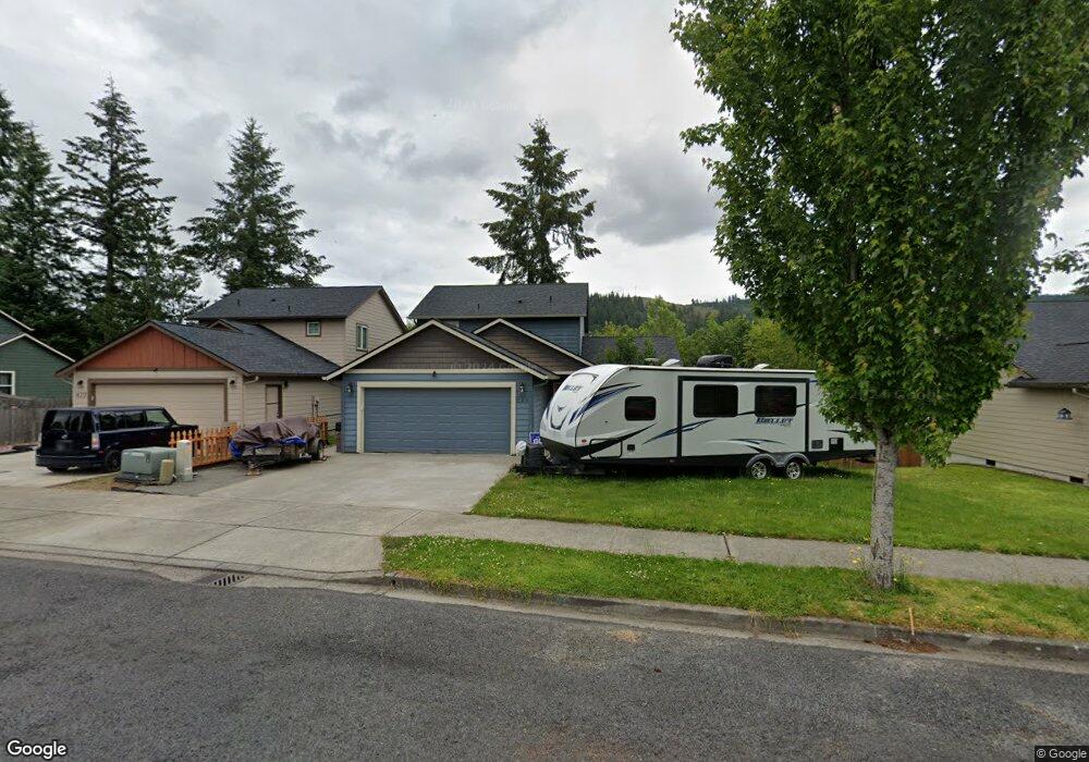
624 Joann Dr NE Castle Rock, WA 98611
Estimated Value: $381,000 - $492,000
4
Beds
2
Baths
1,528
Sq Ft
$285/Sq Ft
Est. Value
About This Home
This home is located at 624 Joann Dr NE, Castle Rock, WA 98611 and is currently estimated at $435,723, approximately $285 per square foot. 624 Joann Dr NE is a home with nearby schools including Castle Rock Elementary School, Castle Rock Middle School, and Castle Rock High School.
Ownership History
Date
Name
Owned For
Owner Type
Purchase Details
Closed on
Feb 28, 2014
Sold by
Lower Columbia Community Action Council
Bought by
Rasmussen Matthew C and Rasmussen Meghan L
Current Estimated Value
Home Financials for this Owner
Home Financials are based on the most recent Mortgage that was taken out on this home.
Original Mortgage
$167,771
Outstanding Balance
$133,700
Interest Rate
4.38%
Mortgage Type
USDA
Estimated Equity
$302,023
Purchase Details
Closed on
Feb 1, 2013
Sold by
Abt Development Inc
Bought by
Lower Columbia Community Action Council
Home Financials for this Owner
Home Financials are based on the most recent Mortgage that was taken out on this home.
Original Mortgage
$135,000
Interest Rate
3.33%
Mortgage Type
Purchase Money Mortgage
Create a Home Valuation Report for This Property
The Home Valuation Report is an in-depth analysis detailing your home's value as well as a comparison with similar homes in the area
Home Values in the Area
Average Home Value in this Area
Purchase History
| Date | Buyer | Sale Price | Title Company |
|---|---|---|---|
| Rasmussen Matthew C | $55,535 | Cowlitz Co Title | |
| Lower Columbia Community Action Council | $495,000 | Cowlitz County Title Company |
Source: Public Records
Mortgage History
| Date | Status | Borrower | Loan Amount |
|---|---|---|---|
| Open | Rasmussen Matthew C | $167,771 | |
| Previous Owner | Lower Columbia Community Action Council | $135,000 |
Source: Public Records
Tax History Compared to Growth
Tax History
| Year | Tax Paid | Tax Assessment Tax Assessment Total Assessment is a certain percentage of the fair market value that is determined by local assessors to be the total taxable value of land and additions on the property. | Land | Improvement |
|---|---|---|---|---|
| 2024 | $3,498 | $410,620 | $80,400 | $330,220 |
| 2023 | $2,891 | $375,590 | $80,400 | $295,190 |
| 2022 | $2,739 | $345,820 | $80,440 | $265,380 |
| 2021 | $2,664 | $295,460 | $70,560 | $224,900 |
| 2020 | $2,463 | $268,590 | $64,140 | $204,450 |
| 2019 | $2,325 | $254,900 | $58,312 | $196,588 |
| 2018 | $2,326 | $224,910 | $58,310 | $166,600 |
| 2017 | $1,830 | $195,770 | $55,540 | $140,230 |
| 2016 | $1,699 | $150,750 | $22,500 | $128,250 |
| 2015 | $282 | $147,250 | $22,500 | $124,750 |
| 2013 | -- | $22,500 | $22,500 | $0 |
Source: Public Records
Map
Nearby Homes
- 0 Pioneer Ave NE
- 611 Pioneer Ave NE
- 203 Roake Ave SE
- 552 North St NE
- 715 NE Pioneer Ave NE
- 438 Front Ave SW
- 1 D St SW
- 385 Front Ave NW
- 114 Cherry St NW
- 110 Dryad Ln
- 705 1st Ave SW
- 237 C St SW
- 56 Shear St SW
- 546 4th Ave SW
- 0 Huntington Ave S Unit NWM2336096
- 1020 3rd Ave SW
- 642 5th Ave SW
- 0 Lot 6 Spirit Lake Parcel Wk3612011 Hwy
- 0 Lot 4 Spirit Lake Parcel Wk3516014 Hwy
- 622 Joann Dr NE
- 626 Joann Dr NE
- 620 Joann Dr NE
- 628 Joann Dr NE
- 623 Joann Dr NE
- 618 Joann Dr NE
- 625 Joann Dr NE
- 630 Joann Dr NE
- 616 Joann Dr NE
- 621 NE Lacey Ct
- 615 Joann Dr NE
- 615 Jo Ann Dr NE
- 619 Lacey Ct NE
- 614 Joann Dr NE
- 613 Joann Dr NE
- 617 Lacey Ct NE
- 611 Joann Dr NE
- 612 Joann Dr NE
- 609 Jo Ann Dr NE
- 605 Tia Ct NE