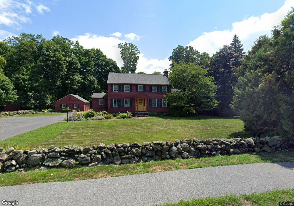
624 Main St Wilbraham, MA 01095
Estimated Value: $505,781 - $690,000
4
Beds
3
Baths
2,516
Sq Ft
$232/Sq Ft
Est. Value
About This Home
This home is located at 624 Main St, Wilbraham, MA 01095 and is currently estimated at $582,695, approximately $231 per square foot. 624 Main St is a home located in Hampden County with nearby schools including Minnechaug Regional High School, Springfield International Charter School, and Wilbraham & Monson Academy.
Ownership History
Date
Name
Owned For
Owner Type
Purchase Details
Closed on
May 20, 1997
Sold by
Gregoire Robert C and Gregoire Carla D
Bought by
Burzdak Deborah A
Current Estimated Value
Home Financials for this Owner
Home Financials are based on the most recent Mortgage that was taken out on this home.
Original Mortgage
$146,400
Outstanding Balance
$20,260
Interest Rate
8.12%
Mortgage Type
Purchase Money Mortgage
Estimated Equity
$562,435
Purchase Details
Closed on
Sep 30, 1992
Sold by
Clauson Herbert E and Clauson Elaine M
Bought by
Gregoire Robert C and Gregoire Carla D
Home Financials for this Owner
Home Financials are based on the most recent Mortgage that was taken out on this home.
Original Mortgage
$165,000
Interest Rate
7.83%
Mortgage Type
Purchase Money Mortgage
Create a Home Valuation Report for This Property
The Home Valuation Report is an in-depth analysis detailing your home's value as well as a comparison with similar homes in the area
Home Values in the Area
Average Home Value in this Area
Purchase History
| Date | Buyer | Sale Price | Title Company |
|---|---|---|---|
| Burzdak Deborah A | $183,000 | -- | |
| Gregoire Robert C | $188,000 | -- |
Source: Public Records
Mortgage History
| Date | Status | Borrower | Loan Amount |
|---|---|---|---|
| Open | Gregoire Robert C | $20,000 | |
| Open | Gregoire Robert C | $146,400 | |
| Previous Owner | Gregoire Robert C | $165,000 |
Source: Public Records
Tax History
| Year | Tax Paid | Tax Assessment Tax Assessment Total Assessment is a certain percentage of the fair market value that is determined by local assessors to be the total taxable value of land and additions on the property. | Land | Improvement |
|---|---|---|---|---|
| 2025 | $8,416 | $470,700 | $108,400 | $362,300 |
| 2024 | $9,098 | $491,800 | $108,400 | $383,400 |
| 2023 | $8,225 | $444,900 | $108,400 | $336,500 |
| 2022 | $8,225 | $401,400 | $108,400 | $293,000 |
| 2021 | $7,118 | $310,000 | $92,600 | $217,400 |
| 2020 | $6,938 | $310,000 | $92,600 | $217,400 |
| 2019 | $6,758 | $310,000 | $92,600 | $217,400 |
| 2018 | $6,738 | $297,600 | $92,600 | $205,000 |
| 2017 | $6,547 | $297,600 | $92,600 | $205,000 |
| 2016 | $6,117 | $283,200 | $103,100 | $180,100 |
| 2015 | $5,913 | $283,200 | $103,100 | $180,100 |
Source: Public Records
Map
Nearby Homes
- 24 Mcintosh Dr
- 6 Katie St
- 6 Hilltop Park
- 8 Patriot Ridge Ln
- 5 Northwood Dr
- 2 Bayberry Dr Unit 51
- 230V Burleigh Rd
- 20 Old Orchard Rd
- 474 Mountain Rd
- 1 Conifer Dr
- 11 Wellfleet Dr
- 374
- 474-480 Mountain Rd
- 27 Eastwood Dr
- 1070 Glendale Rd
- 12 Brooklawn Rd
- 104 High Pine Cir
- 208 Tamarack Dr
- 6 Teak Terrace Unit 24
- 103 Sandalwood Dr Unit site 00